Castner Scrapbook v.20, Delaware River 1, page 33
Historical Images of Philadelphia Castner Scrapbook Collection
Item Info
Historic Street Address: Reed Street, at the Delaware River
Media Type: Scrapbooks
Source: Print and Picture Collection
Notes:
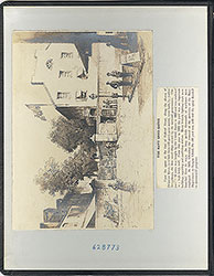
Note: The two images on this page are reproductions of details from a much larger engraved print titled, "An East Prospect of the City of Philadelphia: Taken by George Heap from the Jersey Shore, under the Direction of Nicholas Scull Surveyor General of the Province of Pennsylvania." The original engraving was drawn by Philadelphia artist/mapmaker George Heap in 1752, but he died shortly before it could be engraved. The original engraving was accomplished by Gerard Vandergucht in London, and was 7 feet wide. The print provided one of the the most detailed and significant representations of colonial Philadelphia's waterfront, street grid, and landmarks in its day, as viewed from the New Jersey shore. After the print's publication in 1754, it was reproduced in many later forms, sizes, and publications over the next 100 years.
Item 1, top: The description in pencil reads, "The Blue Anchor Landing, Blue Anchor Tavern, Budds Row, and adjoining buidings, as they appeared in 1753" (and credits the title of the original print). This image of the Blue Anchor Tavern and its surrounding buildings at Dock Creek is but a small detail from the above-noted engraving. It is taken from the 7-foot wide representation of Philadelphia's waterfront, from South Street to Vine Street. The image accurately shows the presence of the drawbridge and the causeway at Dock Creek, but given the scope of the original artwork, this detail is a more schematic or simplified depiction of that area in 1752. Reproduction by an unidentified engraver, of a detail from a larger work, for an unidentified publication, 18.5 x 14.5 cm, undated.
Item 2, bottom: This particular detail from the above-noted print is captioned "The Association Battery. Built in 1748 on the site of the present Navy Yard" (and credits the title of the original print). It features Pennsylvania's largest early fortification on the Delaware River waterfront, at Federal Street. It was built in 1748 by "The Associators," a volunteer military group funded with the help of Benjamin Franklin. By 1801, The Battery's location had eventually become the site of the first Philadelphia Naval Shipyard. Reproduction by an unidentified engraver, of a detail from a larger work, for an unidentified publication, 12.5 x 15 cm, undated.
Creation Year: 1845
Geocode Latitude: Geocode Longitude:-75.141601
Geocode Latitude:39.930554
Call Number: A917.481 P536 v.20
Creator Name: Castner, Samuel, Jr., 1843-1929 - Compiler
George Heap - Artist
Gerard Vandergucht - Engraver
 inside front cover
 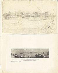 0
0  1c
1c  1
1 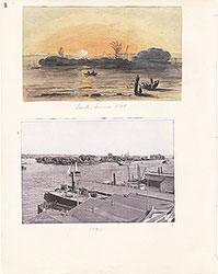 2
2 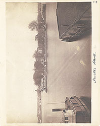 3
3  4
4  5
5  6
6 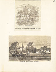 7
7  8
8  9
9  10
10  11
11  12
12  13
13  14
14  15
15 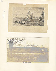 16
16  17
17 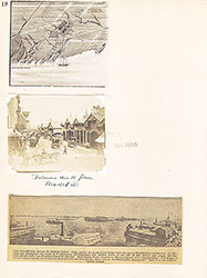 18
18  19
19  20
20  21
21  22
22 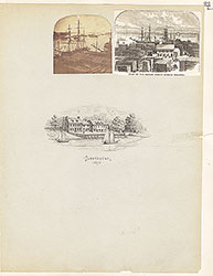 23
23  24
24  25
25  26
26 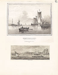 27
27  28
28  29
29  30
30 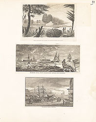 31
31  32
32  33
33
 34
34 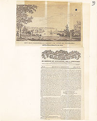 35
35  36
36  37
37 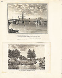 38
38  39
39  39
39  40
40 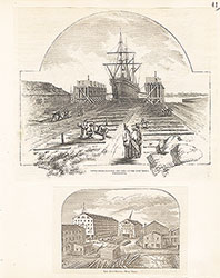 41
41  42
42  43
43  44
44 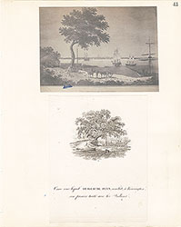 45
45  46
46  47
47  48
48 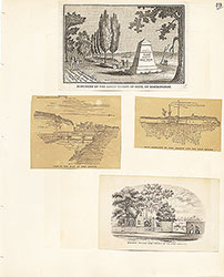 49
49 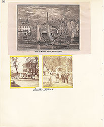 50
50  51
51  51
51 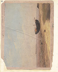 52
52  53
53  53
53  53
53  54
54  55
55 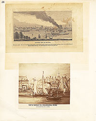 56
56  57
57 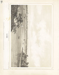 58
58 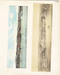 59
59  60
60  61
61 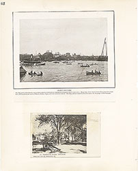 62
62  63
63  64
64  65
65  66
66  67
67 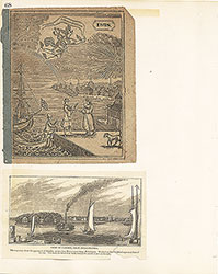 68
68  69
69  69
69  69
69  70
70 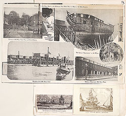 71
71  72
72  73
73  74
74 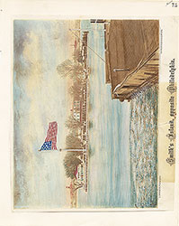 75
75 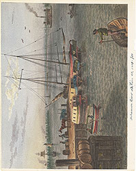 76
76  77
77  78
78  79
79 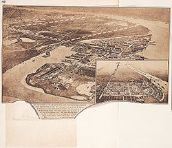 80
80  81
81  82
82  83
83 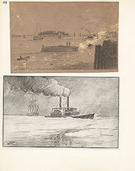 84
84  85
85  86
86  87
87 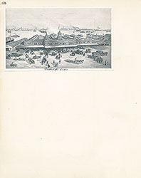 88
88 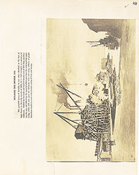 89
89  90
90  91
91 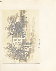 92
92 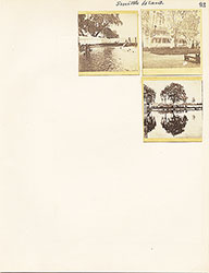 93
93  64a
64a