Castner Scrapbook v.20, Delaware River 1, page 10
Historical Images of Philadelphia Castner Scrapbook Collection
Item Info
Historic Street Address: Market Street, at the Delaware River
Historic Street Address: Vine Street, at the Delaware River
Media Type: Scrapbooks
Source: Print and Picture Collection
Notes:
Item 1, top: Image of the ferry sheds at the Market Street Ferry Terminal, seen from the Delaware River. This terminal was established in 1800, as a principle ferry route for travel and commerce between Philadelphia and Camden, NJ. Pictured are various sheds for several ferry companies, among them the prominent West India & Pacific Steam Line on the left, and the smaller Baltic and Arctic lines. Seen behind them is the famed Ridgway House, built in 1850. This photograph was taken after the Civil War, as evidenced by the substantial development that grew up around the Ridgway House. In late 1880s, the Pennsylvania Railroad began using the Market Street Ferry Terminal, thus providing both local residents and train passengers with ferry service to New Jersey locations along the Delaware. Sepia print photograph, 19 x 11.5 cm, c. 1880.
Item 2, middle: Caption reads, "Vine Street Ferry, Terminus of the Camden and Atlantic Railroad." This image shows the busy ferry terminal on the Delaware River at Vine Street, which was opened c. 1870. The ferry, depicted in front of its shed, transported passengers and products between Philadelphia and Camden, NJ. As shown in this engraving, the ferry shared the river with local sailboats and rowboats. Reproduction of an engraving by Van Ingen-Snyder, 11.5 x 12 cm, c. 1870.
Item 3, bottom: Caption reads, "Mud Island" in 1777, Before the British Attack. [From an old drawing made by Colonel Downman, of the British Army.]" Fort Mifflin occupied Mud Island, just south of where the Schuylkill River meets the Delaware River; and Fort Mercer occupied Red Bank, just opposite on the New Jersey side of the Delaware. On October and November 1777, the British launched a coordinated attack by land and river, ultimately destroying both forts in separate battles, which gave the British access to reinforcements via the Delaware River. Seen in this drawing are the Fort Mifflin fortifications and warships, before their destruction. Reproduction of an engraving, taken from a 1777 drawing by Lt. Col. Downman, for an unidentified publication, 14 x 4 cm, undated.
Creation Year: 1845
Geocode Latitude: Geocode Longitude:-75.213143
Geocode Latitude:39.875229
Call Number: A917.481 P536 v.20
Creator Name: Castner, Samuel, Jr., 1843-1929 - Compiler
Van Ingen-Snyder - Engraver
Francis Downman - Artist
 inside front cover
 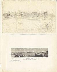 0
0  1c
1c  1
1 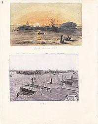 2
2 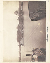 3
3  4
4  5
5  6
6 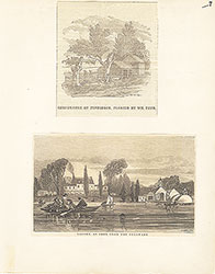 7
7 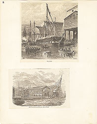 8
8 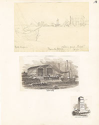 9
9 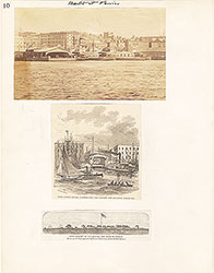 10
10
 11
11  12
12  13
13 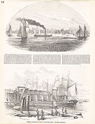 14
14 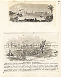 15
15 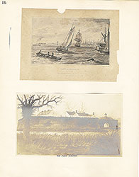 16
16  17
17 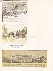 18
18  19
19  20
20  21
21 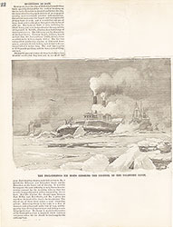 22
22 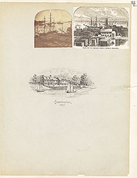 23
23  24
24 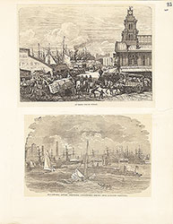 25
25 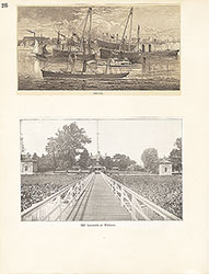 26
26  27
27  28
28 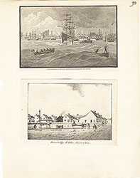 29
29 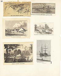 30
30  31
31  32
32  33
33 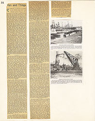 34
34 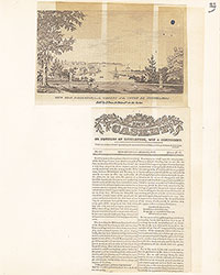 35
35  36
36 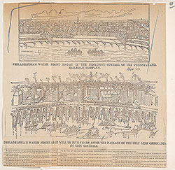 37
37 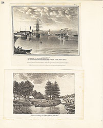 38
38  39
39  39
39 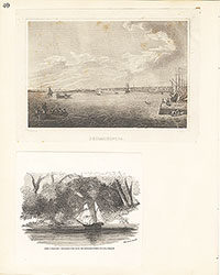 40
40 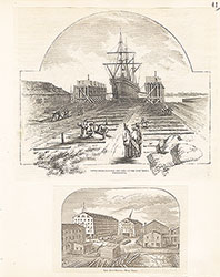 41
41  42
42  43
43  44
44 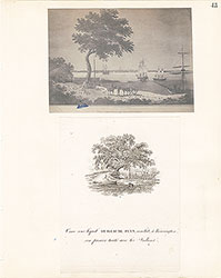 45
45  46
46  47
47  48
48 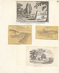 49
49  50
50  51
51  51
51 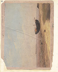 52
52  53
53  53
53 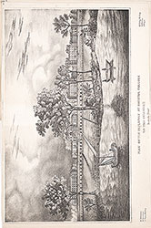 53
53  54
54 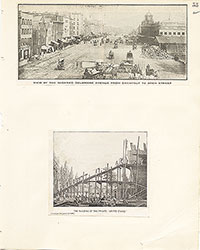 55
55  56
56 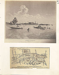 57
57 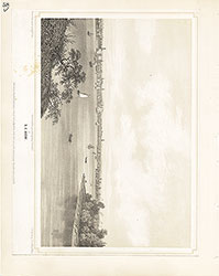 58
58 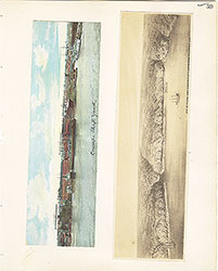 59
59  60
60  61
61 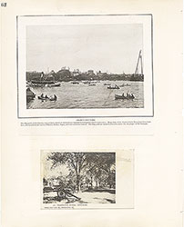 62
62 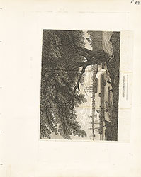 63
63  64
64  65
65  66
66  67
67 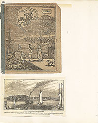 68
68  69
69  69
69  69
69  70
70 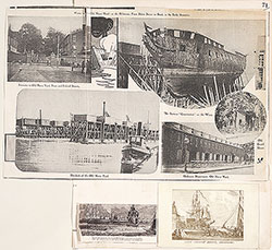 71
71  72
72  73
73  74
74 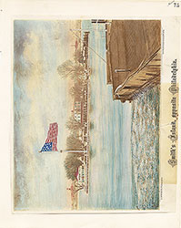 75
75 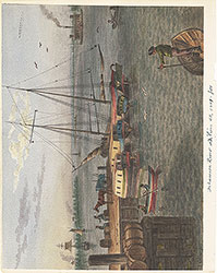 76
76 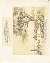 77
77 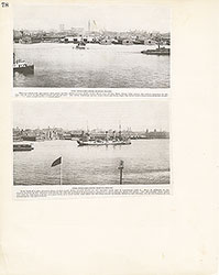 78
78  79
79 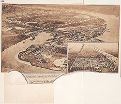 80
80  81
81 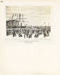 82
82 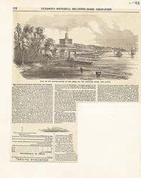 83
83 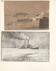 84
84 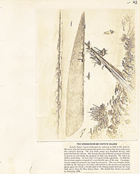 85
85  86
86  87
87 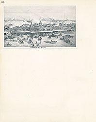 88
88 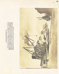 89
89 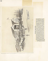 90
90  91
91 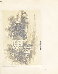 92
92 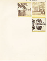 93
93  64a
64a