Castner Scrapbook v.20, Delaware River 1, page 32
Historical Images of Philadelphia Castner Scrapbook Collection
Item Info
Historic Street Address: Penn Treaty Park
Media Type: Scrapbooks
Source: Print and Picture Collection
Notes:
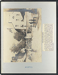
Item 1, top: This image was created by German lithographer Wilhelm Severin, in Dusseldorf, c. 1850. The caption reads, "PHILADELPHIA, von dem grossen Baume zu Kensington aus geschen, unter welchem William Penn den tractat mit den Indianern abschloss." The translation is, "Philadelphia, from the great tree at Kensington, under which William Penn concluded the treaty with the Indians." This lithograph was translated from an original lithograph drawn by German-American artist/lithographer Morris H. Traubel, c. 1850, in Philadelphia. The scene depicts the "Treaty Elm," an obelisk on the right commemorating the site of Penn's treaty with the Lenni-Lenape, some river activity in the foreground, and the highly-developed port of Philadelphia in the background. However, the picture imagines a scenario that could not have existed in reality, as the Treaty Elm was blown down in 1810, and the obelisk was erected in 1827 to mark the location of the ruined tree. Also, the inscription on the obelisk states that this was Penn's landing spot, but Penn first landed in Philadelphia at Dock Creek (later, Dock Street), whereas the setting of the picture is in Kensington (today, Penn Treaty Park). Even so, the image is a lovely composite of the history surrounding the signing of the treaty. Lithograph, 20 x 13 cm, c. 1850.
Item 2, bottom: Hand-colored lithograph of a plan for a bridge over the Delaware River, between Camden, NJ, and then-Windmill Island. The architectural drawing was reportedly made in 1813, but the project was not formally proposed until 1818. The image shows a bridge from Federal Street in Camden, to the eastern shore of Windmill Island. A ferry route was proposed, to complete the trip to Philadelphia, landing at South Street. The plan was ultimately rejected for lack of support by the Pennsylvania Legislature, mostly over future financial concerns for the Port of Philadelphia. In 1838, a canal was built to cut the island in half, thus enabling direct ferry service to Philadelphia. The islands were subsequently eliminated altogether, to enable more favorable navigation by larger ships. Text and image (reproduction of the 1813 lithograph), for an unidentified publication, 23 x 25.5 cm, undated.
Note: To read a detailed article about the proposed plan, see page 70, Item 1 in this collection, at https://libwww.freelibrary.org/staffweb/digicol/CatView.cfm?ItemNo=pdcc03285
Creation Year: 1845
Geocode Latitude: Geocode Longitude:-75.131413
Geocode Latitude:39.944862
Call Number: A917.481 P536 v.20
Creator Name: Castner, Samuel, Jr., 1843-1929 - Compiler
Morris H. Traubel (1820-1897) - Artist
Wilhelm Severin (1809-1888) - Lithographer
Farrand & Sharp - Architect
 inside front cover
 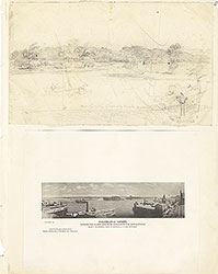 0
0  1c
1c  1
1 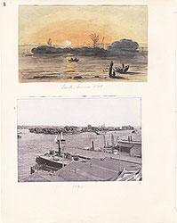 2
2  3
3  4
4  5
5 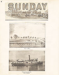 6
6  7
7  8
8 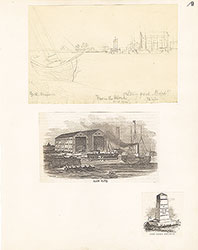 9
9 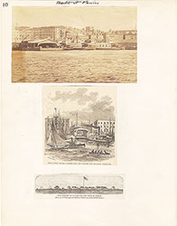 10
10  11
11  12
12  13
13 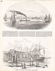 14
14 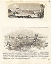 15
15  16
16  17
17 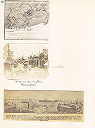 18
18 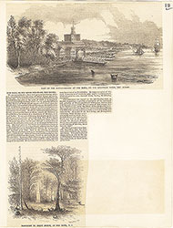 19
19  20
20  21
21  22
22 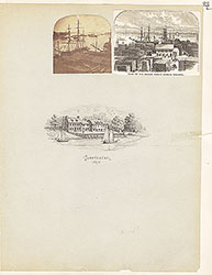 23
23  24
24  25
25 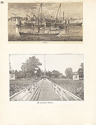 26
26 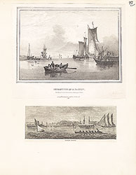 27
27  28
28  29
29 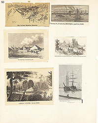 30
30  31
31 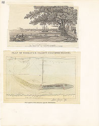 32
32
 33
33  34
34 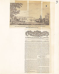 35
35 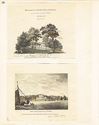 36
36  37
37 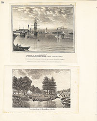 38
38 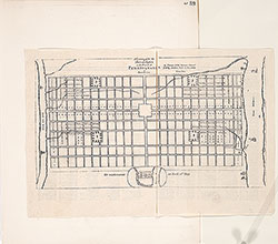 39
39  39
39 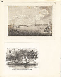 40
40 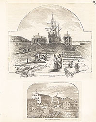 41
41  42
42  43
43 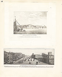 44
44 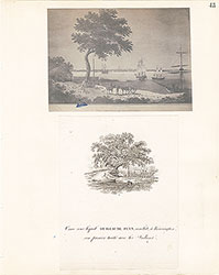 45
45 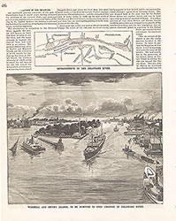 46
46  47
47  48
48 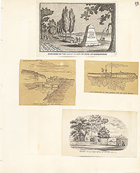 49
49 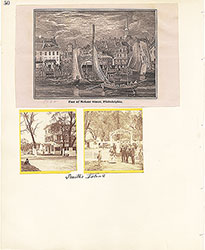 50
50  51
51  51
51 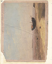 52
52  53
53  53
53 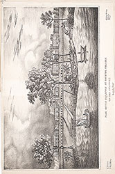 53
53 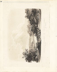 54
54  55
55 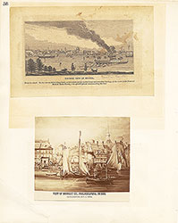 56
56 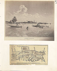 57
57 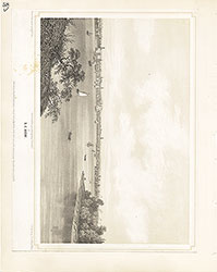 58
58 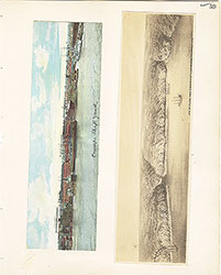 59
59  60
60  61
61 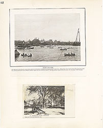 62
62 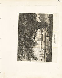 63
63  64
64  65
65  66
66  67
67 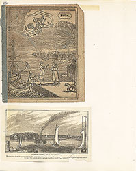 68
68  69
69 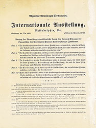 69
69 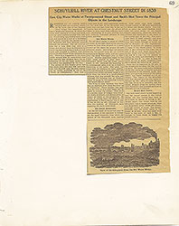 69
69 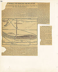 70
70  71
71  72
72  73
73 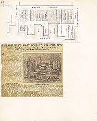 74
74 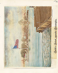 75
75 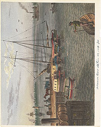 76
76 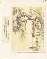 77
77  78
78  79
79  80
80 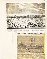 81
81 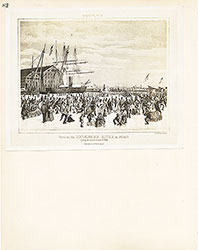 82
82  83
83 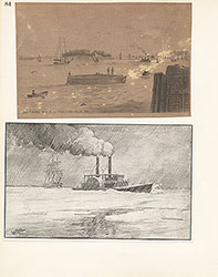 84
84 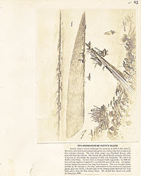 85
85  86
86  87
87 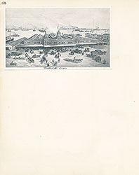 88
88 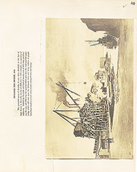 89
89 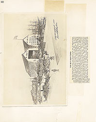 90
90  91
91 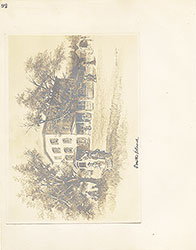 92
92 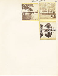 93
93  64a
64a