Castner Scrapbook v.20, Delaware River 1, page 30
Historical Images of Philadelphia Castner Scrapbook Collection
Item Info
Historic Street Address: 6400 Hog Island Road
Historic Street Address: Columbus Blvd & Dock Street
Historic Street Address: Cooper's Point, 801-811 Delaware Ave, Camden, NJ
Media Type: Scrapbooks
Source: Print and Picture Collection
Notes:
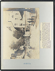
Item 1, top left: Captioned "The Narrow Western Channel," this was a western tributary of the Schuylkill River, emptying into the Delaware River near today's Philadelphia International Airport. Its sheltered passage along the northern shores of Hog Island and Mud Island made it ideal as a route for river trade, manufacturing, shipbuilding, and defense in colonial Philadelphia. Featured are a large ship and Fort Mifflin in the foreground, and manufacturing and river activity in the background. Since the fort was built on Mud Island from 1771-1776, this image appears to depict that period. The channel was gradually filled in between the late-1800s and early-1900s, to facilitate better land use and increased navigation on the Delaware River, as Philadelphia developed as a major port. Reproduction of a drawing for an unidentified newspaper, 12 x 6.5 cm, undated.
Item 2, top right: Caption reads, "Chester, PA., 16 miles from Philadelphia; population 18,000." This depiction of the Chester waterfront appears to represent a period c. 1870, before the rapid growth of activity at the port. A sailboat and a paddle steamer feature prominently in the foreground, with considerable manufacturing and development on the coast in the background. The Chester waterfront became a major shipbuilding and iron-producing center, especially with the 1871 founding of the Delaware River Iron Ship Building and Engine Works. According to census records, the population would have reached 18,000 c. 1885. Reproduction of an engraving for an unidentified publication, 11 x 5.5 cm, undated.
Item 3, middle left: Image of the buildings along the banks of Dock Creek, a tributary of the Delaware River. The prominent building on the right is the Blue Anchor Tavern, built by George Guest, c.1682. It was the first inn/tavern in colonial Philadelphia. It was here William Penn first ate, upon landing in colonial Philadelphia in October 1682. But this image represents a later period. The drawbridge, seen in the left background, was built in 1704. The causeway to the right was built over the creek in the late 1720s. There is substantial development of the area, including manufacturing. An anchor can be seen on a sign at the far corner of the tavern. Also depicted are people walking on the causeway, and two manned gondolas in the water. (Over time, the creek was filled in gradually, and was finally paved over in the 1790s, becoming Dock Street.) Engraving, drawn by artist William L. Breton and printed by Barrington & Haswell, 12.25 x 9 cm, undated.
Item 4, middle right: Caption reads, "Philadelphia As Penn First Saw It. The Blue Anchor Landing." This image imagines the Penn's arrival in colonial Philadelphia in 1682. There are many artists' conceptions of what the area looked like when William Penn landed in 1682. In this image, the Blue Anchor Tavern is a simple, solitary building. A landing party of several men--the man second from the right presumably being Penn--are gathered at the shore, with two more men in a rowboat. Reproduction of an engraving for an unidentified publication, 9 x 5.5 cm, undated.
Item 5, bottom left: Caption reads, "Landing of Penn.--Dock Creek" In contrast with image #4 above, this depiction of William Penn landing in Philadelphia in 1682 imagines a much more lush landscape and an upgraded Blue Anchor Inn. Based on many drawings of the tavern, this is how it looked for most of its existence. The landing party is seen arriving via Dock Creek (a tributary of the Delaware River) in a long rowboat, and a group of Native Americans observe the scene in the right foreground. Lithograph for a unidentified publication, 13.5 x 10 cm, undated.
Item 6, bottom right: Image of two schooners moored at Cooper's Point, Camden, NJ. Cooper's Point was a significant hub on the Delaware River, for ferry service between Camden and Philadelphia, beginning in the late 1600s. This painting depicts a later period, as evidenced by the faint appearance in the background of a bustling Port of Philadelphia. Black-and-white reproduction of an early-1900s watercolor painting for an unidentified publication, by Philadelphia artist Frederick L. Pitts, 7 x 11 cm, undated.
Creation Year: 1845
Geocode Latitude: Geocode Longitude:-75.142053
Geocode Latitude:39.945127
Call Number: A917.481 P536 v.20
Creator Name: Castner, Samuel, Jr., 1843-1929 - Compiler
William L. Breton - Artist
Barrington & Haswell - Lithographer
Frederick L. Pitts - Artist
 inside front cover
  0
0  1c
1c  1
1 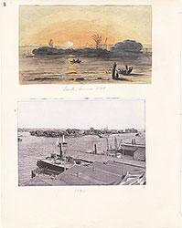 2
2 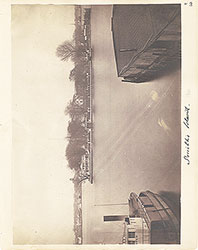 3
3 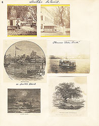 4
4  5
5 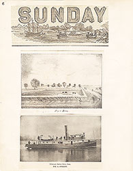 6
6 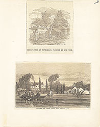 7
7  8
8  9
9 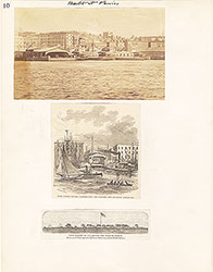 10
10 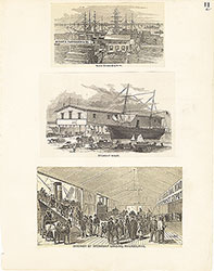 11
11 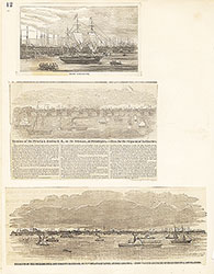 12
12  13
13 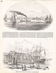 14
14 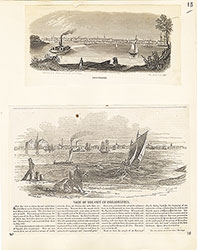 15
15 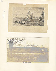 16
16  17
17  18
18  19
19  20
20  21
21  22
22  23
23  24
24  25
25 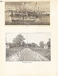 26
26 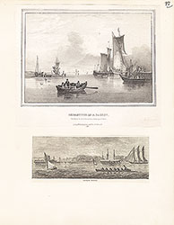 27
27 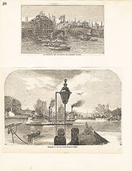 28
28 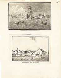 29
29 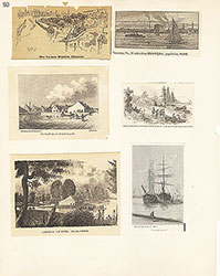 30
30
 31
31  32
32  33
33  34
34  35
35  36
36  37
37 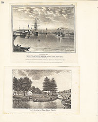 38
38  39
39  39
39 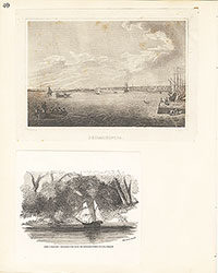 40
40 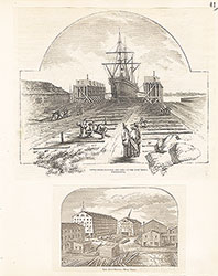 41
41  42
42 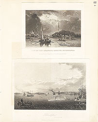 43
43 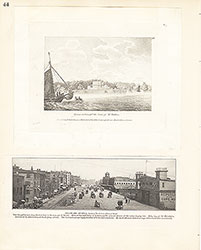 44
44 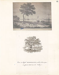 45
45  46
46  47
47  48
48 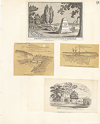 49
49  50
50  51
51  51
51 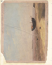 52
52  53
53  53
53 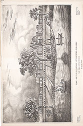 53
53  54
54  55
55  56
56  57
57 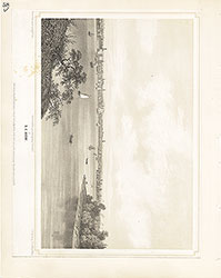 58
58 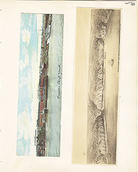 59
59  60
60 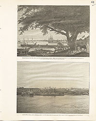 61
61  62
62  63
63  64
64  65
65  66
66  67
67 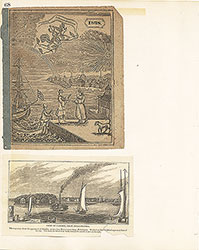 68
68  69
69  69
69  69
69  70
70 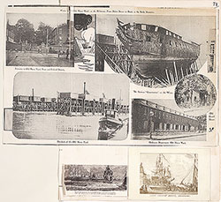 71
71  72
72  73
73  74
74 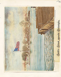 75
75 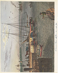 76
76  77
77  78
78  79
79 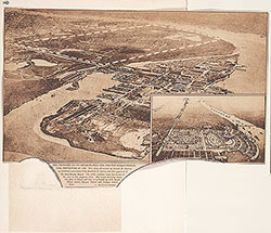 80
80 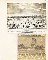 81
81 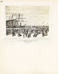 82
82 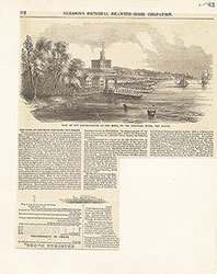 83
83 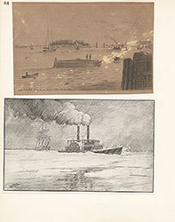 84
84 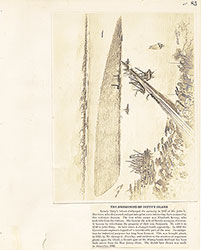 85
85 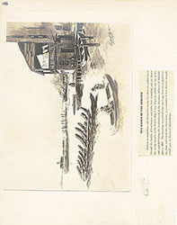 86
86 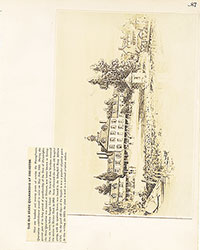 87
87 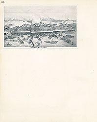 88
88 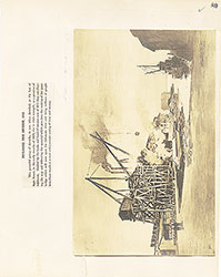 89
89 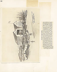 90
90  91
91 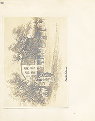 92
92 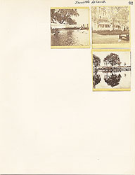 93
93  64a
64a