Castner Scrapbook v.20, Delaware River 1, page 31
Historical Images of Philadelphia Castner Scrapbook Collection
Item Info
Historic Street Address: Fort Delaware on Pea Patch Island, DE
Historic Street Address: Market Street, at the Delaware River
Media Type: Scrapbooks
Source: Print and Picture Collection
Notes:
Item 1, top: Caption reads, "The Landing of Penn at Dock Creek Philad." This depiction of William Penn's arrival in colonial Philadelphia in 1682 imagines a lush landscape surrounding the Blue Anchor Inn, where Penn first took refreshment. The landing party is seen arriving via Dock Creek (a tributary of the Delaware River) in a long rowboat, and a group of Native Americans observe the scene in the right foreground. Engraving by an unnamed artist, for an unidentified publication, 16.5 x 12 cm, undated.
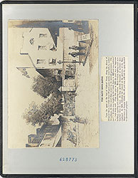
Item 2, middle: Caption reads, "Delaware River, Below Philadelphia, Showing Fort Delaware." This image shows Fort Delaware in the center background, located on Pea Patch Island, DE. It is isurrounded by multiple ships and sailing vessels, on the choppy waters of the Delaware River. It was built well south of Philadelphia, providing the city with an important strategic defence location. This last version of the fort (there were three, beginning in 1817) was built in 1846. Engraving, drawn by artist Frederic. B. Schell and engraved by John Dalziel, for an unidentified publication, 18.5 x 8.5 cm, c. 1885.
Item 3, bottom: Caption reads, "Delaware Avenue Shipping." This image depicts one of the many shipping wharves along the Delaware River. Delaware Avenue was built in 1834-1835, providing improved access for commercial waterfront activity. Featured in the foreground are horse-drawn vehicles, buildings, and large ships, all in service to travel and shipping industries. The background gives added imagery of a large, bustling port. Reproduction of an engraving, drawn by artist John B. Sword and engraved by John Andrew, for an unidentified publication, 14 x 8.5 cm, undated.
Creation Year: 1845
Geocode Latitude: Geocode Longitude:-75.140234
Geocode Latitude:39.949681
Call Number: A917.481 P536 v.20
Creator Name: Castner, Samuel, Jr., 1843-1929 - Compiler
Frederic B. Schell (1838-1905) - Artist
John Dalziel (1839-1937) - Engraver
John Andrew (1815-1875) - Engraver
James B. Sword (1839-1915) - Artist
 inside front cover
 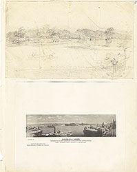 0
0  1c
1c  1
1 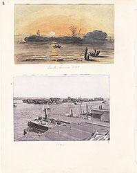 2
2 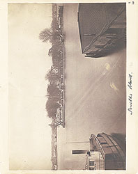 3
3  4
4  5
5 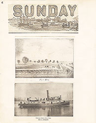 6
6  7
7  8
8  9
9 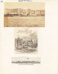 10
10  11
11  12
12  13
13 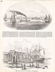 14
14 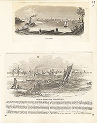 15
15  16
16  17
17 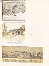 18
18  19
19  20
20  21
21 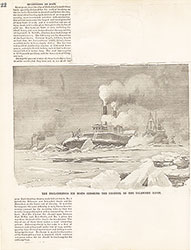 22
22  23
23  24
24 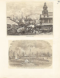 25
25  26
26  27
27  28
28 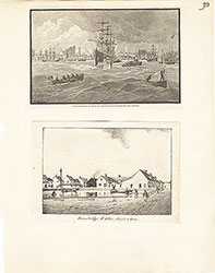 29
29  30
30 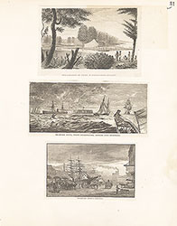 31
31
 32
32  33
33 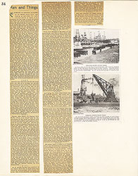 34
34  35
35  36
36 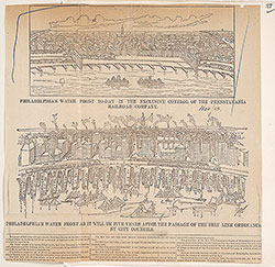 37
37 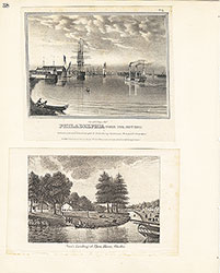 38
38  39
39  39
39 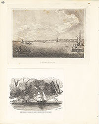 40
40 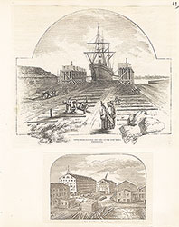 41
41  42
42  43
43  44
44 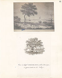 45
45  46
46  47
47  48
48 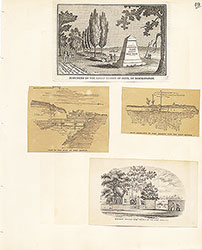 49
49  50
50  51
51  51
51 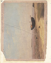 52
52  53
53  53
53 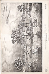 53
53  54
54  55
55 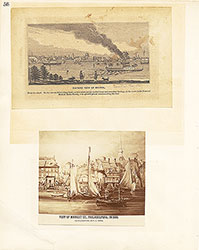 56
56 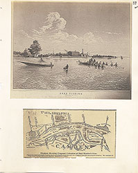 57
57 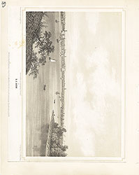 58
58 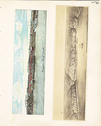 59
59 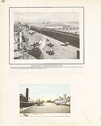 60
60 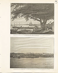 61
61 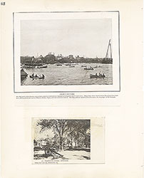 62
62 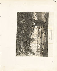 63
63  64
64  65
65  66
66  67
67 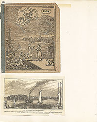 68
68  69
69  69
69  69
69  70
70 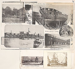 71
71 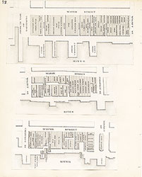 72
72 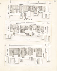 73
73 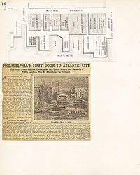 74
74 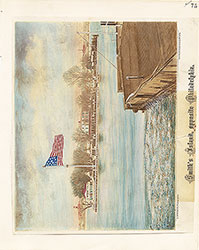 75
75 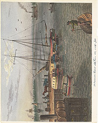 76
76  77
77 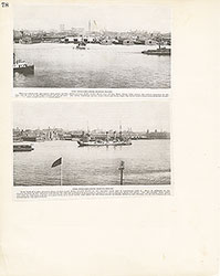 78
78  79
79 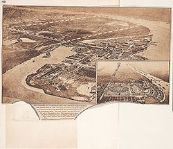 80
80  81
81 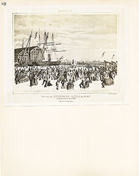 82
82 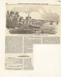 83
83 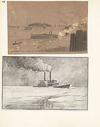 84
84  85
85  86
86  87
87 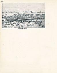 88
88 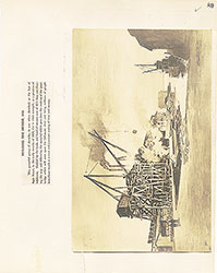 89
89 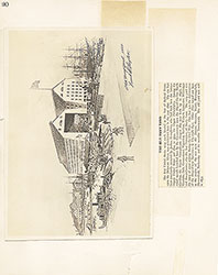 90
90  91
91 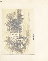 92
92 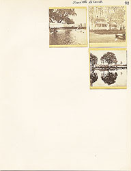 93
93  64a
64a