Castner Scrapbook v. 11, Hotels, Inns, page 17
Historical Images of Philadelphia Castner Scrapbook Collection
Item Info
Historic Street Address: 915-917 Walnut Street
Media Type: Scrapbooks
Source: Print and Picture Collection
Notes:
Item pdcc01087, bottom left [image dimensions 7.9 cm x 7.9 cm]:
Shows the elegant facade of the Irving House hotel, located on the north side of Walnut Street above 9th Street.
Building demolished: YES
Notes:
Item pdcc01088, bottom right [image dimensions 8.7 cm x 13.8 cm]:
Printed postcard of the historic inn located in Downingtown, Chester County. Built in 1761, the General Washington Inn was variously known as the "King of Arms" and "King George" prior to the Revolutionary War. In 1796 it became the first Post Office in Chester County. A silhouette of a coach-and-four is illustrated in the upper left corner.
Notes:
Item pdcc01089, second down [image dimensions 8.3 cm x 25.6 cm]:
Reproduction of a drawing showing the facade of the Girard House hotel and adjacent buildings located on the 800 block of Chestnut Street, North side. The hotel was built in 1852 after designs of John McArthur, Jr., architect of City Hall and the Continental Hotel, which was located across the street. During the Civil War, the hotel was commandeered for use as a baracks for Union soldiers, as well as a sewing factory for their uniforms. Other businesses depicted include, from left B & O ticket office, C. Laflin fine shoes, Rosenberg & Co., tailors, The Daily News Building.
Published in Julio Rae's Philadelphia pictorial directory and panoramic advertiser, 1886.
Building demolished: YES
Notes:
Item pdcc01099, top [image dimensions 9.1 cm x 25.0 cm]:
Engraving showing the facade of the Girard House hotel, proprietors Presbury & Billings, and adjacent buildings located on the 800 block of Chestnut Street, North side. The hotel was built in 1851-52 after designs of John McArthur, Jr., architect of City Hall and the Continental Hotel, which was located across the street. During the Civil War, the hotel was commandeered for use as a baracks for Union soldiers, as well as a sewing factory for their uniforms.
Published in Julio Rae's Philadelphia pictorial directory & panoramic advertiser, 1851.
Building demolished: YES
Geocode Latitude: Geocode Longitude:-75.154717
Geocode Latitude:39.949815
Call Number: A917.481 P536 v.11
Creator Name: Castner, Samuel, Jr., 1843-1929 - Compiler
MacNeill, Henry T. - Artist
McArthur, John, 1823-1890 - Architect
 1A
1A  1A
1A  1A
1A  1B
1B 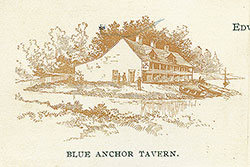 1B
1B 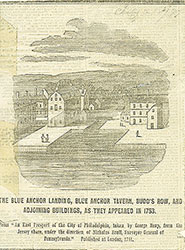 1B
1B  1B
1B  1
1  1C
1C 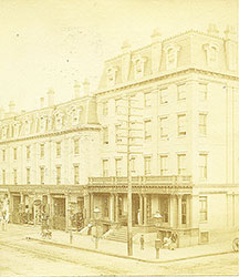 1C
1C  1C
1C 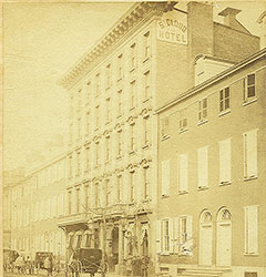 2
2  2
2  3
3  3
3  3
3  3
3  3
3  4
4  4
4  4
4  4
4  4
4  1C
1C  1C
1C  1C
1C  1
1  1A
1A 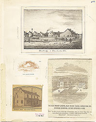 1B
1B  1C
1C  1
1  2
2 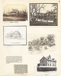 3
3 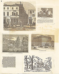 4
4  5
5  5
5 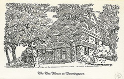 6
6  6
6  6
6  6
6  7
7  7
7  8
8  8
8 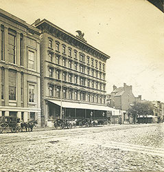 9
9 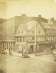 57
57 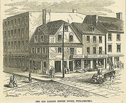 9
9 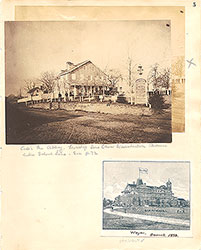 5
5  5
5  6
6  7
7  8
8 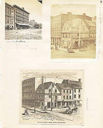 9
9 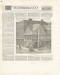 10
10 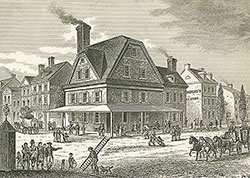 11
11  11
11  12
12 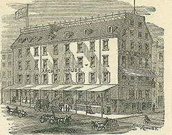 13
13  13
13  16
16 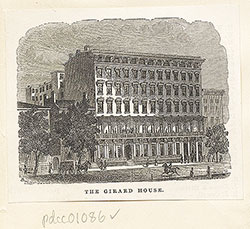 16
16 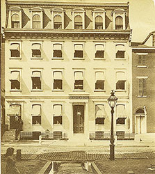 17
17 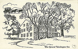 17
17 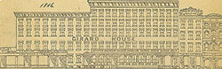 17
17  18
18  18
18  18
18  19
19  22
22 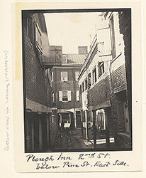 22
22 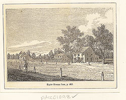 22
22 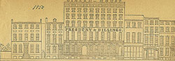 17
17  24
24 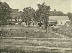 24
24 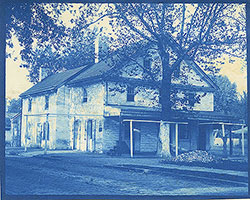 25
25 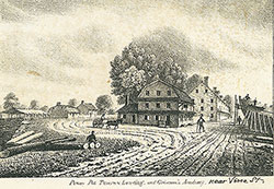 25
25 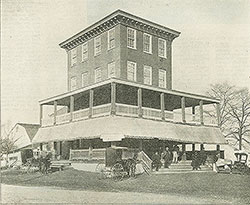 26
26 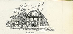 27
27  14
14  14
14 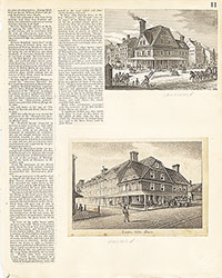 11
11 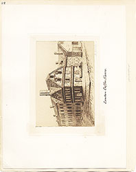 12
12 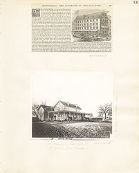 13
13 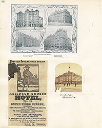 14
14 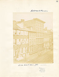 15
15 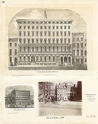 16
16 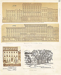 17
17
 18
18  19
19 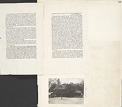 19
19 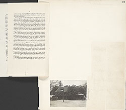 19
19 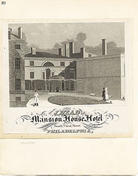 20
20  21
21 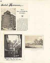 22
22 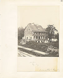 23
23 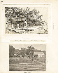 24
24 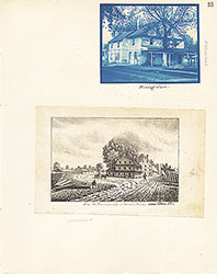 25
25  26
26  27
27  16
16  28
28  28
28 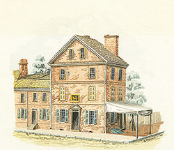 29
29  31
31 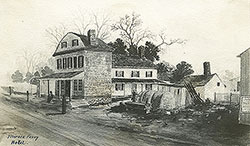 31
31  34
34  34
34  34
34  34
34  35
35  35
35  35
35  35
35  35
35  36
36  36
36  36
36  36
36  36
36  38
38  39
39  41
41 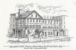 42
42  43
43 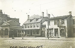 43
43 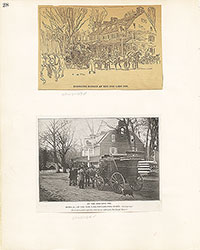 28
28 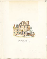 29
29  30
30 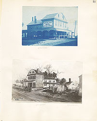 31
31  32
32  33
33 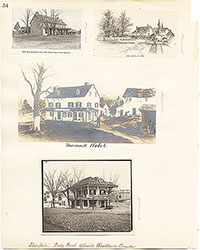 34
34  35
35 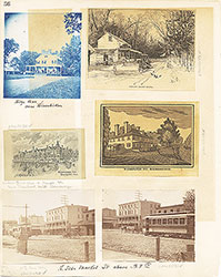 36
36  37
37 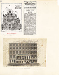 38
38  39
39 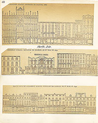 40
40 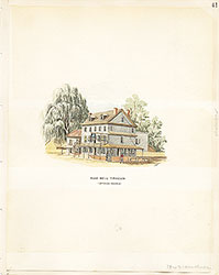 41
41  42
42 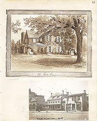 43
43  54
54  44
44  45
45  47
47 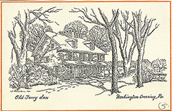 47
47  47
47  48
48  48
48 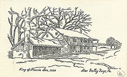 49
49  49
49  49
49 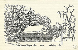 50
50  51
51  51
51  54
54 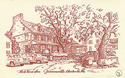 56
56  56
56  52
52  55
55 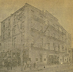 53
53 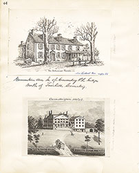 44
44 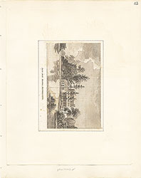 45
45  46
46 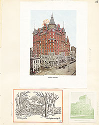 47
47 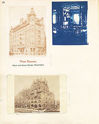 48
48 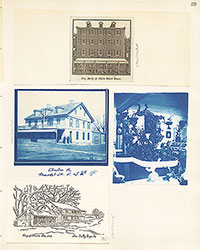 49
49  50
50  51
51  52
52  53
53 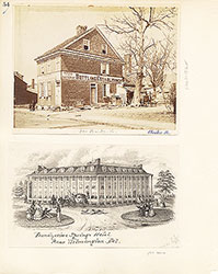 54
54 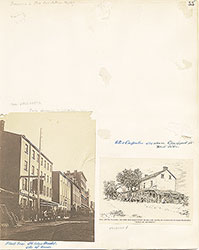 55
55 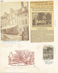 56
56 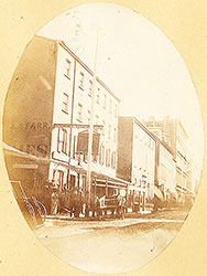 Black Bear Inn, 5th Street at Market
 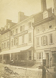 56
56 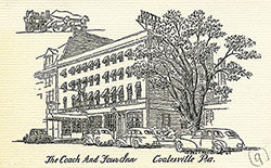 58
58 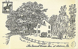 61
61 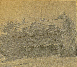 65
65  59
59  59
59 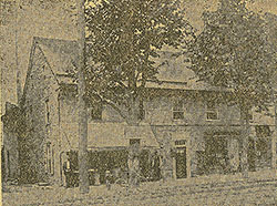 56
56  61
61  58
58  58
58  60
60  60
60  60
60  60
60  60
60  62
62  62
62  62
62  62
62 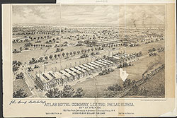 63
63 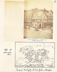 57
57 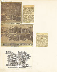 58
58  59
59  60
60 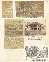 61
61 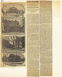 62
62  63
63  64
64  65
65  66
66  67
67  68
68  74
74  80
80 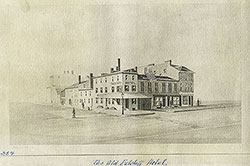 83
83 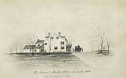 85
85  84
84  85
85  86
86  82
82  69
69  86
86  71
71  72
72  73
73  73
73 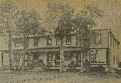 75
75  82
82  84
84 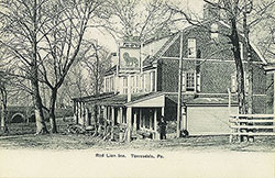 86
86  81
81  69
69  70
70  71
71 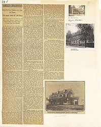 72
72 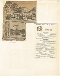 73
73  74
74 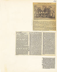 75
75  76
76  77
77  77
77 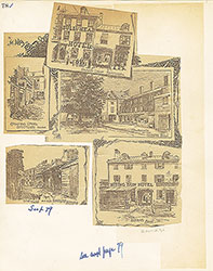 78
78  79
79 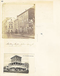 80
80  81
81  82
82 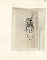 83
83 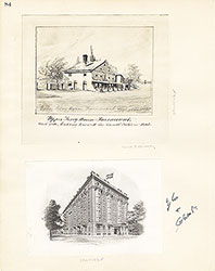 84
84 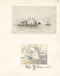 85
85  86
86  87
87 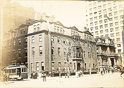 87
87 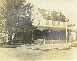 92
92  87
87  87
87 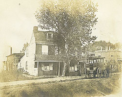 91
91 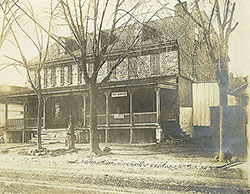 91
91 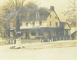 92
92 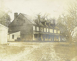 93
93 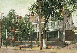 94
94 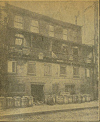 94
94 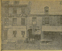 96
96  97
97 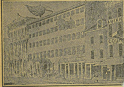 97
97 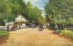 88
88  90
90 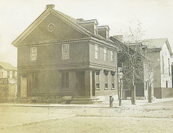 89
89 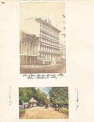 88
88 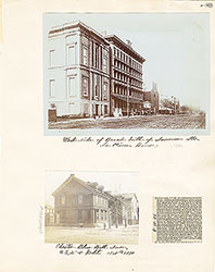 89
89 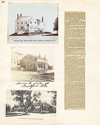 90
90  91
91  92
92 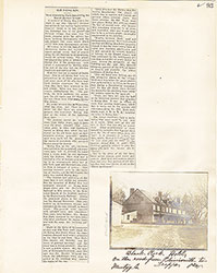 93
93 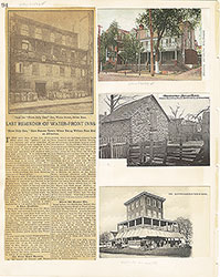 94
94  95
95  96
96  97
97