Map Collection
Our map collection enables you to see how Philadelphia's neighborhoods and streets have grown and changed. Use our interactive mapping tool to overlay atlases dating back as far as 1843 over today's street layout.
Showing 1001 to 1020 of 5,193
City Atlas of Philadelphia, 21st & 28th Wards, 1875, Plate K
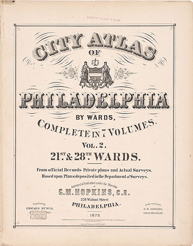
1875: G.M. Hopkins Atlas of Philadelphia, Wards 21, 28, Volume 2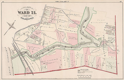
City Atlas of Philadelphia, 21st & 28th Wards, 1875, Plate J
1875: G.M. Hopkins Atlas of Philadelphia, Wards 21, 28, Volume 2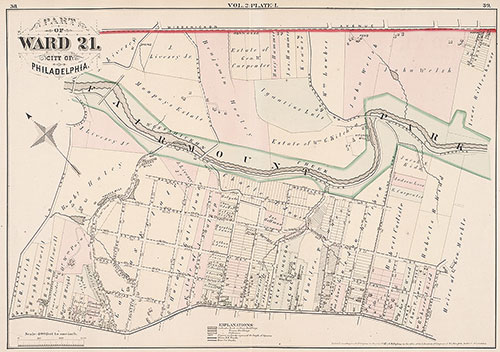
City Atlas of Philadelphia, 21st & 28th Wards, 1875, Plate I
1875: G.M. Hopkins Atlas of Philadelphia, Wards 21, 28, Volume 2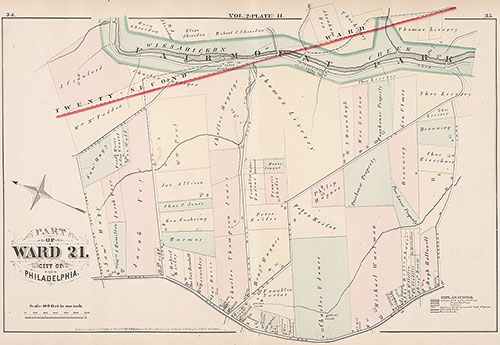
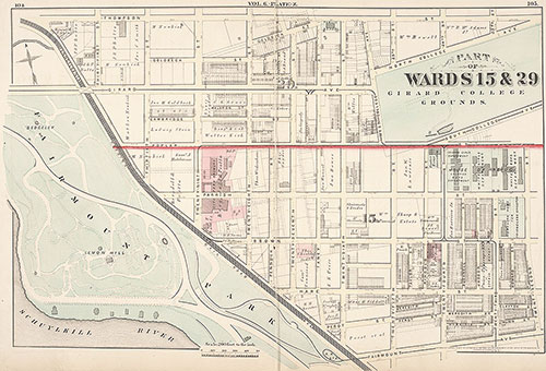
City Atlas of Philadelphia, 21st & 28th Wards, 1875, Plate H
1875: G.M. Hopkins Atlas of Philadelphia, Wards 21, 28, Volume 2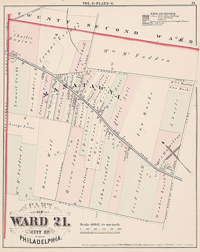
City Atlas of Philadelphia, 21st & 28th Wards, 1875, Plate G
1875: G.M. Hopkins Atlas of Philadelphia, Wards 21, 28, Volume 2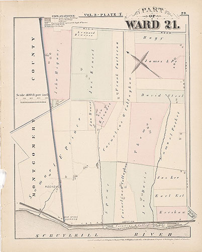
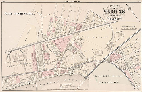
City Atlas of Philadelphia, 21st & 28th Wards, 1875, Plate F
1875: G.M. Hopkins Atlas of Philadelphia, Wards 21, 28, Volume 2
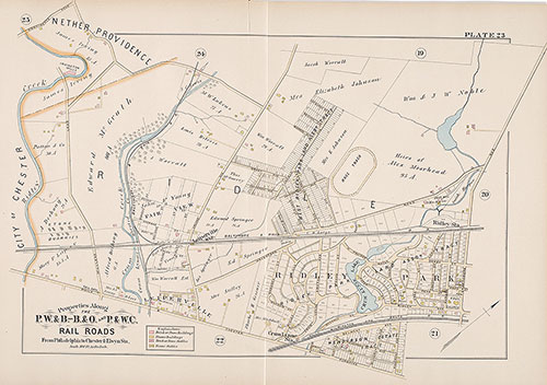
Atlas of Properties Along the Philadelphia, Wilmington and Baltimore R.R., Baltimore & Ohio R.R., Phila. & West Chester R.R. and Part of Philada. & Reading R.R., 1889, Plate: 23
1889: Atlas of Properties Along the Philadelphia, Wilmington and Baltimore R.R., Baltimore & Ohio R.R., Phila. & West Chester R.R. and Part of Phila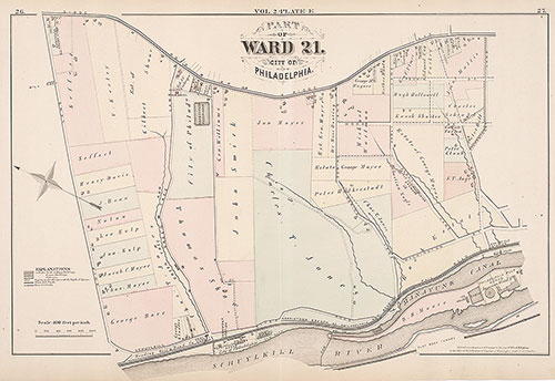
City Atlas of Philadelphia, 21st & 28th Wards, 1875, Plate E
1875: G.M. Hopkins Atlas of Philadelphia, Wards 21, 28, Volume 2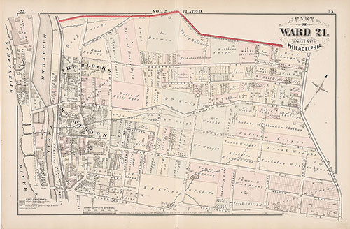
City Atlas of Philadelphia, 21st & 28th Wards, 1875, Plate D
1875: G.M. Hopkins Atlas of Philadelphia, Wards 21, 28, Volume 2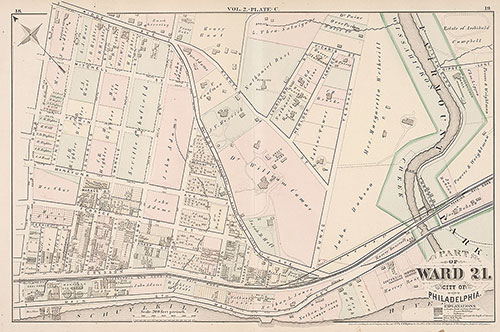
City Atlas of Philadelphia, 21st & 28th Wards, 1875, Plate C
1875: G.M. Hopkins Atlas of Philadelphia, Wards 21, 28, Volume 2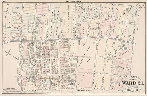
City Atlas of Philadelphia, 21st & 28th Wards, 1875, Plate B
1875: G.M. Hopkins Atlas of Philadelphia, Wards 21, 28, Volume 2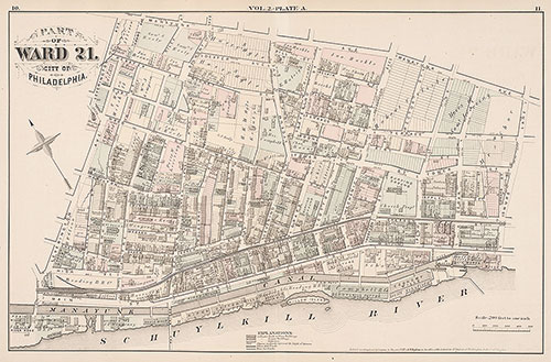
City Atlas of Philadelphia, 21st & 28th Wards, 1875, Plate A
1875: G.M. Hopkins Atlas of Philadelphia, Wards 21, 28, Volume 2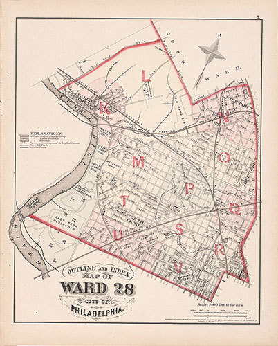
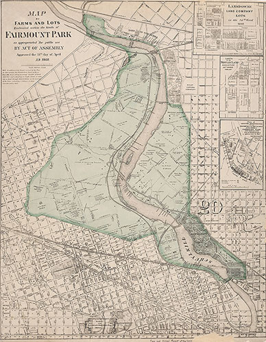
City Atlas of Philadelphia, 21st & 28th Wards, 1875, 28th Ward Map Index
1875: G.M. Hopkins Atlas of Philadelphia, Wards 21, 28, Volume 2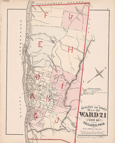
City Atlas of Philadelphia, 21st & 28th Wards, 1875, 21st Ward Index Map
1875: G.M. Hopkins Atlas of Philadelphia, Wards 21, 28, Volume 2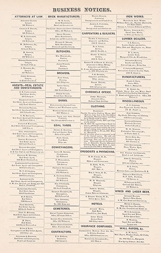
City Atlas of Philadelphia, 21st & 28th Wards, 1875, Business Notices
1875: G.M. Hopkins Atlas of Philadelphia, Wards 21, 28, Volume 2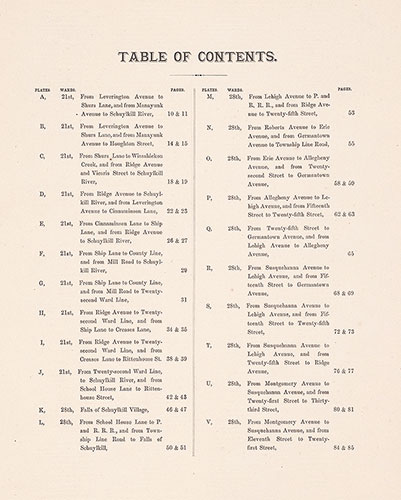
City Atlas of Philadelphia, 21st & 28th Wards, 1875, Table of Contents
1875: G.M. Hopkins Atlas of Philadelphia, Wards 21, 28, Volume 2