Map Collection
Our map collection enables you to see how Philadelphia's neighborhoods and streets have grown and changed. Use our interactive mapping tool to overlay atlases dating back as far as 1843 over today's street layout.
Showing 941 to 960 of 5,193
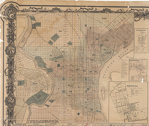
Map of the Vicinity of Philadelphia, from Actual Surveys, 1861, Plate 1-A: Philadelphia (part)
1861: Map of the Vicinity of Philadelphia, from Actual Surveys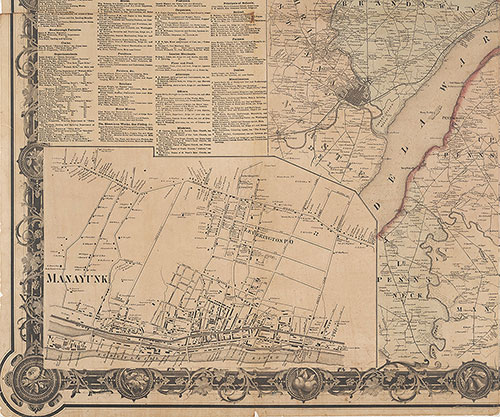
Map of the Vicinity of Philadelphia, From Actual Surveys, 1861, Plate 4-B: Southeast Suburbs
1861: Map of the Vicinity of Philadelphia, from Actual Surveys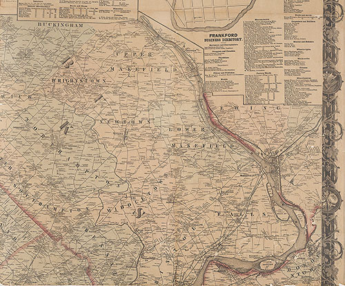
Map of the Vicinity of Philadelphia, From Actual Surveys, 1861, Plate 3-B: Northeast Suburbs
1861: Map of the Vicinity of Philadelphia, from Actual Surveys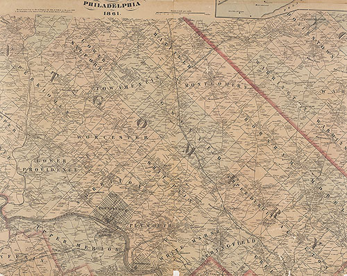
Map of the Vicinity of Philadelphia, From Actual Surveys, 1861, Plate 2-B: North Suburbs
1861: Map of the Vicinity of Philadelphia, from Actual Surveys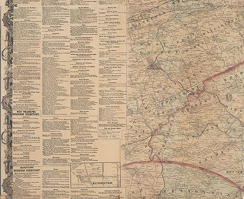
Map of the Vicinity of Philadelphia From Actual Surveys 1861, Plate 4-A: Southeast Suburbs
1861: Map of the Vicinity of Philadelphia, from Actual Surveys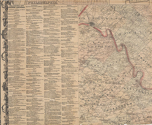
Map of the Vicinity of Philadelphia, From Actual Surveys, 1861, Plate 1-B: Northwest Suburbs
1861: Map of the Vicinity of Philadelphia, from Actual Surveys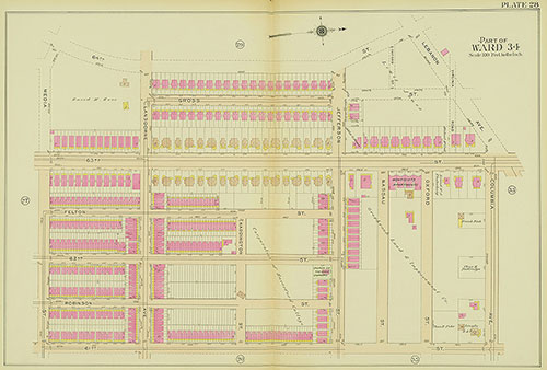
Atlas of the 24th, 34th & 44th Wards of the City of Philadelphia, 1911-1912, Plate 28
1911-1912: Atlas of the 24th, 34th & 44th Wards of the City of Philadelphia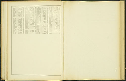
Atlas of the 24th, 34th & 44th Wards of the City of Philadelphia, 1911-1912, Street index R-Z
1911-1912: Atlas of the 24th, 34th & 44th Wards of the City of Philadelphia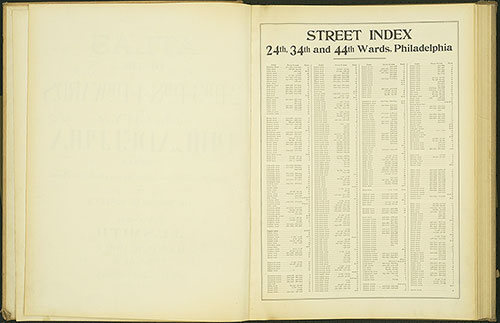
Atlas of the 24th, 34th & 44th Wards of the City of Philadelphia, 1911-1912, Street Index A-Q
1911-1912: Atlas of the 24th, 34th & 44th Wards of the City of Philadelphia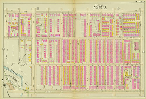
Atlas of the 24th, 34th & 44th Wards of the City of Philadelphia, 1911-1912, Plate 24
1911-1912: Atlas of the 24th, 34th & 44th Wards of the City of Philadelphia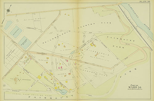
Atlas of the 24th, 34th & 44th Wards of the City of Philadelphia, 1911-1912, Plate 38
1911-1912: Atlas of the 24th, 34th & 44th Wards of the City of Philadelphia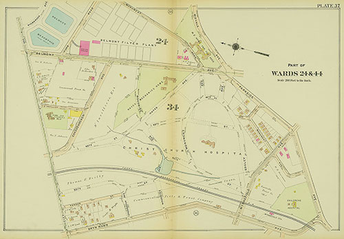
Atlas of the 24th, 34th & 44th Wards of the City of Philadelphia, 1911-1912, Plate 37
1911-1912: Atlas of the 24th, 34th & 44th Wards of the City of Philadelphia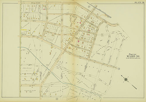
Atlas of the 24th, 34th & 44th Wards of the City of Philadelphia, 1911-1912, Plate 36
1911-1912: Atlas of the 24th, 34th & 44th Wards of the City of Philadelphia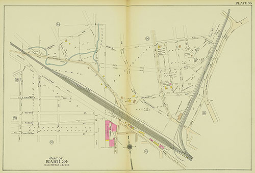
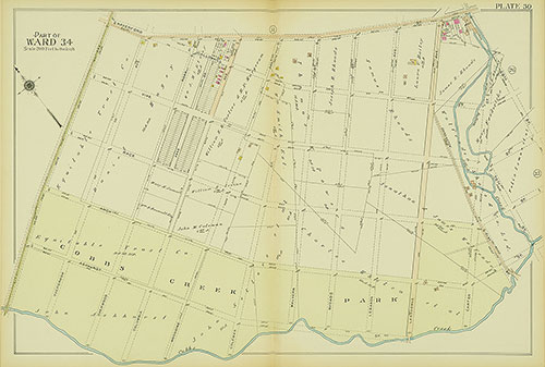
Atlas of the 24th, 34th & 44th Wards of the City of Philadelphia, 1911-1912, Plate 35
1911-1912: Atlas of the 24th, 34th & 44th Wards of the City of Philadelphia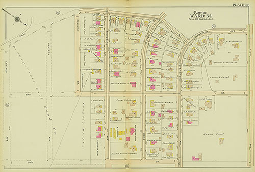
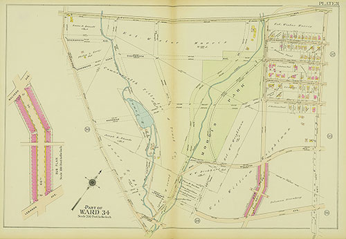
Atlas of the 24th, 34th & 44th Wards of the City of Philadelphia, 1911-1912, Plate 34
1911-1912: Atlas of the 24th, 34th & 44th Wards of the City of Philadelphia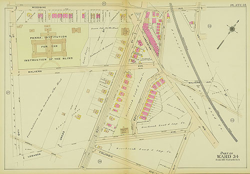
Atlas of the 24th, 34th & 44th Wards of the City of Philadelphia, 1911-1912, Plate 33
1911-1912: Atlas of the 24th, 34th & 44th Wards of the City of Philadelphia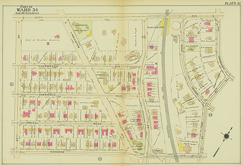
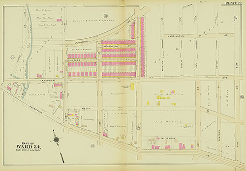
Atlas of the 24th, 34th & 44th Wards of the City of Philadelphia, 1911-1912, Plate 32
1911-1912: Atlas of the 24th, 34th & 44th Wards of the City of Philadelphia