Map Collection
Our map collection enables you to see how Philadelphia's neighborhoods and streets have grown and changed. Use our interactive mapping tool to overlay atlases dating back as far as 1843 over today's street layout.
Showing 861 to 880 of 5,193
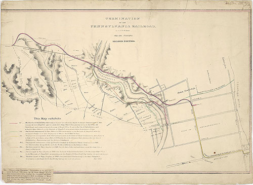
Termination of the Pennsylvania Railroad, 1829, map
1829: Swett, Termination of the Pennsylvania Railroad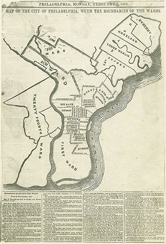
Map of the City of Philadelphia With the Boundaries of the Wards, 1854, Map
1854: Map of the City of Philadelphia With the Boundaries of the Wards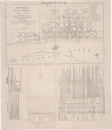
The Centennial Railway Guide Map of the City of Philadelphia, 1875, key
1875: Haupt, The Centennial Railway Guide Map to the City of Philadelphia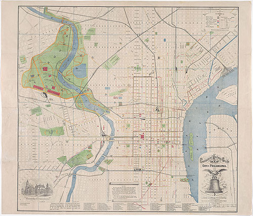
The Centennial Railway Guide Map to the City of Philadelphia, 1875, Map
1875: Haupt, The Centennial Railway Guide Map to the City of Philadelphia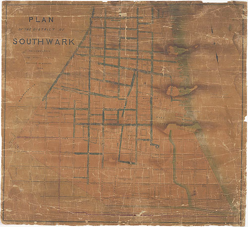
Plan of the District of Southwark, Philadelphia, 1848, map
1849: Dripps, Map of the Township of Oxford, Boroughs of Frankford & Bridesburg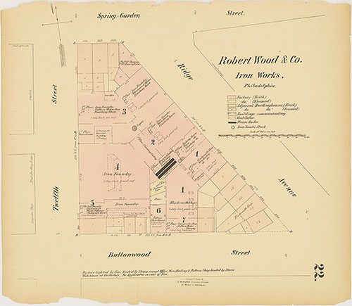
Hexamer General Surveys, Volume 1, Plate 22
1866-1867: Hexamer General Surveys: Volume 1, Plates 1-79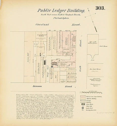
Hexamer General Surveys, Volume 4, Plate 303
1866-1867: Hexamer General Surveys: Volume 4, Plates 261-356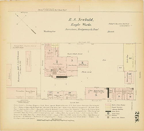
Hexamer General Surveys, Volume 4, Plate 268
1866-1867: Hexamer General Surveys: Volume 4, Plates 261-356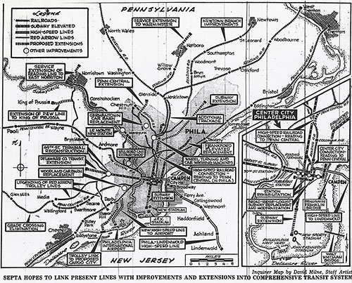
[Philadelphia and Vicinity Mass Transity System], 1968, map
1968: Philadelphia and Vicinity Mass Transity System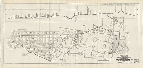
Frankford, Bustleton & Byberry Surface Passenger Railway, 1916, map
1914: Estimated Time Saving From Market St-Broad to 8th St. by Recommended Rapid Transit Lines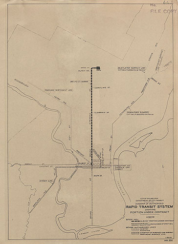
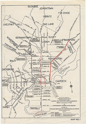
... Authorized Rapid Transit System Showing Portion Under Contract, 1925, map
1914: Estimated Time Saving From Market St-Broad to 8th St. by Recommended Rapid Transit Lines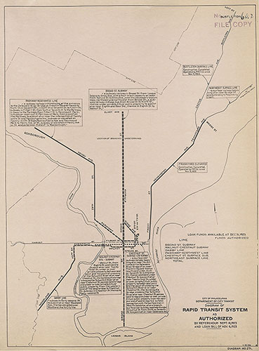
Diagram of Rapid Transit System as Authorized, 1923, map
1914: Estimated Time Saving From Market St-Broad to 8th St. by Recommended Rapid Transit Lines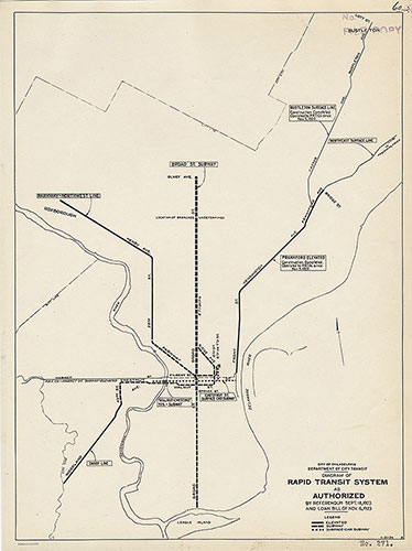
Diagram of Rapid Transit System as Authorized, 1924, map
1914: Estimated Time Saving From Market St-Broad to 8th St. by Recommended Rapid Transit Lines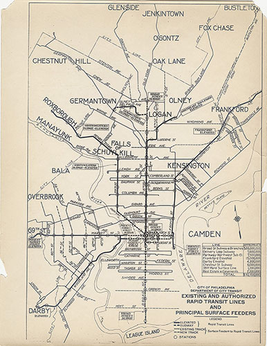
Existing & Authorized Rapid Transit Lines and & Principal Surface Feeders, 1923, map
1914: Estimated Time Saving From Market St-Broad to 8th St. by Recommended Rapid Transit Lines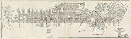
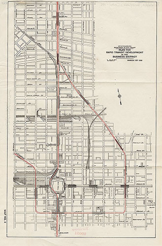
Plan of Subways and Elevated Railways, 1916, map
1914: Estimated Time Saving From Market St-Broad to 8th St. by Recommended Rapid Transit Lines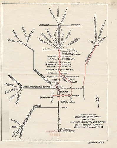
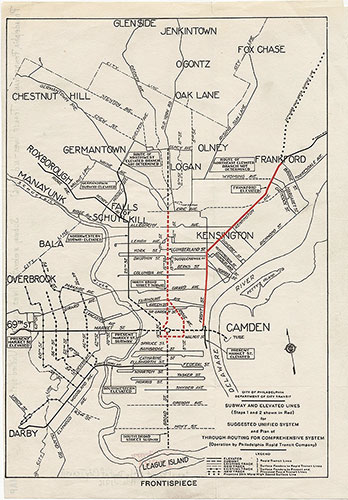
Diagram of Modified Rapid Transit System With Through Routing, 1916, map
1914: Estimated Time Saving From Market St-Broad to 8th St. by Recommended Rapid Transit Lines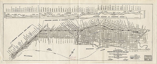
Frankford Elevated Railway..Front & Arch to Rhawn St., 1916, map
1914: Estimated Time Saving From Market St-Broad to 8th St. by Recommended Rapid Transit Lines