Map Collection
Our map collection enables you to see how Philadelphia's neighborhoods and streets have grown and changed. Use our interactive mapping tool to overlay atlases dating back as far as 1843 over today's street layout.
Showing 821 to 840 of 5,193
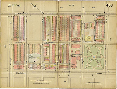
Insurance Maps of the City of Philadelphia, 1913-1918, Plate 406
1913-1918: Hexamer, Insurance Maps of the City of Philadelphia, Volume 19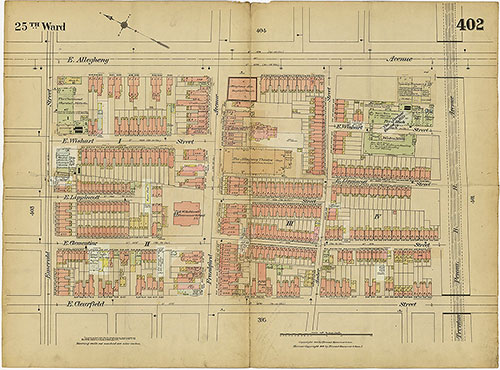
Insurance Maps of the City of Philadelphia, 1913-1918, Plate 402
1913-1918: Hexamer, Insurance Maps of the City of Philadelphia, Volume 19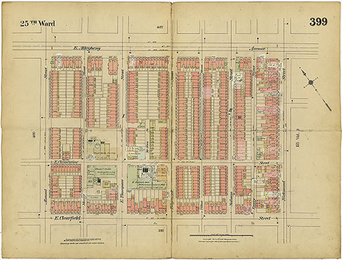
Insurance Maps of the City of Philadelphia, 1913-1918, Plate 399
1913-1918: Hexamer, Insurance Maps of the City of Philadelphia, Volume 19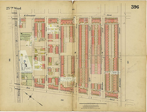
Insurance Maps of the City of Philadelphia, 1913-1918, Plate 396
1913-1918: Hexamer, Insurance Maps of the City of Philadelphia, Volume 19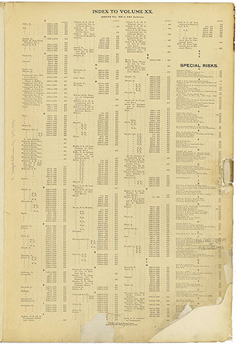
Insurance Maps of the City of Philadelphia, 1915-1920, Street Index & Special Risks
1915-1920: Hexamer, Insurance Maps of the City of Philadelphia, Volume 20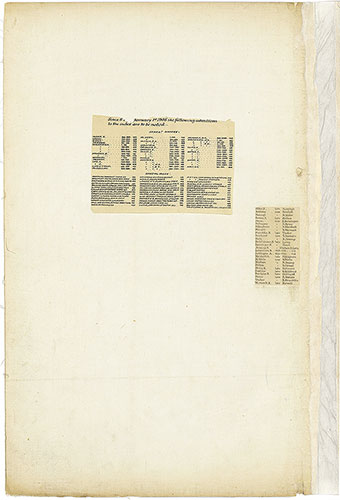
Insurance Maps of the City of Philadelphia, 1893-1914, Revised Streets & Risks
1893-1914: Hexamer, Insurance Maps of the City of Philadelphia, Volume 20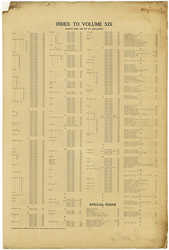
Insurance Maps of the City of Philadelphia, 1913-1918, Street Index & Special Risks
1913-1918: Hexamer, Insurance Maps of the City of Philadelphia, Volume 19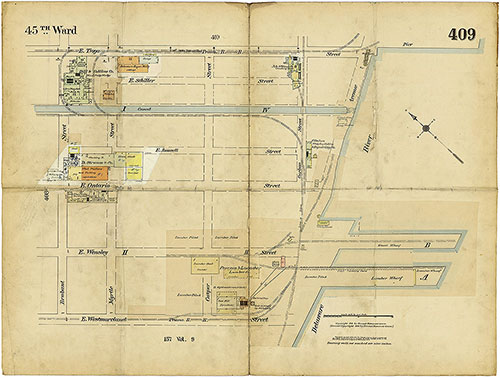
Insurance Maps of the City of Philadelphia, 1913-1918, Plate 409
1913-1918: Hexamer, Insurance Maps of the City of Philadelphia, Volume 19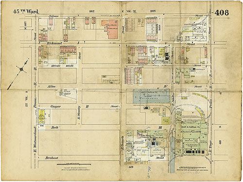
Insurance Maps of the City of Philadelphia, 1913-1918, Plate 408
1913-1918: Hexamer, Insurance Maps of the City of Philadelphia, Volume 19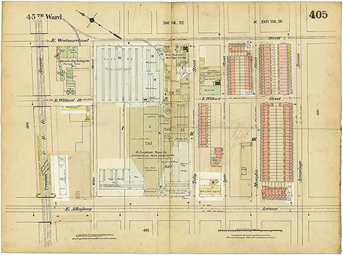
Insurance Maps of the City of Philadelphia, 1913-1918, Plate 405
1913-1918: Hexamer, Insurance Maps of the City of Philadelphia, Volume 19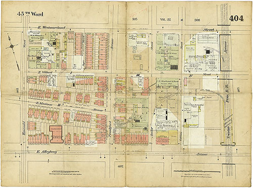
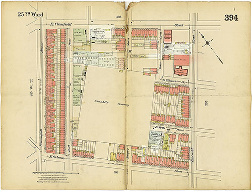
Insurance Maps of the City of Philadelphia, 1913-1918, Plate 404
1913-1918: Hexamer, Insurance Maps of the City of Philadelphia, Volume 19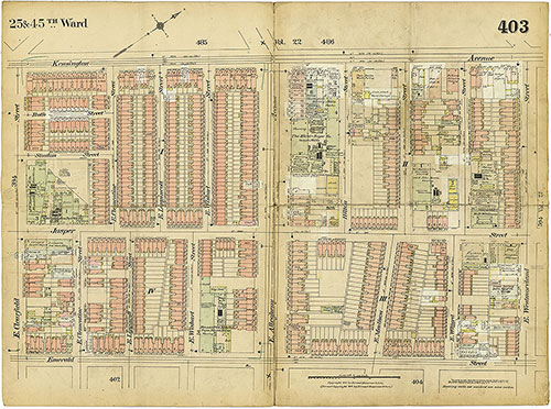
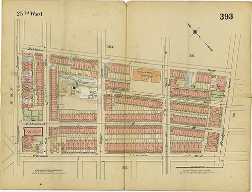
Insurance Maps of the City of Philadelphia, 1913-1918, Plate 403
1913-1918: Hexamer, Insurance Maps of the City of Philadelphia, Volume 19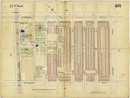
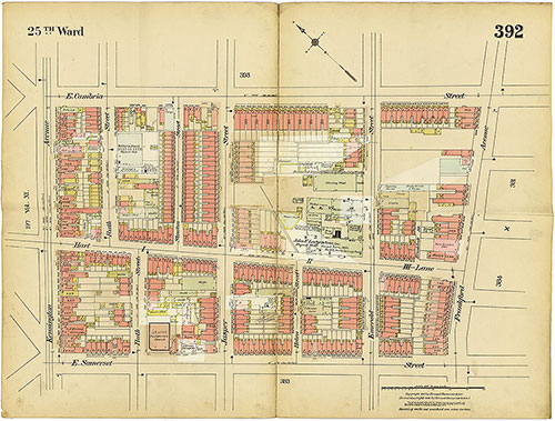
Insurance Maps of the City of Philadelphia, 1913-1918, Plate 401
1913-1918: Hexamer, Insurance Maps of the City of Philadelphia, Volume 19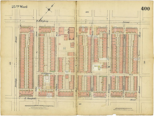
Insurance Maps of the City of Philadelphia, 1913-1918, Plate 400
1913-1918: Hexamer, Insurance Maps of the City of Philadelphia, Volume 19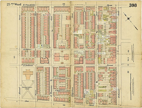
Insurance Maps of the City of Philadelphia, 1913-1918, Plate 398
1913-1918: Hexamer, Insurance Maps of the City of Philadelphia, Volume 19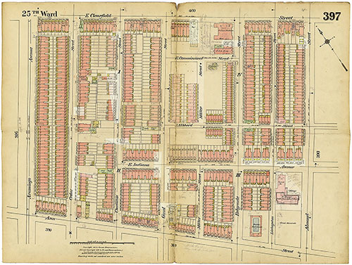
Insurance Maps of the City of Philadelphia, 1913-1918, Plate 397
1913-1918: Hexamer, Insurance Maps of the City of Philadelphia, Volume 19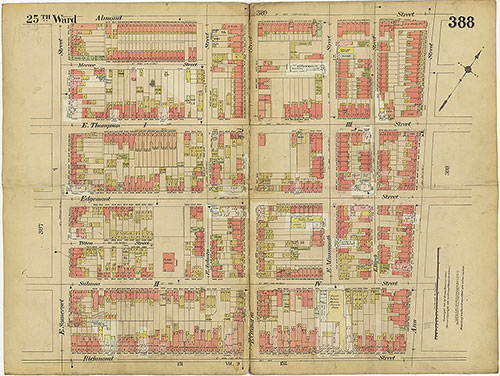
Insurance Maps of the City of Philadelphia, 1913-1918, Plate 388
1913-1918: Hexamer, Insurance Maps of the City of Philadelphia, Volume 19