Map Collection
Our map collection enables you to see how Philadelphia's neighborhoods and streets have grown and changed. Use our interactive mapping tool to overlay atlases dating back as far as 1843 over today's street layout.
Showing 781 to 800 of 5,193
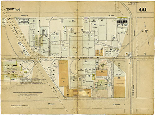
Insurance Maps of the City of Philadelphia, 1915-1919, Plate 441
1915-1919: Hexamer, Insurance Maps of the City of Philadelphia, Volume 20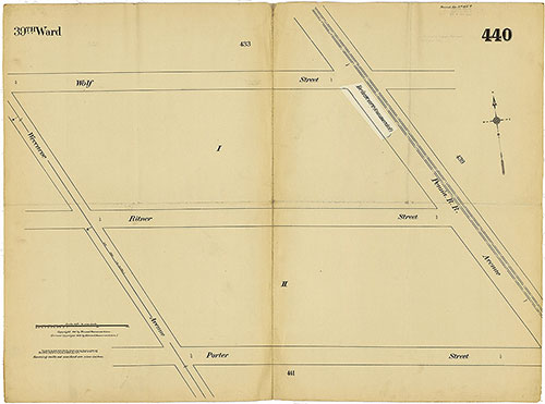
Insurance Maps of the City of Philadelphia, 1915-1919, Plate 440
1915-1919: Hexamer, Insurance Maps of the City of Philadelphia, Volume 20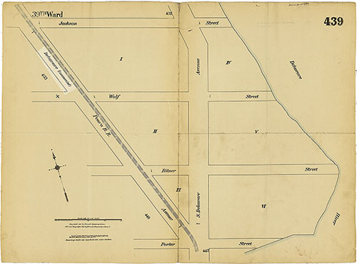
Insurance Maps of the City of Philadelphia, 1915-1919, Plate 439
1915-1919: Hexamer, Insurance Maps of the City of Philadelphia, Volume 20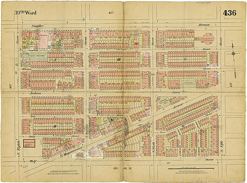
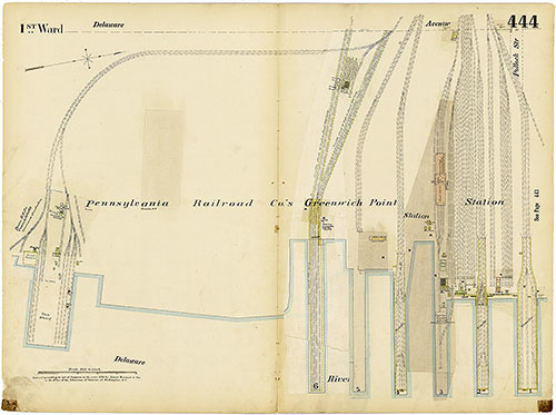
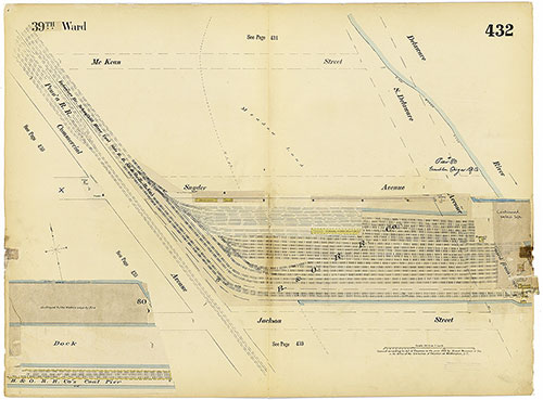
Insurance Maps of the City of Philadelphia, 1915-1919, Plate 436
1915-1919: Hexamer, Insurance Maps of the City of Philadelphia, Volume 20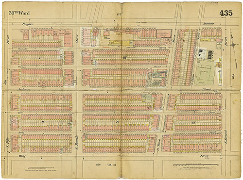
Insurance Maps of the City of Philadelphia, 1915-1919, Plate 435
1915-1919: Hexamer, Insurance Maps of the City of Philadelphia, Volume 20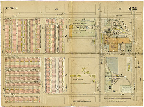
Insurance Maps of the City of Philadelphia, 1915-1919, Plate 434
1915-1919: Hexamer, Insurance Maps of the City of Philadelphia, Volume 20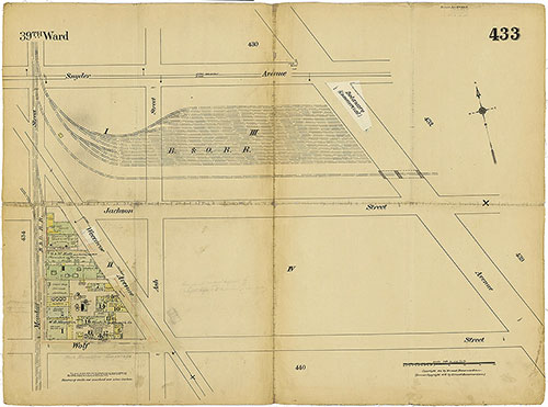
Insurance Maps of the City of Philadelphia, 1915-1919, Plate 433
1915-1919: Hexamer, Insurance Maps of the City of Philadelphia, Volume 20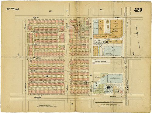
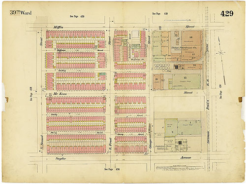
Insurance Maps of the City of Philadelphia, 1915-1919, Plate 429
1915-1919: Hexamer, Insurance Maps of the City of Philadelphia, Volume 20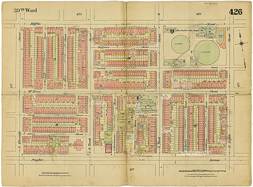
Insurance Maps of the City of Philadelphia, 1915-1919, Plate 426
1915-1919: Hexamer, Insurance Maps of the City of Philadelphia, Volume 20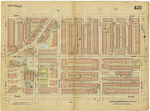
Insurance Maps of the City of Philadelphia, 1915-1919, Plate 425
1915-1919: Hexamer, Insurance Maps of the City of Philadelphia, Volume 20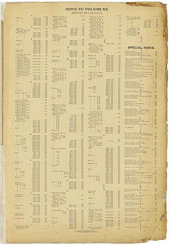
Insurance Maps of the City of Philadelphia, 1915-1919, Street Index & Special Risks
1915-1919: Hexamer, Insurance Maps of the City of Philadelphia, Volume 20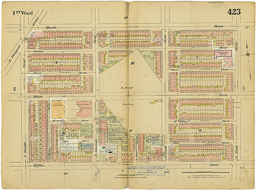
Insurance Maps of the City of Philadelphia, 1915-1919, Plate 423
1915-1919: Hexamer, Insurance Maps of the City of Philadelphia, Volume 20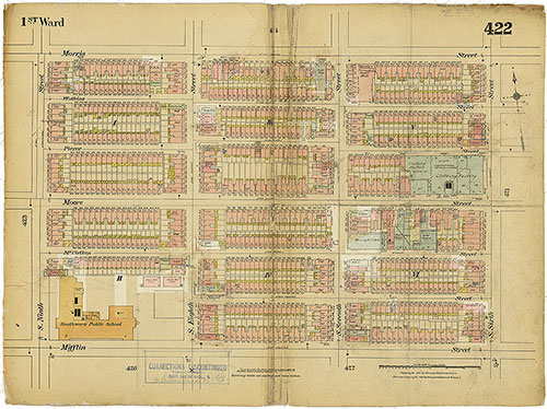
Insurance Maps of the City of Philadelphia, 1915-1919, Plate 422
1915-1919: Hexamer, Insurance Maps of the City of Philadelphia, Volume 20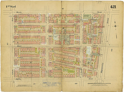
Insurance Maps of the City of Philadelphia, 1915-1919, Plate 421
1915-1919: Hexamer, Insurance Maps of the City of Philadelphia, Volume 20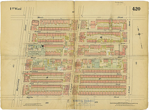
Insurance Maps of the City of Philadelphia, 1915-1919, Plate 420
1915-1919: Hexamer, Insurance Maps of the City of Philadelphia, Volume 20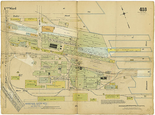
Insurance Maps of the City of Philadelphia, 1915-1919, Plate 418
1915-1919: Hexamer, Insurance Maps of the City of Philadelphia, Volume 20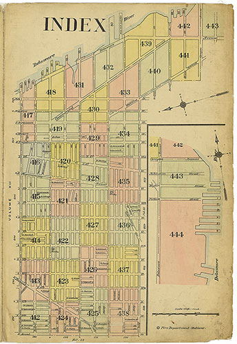
Insurance Maps of the City of Philadelphia, 1915-1919, Map Index
1915-1919: Hexamer, Insurance Maps of the City of Philadelphia, Volume 20