Map Collection
Our map collection enables you to see how Philadelphia's neighborhoods and streets have grown and changed. Use our interactive mapping tool to overlay atlases dating back as far as 1843 over today's street layout.
Showing 901 to 920 of 5,193
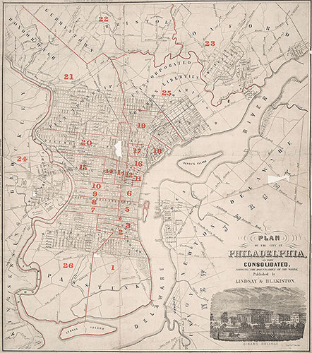
Plan of the City of Philadelphia As Now Consolidated, 1856, Map
1852: Lindsay, Plan of the City of Philadelphia and Environs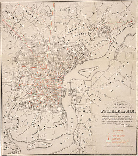
Plan of.. Fire Districts, Signal Boxes..Police Stations, Circuits..Proposed, 1854, Map
1854: Purdy & Philips, Plan of.. Fire Districts, Signal Boxes..Police Stations, Circuits..Proposed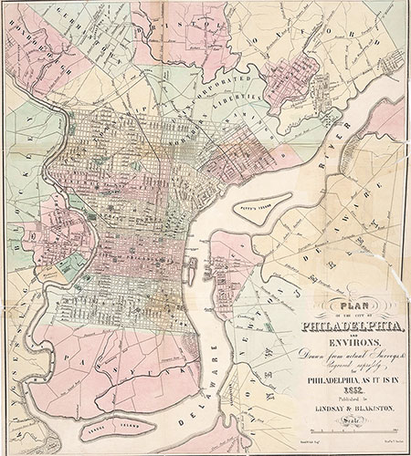
Plan of the City of Philadelphia and Environs, 1852, Map
1852: Lindsay, Plan of the City of Philadelphia and Environs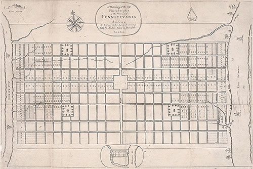
Portraiture of the City of Philadelphia in the Province of Pennsylvania in America, 1683, Map
1683: Holme, Portraiture of the City of Philadelphia in the Province of Pennsylvania in America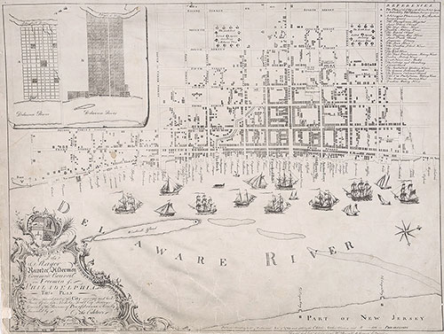
To the Mayor, Recorder, Aldermen, Common Council, and Freemen of Philadelphia this Plan of the Improved part of the City Surveyed and Laid Down by the Late Nicholas Scull [...], 1762, map
1762: Clarkson, Biddle, To the Mayor, Aldermen, Common Council and Freemen of Philadelphia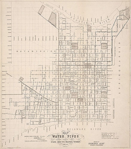
Map of the Water Pipes Now Supplied From Fair Mount Water Works, 1853, Map
1853: Graff, Map of the Water Pipes Now Supplied From Fair Mount Water Works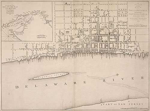
A Plan of the City of Philadelphia, the Capital of Pennsylvania, 1776, Map
1776: Benjamin Easburn, A Plan of the City of Philadelphia, The Capital of Pennsylvania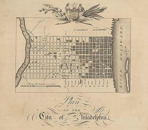
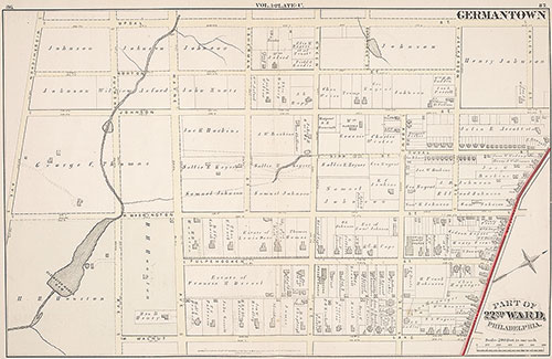
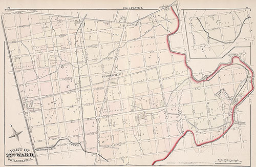
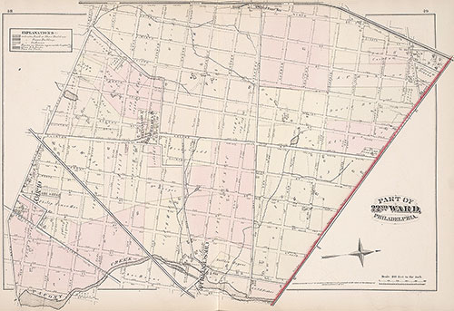
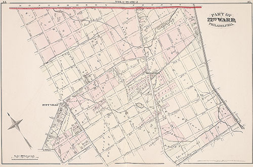
City Atlas of Philadelphia, 22nd ward, 1876, Plate U
1876: G. M. Hopkins, City Atlas of Philadelphia, 22nd Ward, Volume 1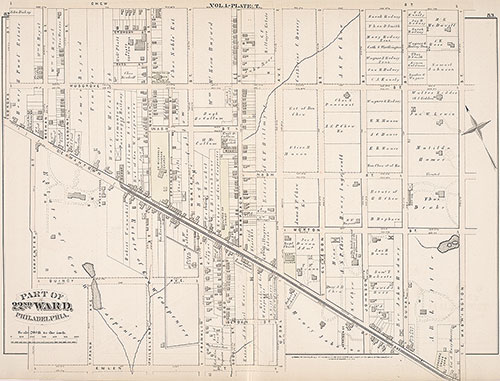
City Atlas of Philadelphia, 22nd ward, 1876, Plate T
1876: G. M. Hopkins, City Atlas of Philadelphia, 22nd Ward, Volume 1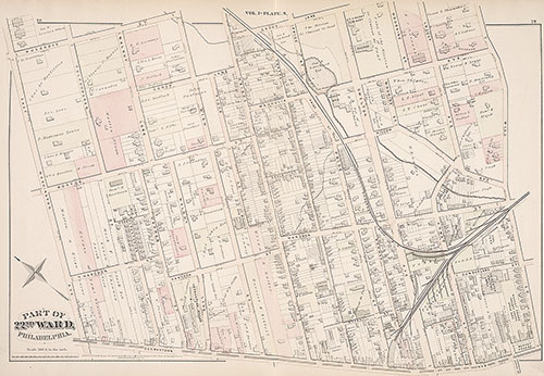
City Atlas of Philadelphia, 22nd ward, 1876, Plate S
1876: G. M. Hopkins, City Atlas of Philadelphia, 22nd Ward, Volume 1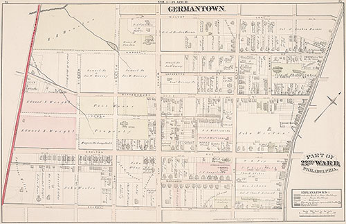
City Atlas of Philadelphia, 22nd ward, 1876, Plate R
1876: G. M. Hopkins, City Atlas of Philadelphia, 22nd Ward, Volume 1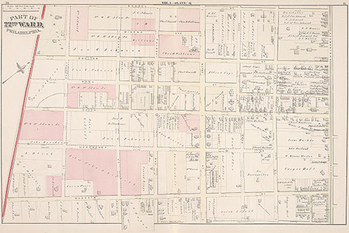
City Atlas of Philadelphia, 22nd ward, 1876, Plate Q
1876: G. M. Hopkins, City Atlas of Philadelphia, 22nd Ward, Volume 1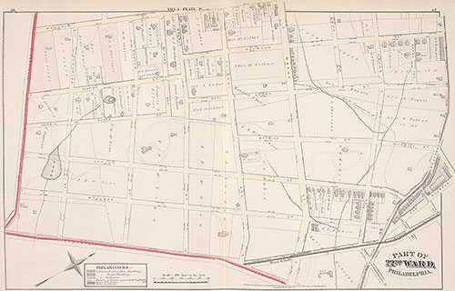
City Atlas of Philadelphia, 22nd ward, 1876, Plate P
1876: G. M. Hopkins, City Atlas of Philadelphia, 22nd Ward, Volume 1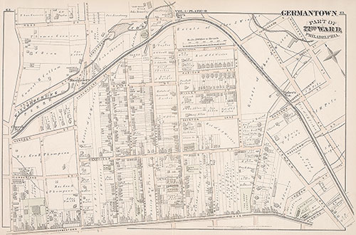
City Atlas of Philadelphia, 22nd ward, 1876, Plate O
1876: G. M. Hopkins, City Atlas of Philadelphia, 22nd Ward, Volume 1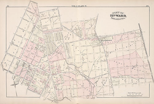
City Atlas of Philadelphia, 22nd ward, 1876, Plate N
1876: G. M. Hopkins, City Atlas of Philadelphia, 22nd Ward, Volume 1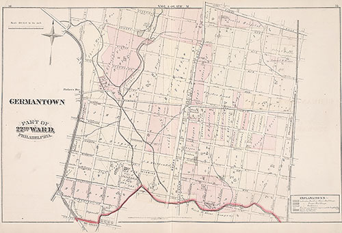
City Atlas of Philadelphia, 22nd ward, 1876, Plate M
1876: G. M. Hopkins, City Atlas of Philadelphia, 22nd Ward, Volume 1