Map Collection
Our map collection enables you to see how Philadelphia's neighborhoods and streets have grown and changed. Use our interactive mapping tool to overlay atlases dating back as far as 1843 over today's street layout.
Showing 961 to 980 of 5,193
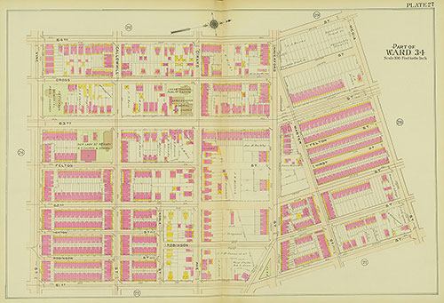
Atlas of the 24th, 34th & 44th Wards of the City of Philadelphia, 1911-1912, Plate 27
1911-1912: Atlas of the 24th, 34th & 44th Wards of the City of Philadelphia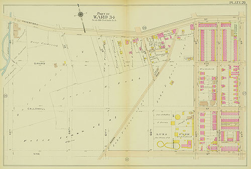
Atlas of the 24th, 34th & 44th Wards of the City of Philadelphia, 1911-1912, Plate 26
1911-1912: Atlas of the 24th, 34th & 44th Wards of the City of Philadelphia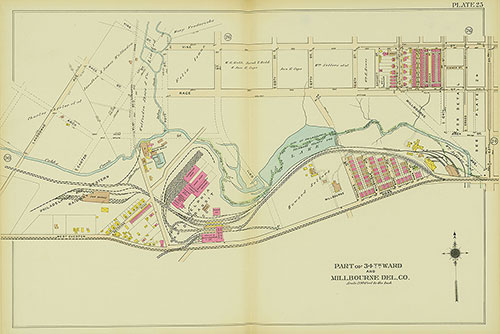
Atlas of the 24th, 34th & 44th Wards of the City of Philadelphia, 1911-1912, Plate 25
1911-1912: Atlas of the 24th, 34th & 44th Wards of the City of Philadelphia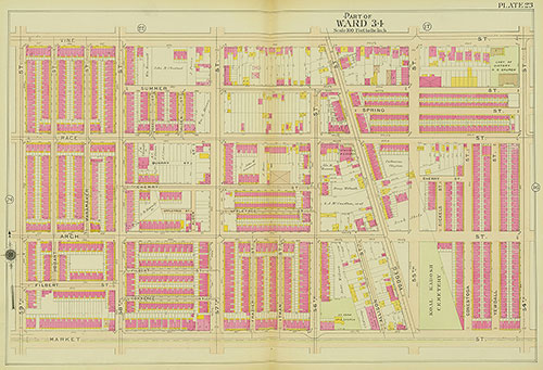
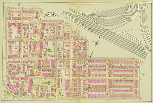
Atlas of the 24th, 34th & 44th Wards of the City of Philadelphia, 1911-1912, Plate 23
1911-1912: Atlas of the 24th, 34th & 44th Wards of the City of Philadelphia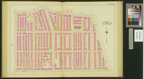
Atlas of the 24th, 34th & 44th Wards of the City of Philadelphia, 1911-1912, Plate 16
1911-1912: Atlas of the 24th, 34th & 44th Wards of the City of Philadelphia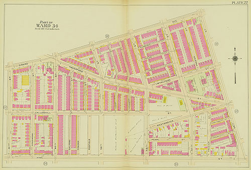
Atlas of the 24th, 34th & 44th Wards of the City of Philadelphia, 1911-1912, Plate 22
1911-1912: Atlas of the 24th, 34th & 44th Wards of the City of Philadelphia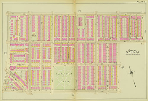
Atlas of the 24th, 34th & 44th Wards of the City of Philadelphia, 1911-1912, Plate 21
1911-1912: Atlas of the 24th, 34th & 44th Wards of the City of Philadelphia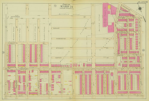
Atlas of the 24th, 34th & 44th Wards of the City of Philadelphia, 1911-1912, Plate 20
1911-1912: Atlas of the 24th, 34th & 44th Wards of the City of Philadelphia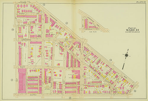
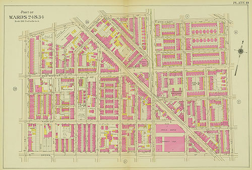
Atlas of the 24th, 34th & 44th Wards of the City of Philadelphia, 1911-1912, Plate 19
1911-1912: Atlas of the 24th, 34th & 44th Wards of the City of Philadelphia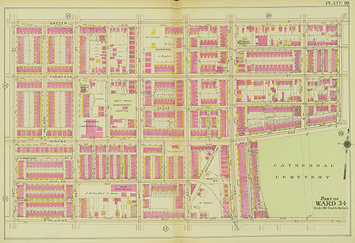
Atlas of the 24th, 34th & 44th Wards of the City of Philadelphia, 1911-1912, Plate 18
1911-1912: Atlas of the 24th, 34th & 44th Wards of the City of Philadelphia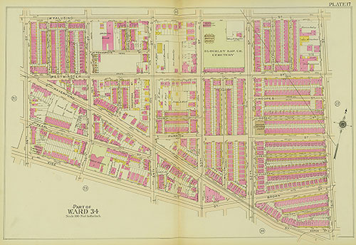
Atlas of the 24th, 34th & 44th Wards of the City of Philadelphia, 1911-1912, Plate 17
1911-1912: Atlas of the 24th, 34th & 44th Wards of the City of Philadelphia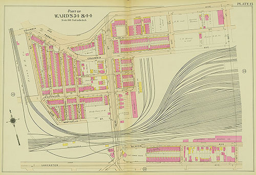
Atlas of the 24th, 34th & 44th Wards of the City of Philadelphia, 1911-1912, Plate 15
1911-1912: Atlas of the 24th, 34th & 44th Wards of the City of Philadelphia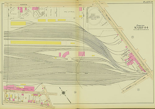
Atlas of the 24th, 34th & 44th Wards of the City of Philadelphia, 1911-1912, Plate 14
1911-1912: Atlas of the 24th, 34th & 44th Wards of the City of Philadelphia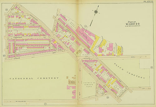
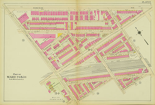
Atlas of the 24th, 34th & 44th Wards of the City of Philadelphia, 1911-1912, Plate 13
1911-1912: Atlas of the 24th, 34th & 44th Wards of the City of Philadelphia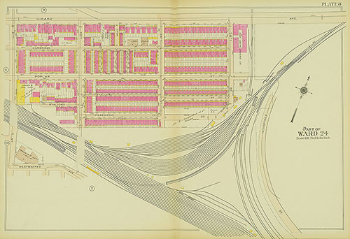
Atlas of the 24th, 34th & 44th Wards of the City of Philadelphia, 1911-1912, Plate 8
1911-1912: Atlas of the 24th, 34th & 44th Wards of the City of Philadelphia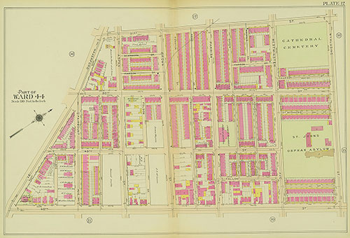
Atlas of the 24th, 34th & 44th Wards of the City of Philadelphia, 1911-1912, Plate 12
1911-1912: Atlas of the 24th, 34th & 44th Wards of the City of Philadelphia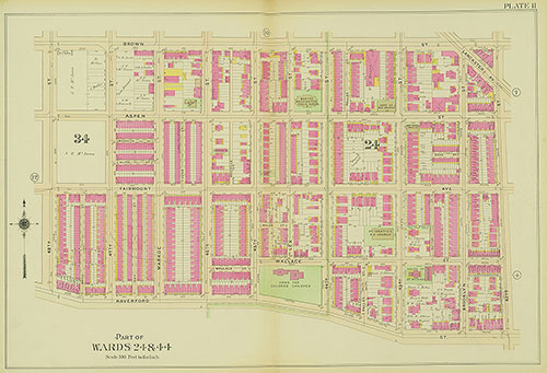
Atlas of the 24th, 34th & 44th Wards of the City of Philadelphia, 1911-1912, Plate 11
1911-1912: Atlas of the 24th, 34th & 44th Wards of the City of Philadelphia