Map Collection
Our map collection enables you to see how Philadelphia's neighborhoods and streets have grown and changed. Use our interactive mapping tool to overlay atlases dating back as far as 1843 over today's street layout.
Showing 921 to 940 of 5,193
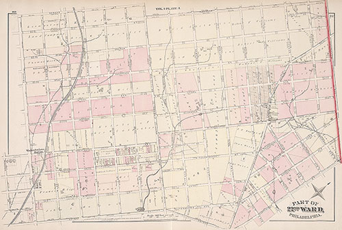
City Atlas of Philadelphia, 22nd ward, 1876, Plate I
1876: G. M. Hopkins, City Atlas of Philadelphia, 22nd Ward, Volume 1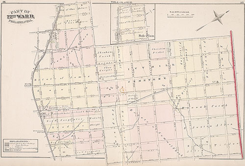
City Atlas of Philadelphia, 22nd ward, 1876, Plate H
1876: G. M. Hopkins, City Atlas of Philadelphia, 22nd Ward, Volume 1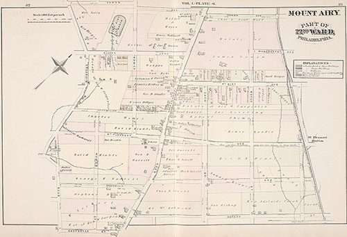
City Atlas of Philadelphia, 22nd ward, 1876, Plate G
1876: G. M. Hopkins, City Atlas of Philadelphia, 22nd Ward, Volume 1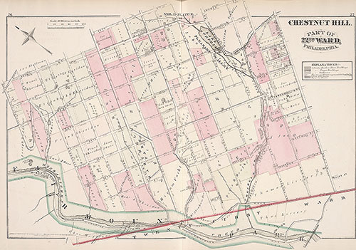
City Atlas of Philadelphia, 22nd ward, 1876, Plate E
1876: G. M. Hopkins, City Atlas of Philadelphia, 22nd Ward, Volume 1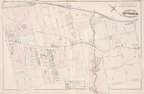
City Atlas of Philadelphia, 22nd ward, 1876, Plate D
1876: G. M. Hopkins, City Atlas of Philadelphia, 22nd Ward, Volume 1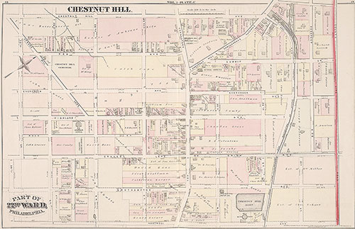
City Atlas of Philadelphia, 22nd ward, 1876, Plate C
1876: G. M. Hopkins, City Atlas of Philadelphia, 22nd Ward, Volume 1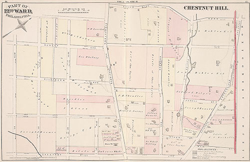
City Atlas of Philadelphia, 22nd ward, 1876, Plate B
1876: G. M. Hopkins, City Atlas of Philadelphia, 22nd Ward, Volume 1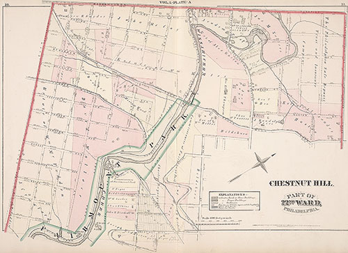
City Atlas of Philadelphia, 22nd ward, 1876, Plate A
1876: G. M. Hopkins, City Atlas of Philadelphia, 22nd Ward, Volume 1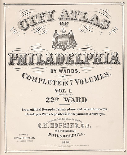
City Atlas of Philadelphia, 22nd ward, 1876, Title Page
1876: G. M. Hopkins, City Atlas of Philadelphia, 22nd Ward, Volume 1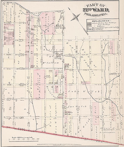
City Atlas of Philadelphia, 22nd ward, 1876, Plate F
1876: G. M. Hopkins, City Atlas of Philadelphia, 22nd Ward, Volume 1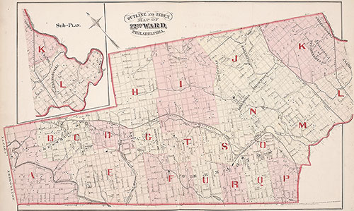
City Atlas of Philadelphia, 22nd ward, 1876, Map Index
1876: G. M. Hopkins, City Atlas of Philadelphia, 22nd Ward, Volume 1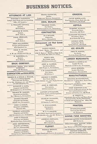
City Atlas of Philadelphia, 22nd ward, 1876, Business Notices
1876: G. M. Hopkins, City Atlas of Philadelphia, 22nd Ward, Volume 1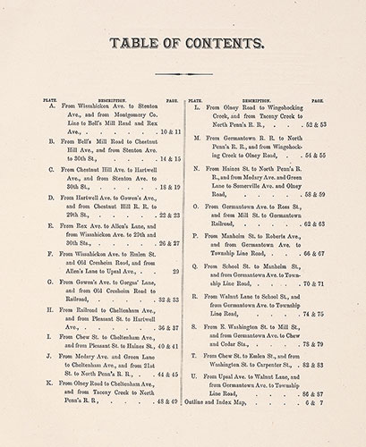
City Atlas of Philadelphia, 22nd ward, 1876, Table of Contents
1876: G. M. Hopkins, City Atlas of Philadelphia, 22nd Ward, Volume 1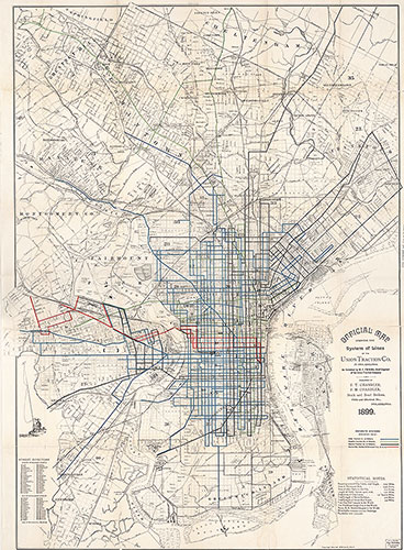
Official Map Showing the System of Lines of the Union Traction Co. in Philadelphia, 1899, Map
1899: Official Map Showing the System of Lines of the Union Traction Co. in Philadelphia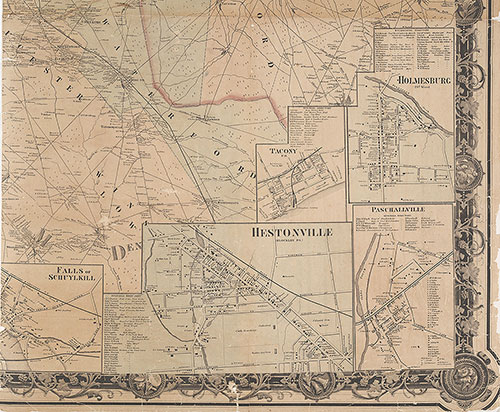
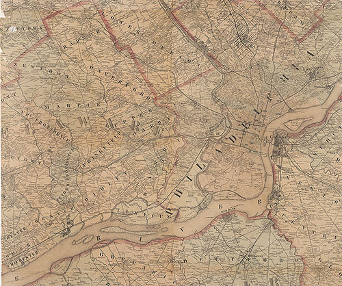
Map of the Vicinity of Philadelphia, From Actual Surveys, 1861, Plate 6-B: Southeast Suburbs
1861: Map of the Vicinity of Philadelphia, from Actual Surveys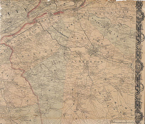
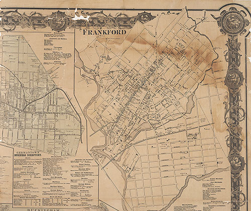
Map of the Vicinity of Philadelphia From Actual Surveys 1861, Plate 6-A: Southeast Suburbs
1861: Map of the Vicinity of Philadelphia, from Actual Surveys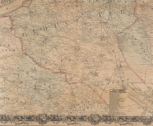
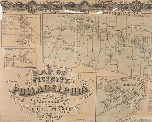
Map of the Vicinity of Philadelphia, From Actual Surveys, 1861, Plate 5-B: South Suburbs
1861: Map of the Vicinity of Philadelphia, from Actual Surveys