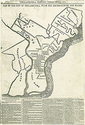
Map of the City of Philadelphia With the Boundaries of the Wards, 1854, Map
Maps 1854: Map of the City of Philadelphia With the Boundaries of the Wards
Item Info
Item No: MPHBAA00001
Title: Map of the City of Philadelphia With the Boundaries of the Wards, 1854, Map
Additional Title: Map of the City of Philadelphia With the Boundaries of the Wards, 1854
Creation Date:
2/6/1854
Page: 1
Work Type: Historical Divisions and Boundaries
Source: Map Collection
Notes:
new ward system created with city consolidation
Northside Orientation of Image: Top
Alternate Page Number: map
City/Town/Township: Geographic Coverage State/Province:Pennsylvania
Geographic Coverage City/Town/Township:Philadelphia
Creator Name: Philadelphia Bulletin - Publisher
 map
map