Map Collection
Our map collection enables you to see how Philadelphia's neighborhoods and streets have grown and changed. Use our interactive mapping tool to overlay atlases dating back as far as 1843 over today's street layout.
Showing 1061 to 1080 of 5,193
Insurance Maps of the City of Philadelphia, 1887, Plate 28
1887: Hexamer, Insurance Maps of the City of Philadelphia, Volume 2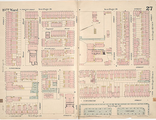
Insurance Maps of the City of Philadelphia, 1887, Plate 27
1887: Hexamer, Insurance Maps of the City of Philadelphia, Volume 2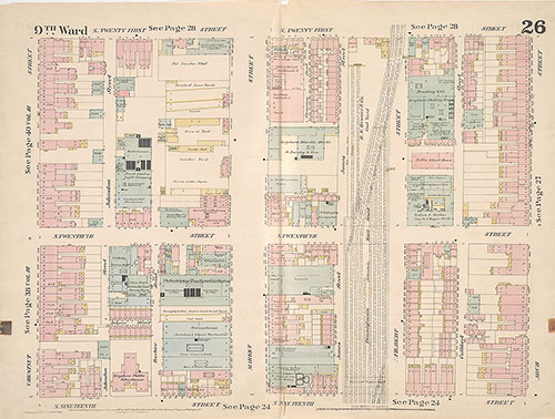
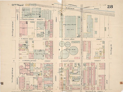
Insurance Maps of the City of Philadelphia, 1887, Plate 26
1887: Hexamer, Insurance Maps of the City of Philadelphia, Volume 2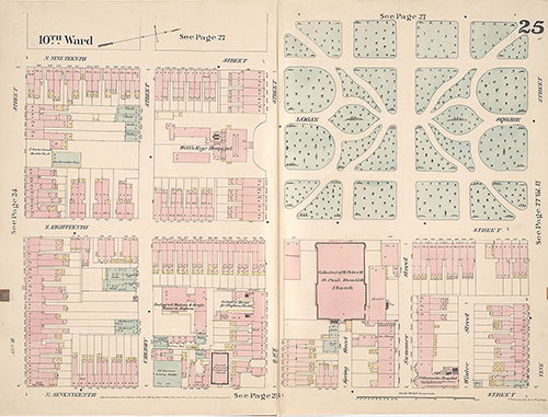
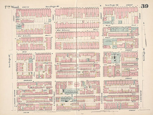
Insurance Maps of the City of Philadelphia, 1887, Plate 25
1887: Hexamer, Insurance Maps of the City of Philadelphia, Volume 2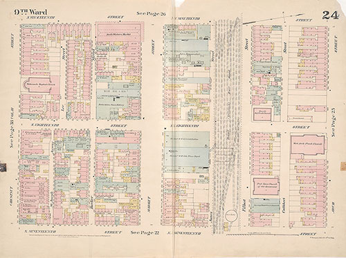
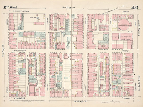
Insurance Maps of the City of Philadelphia, 1887, Plate 24
1887: Hexamer, Insurance Maps of the City of Philadelphia, Volume 2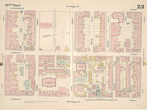
Insurance Maps of the City of Philadelphia, 1887, Plate 23
1887: Hexamer, Insurance Maps of the City of Philadelphia, Volume 2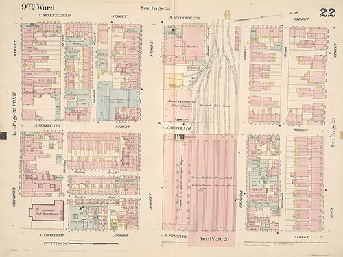
Insurance Maps of the City of Philadelphia, 1887, Plate 22
1887: Hexamer, Insurance Maps of the City of Philadelphia, Volume 2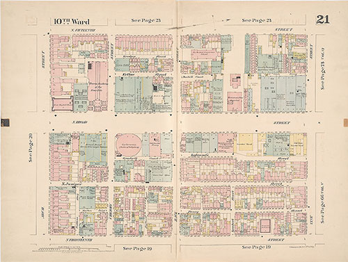
Insurance Maps of the City of Philadelphia, 1887, Plate 21
1887: Hexamer, Insurance Maps of the City of Philadelphia, Volume 2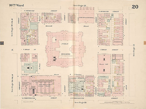
Insurance Maps of the City of Philadelphia, 1887, Plate 20
1887: Hexamer, Insurance Maps of the City of Philadelphia, Volume 2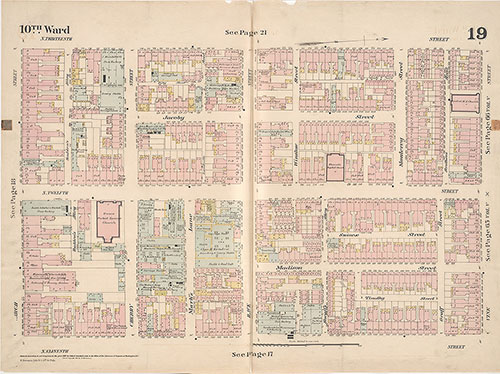
Insurance Maps of the City of Philadelphia, 1887, Plate 19
1887: Hexamer, Insurance Maps of the City of Philadelphia, Volume 2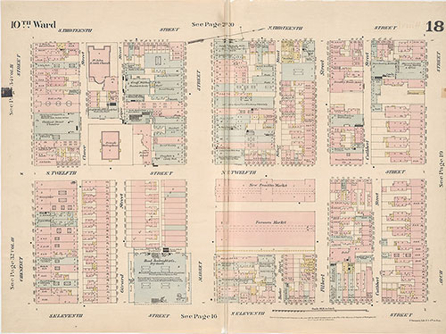
Insurance Maps of the City of Philadelphia, 1887, Plate 18
1887: Hexamer, Insurance Maps of the City of Philadelphia, Volume 2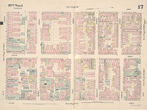
Insurance Maps of the City of Philadelphia, 1887, Plate 17
1887: Hexamer, Insurance Maps of the City of Philadelphia, Volume 2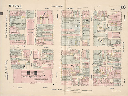
Insurance Maps of the City of Philadelphia, 1887, Plate 16
1887: Hexamer, Insurance Maps of the City of Philadelphia, Volume 2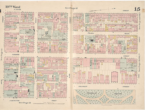
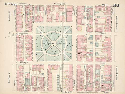
Insurance Maps of the City of Philadelphia, 1887, Plate 15
1887: Hexamer, Insurance Maps of the City of Philadelphia, Volume 2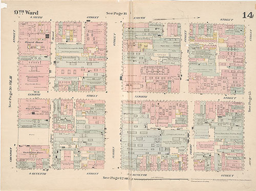
Insurance Maps of the City of Philadelphia, 1887, Plate 14
1887: Hexamer, Insurance Maps of the City of Philadelphia, Volume 2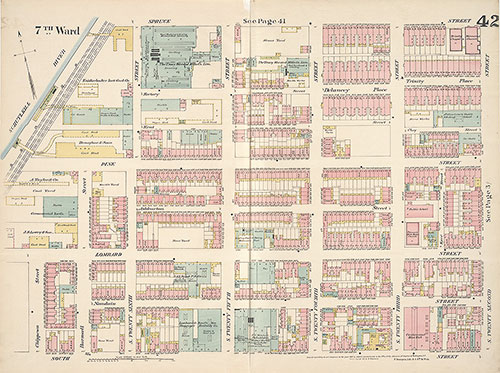
Insurance Maps of the City of Philadelphia, 1887, Plate 42
1887: Hexamer, Insurance Maps of the City of Philadelphia, Volume 3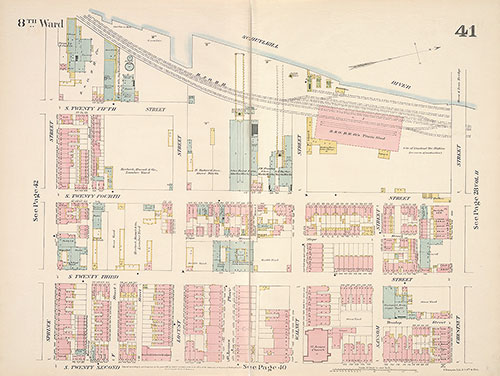
Insurance Maps of the City of Philadelphia, 1887, Plate 41
1887: Hexamer, Insurance Maps of the City of Philadelphia, Volume 3