Map Collection
Our map collection enables you to see how Philadelphia's neighborhoods and streets have grown and changed. Use our interactive mapping tool to overlay atlases dating back as far as 1843 over today's street layout.
Showing 1081 to 1100 of 5,193
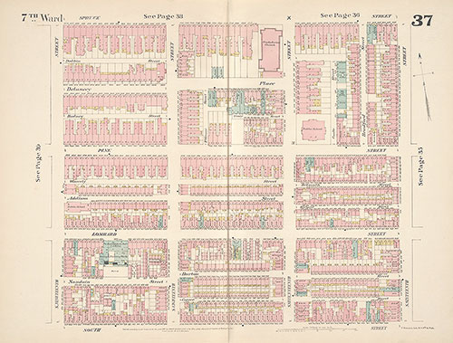
Insurance Maps of the City of Philadelphia, 1887, Plate 37
1887: Hexamer, Insurance Maps of the City of Philadelphia, Volume 3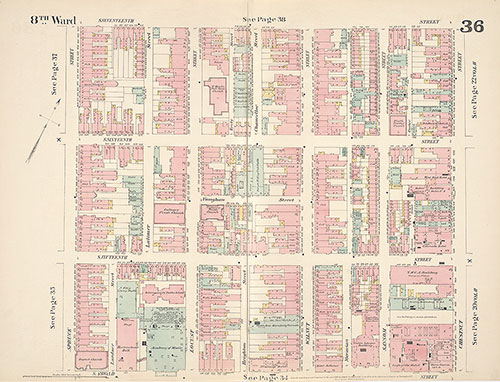
Insurance Maps of the City of Philadelphia, 1887, Plate 36
1887: Hexamer, Insurance Maps of the City of Philadelphia, Volume 3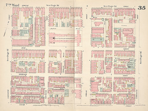
Insurance Maps of the City of Philadelphia, 1887, Plate 35
1887: Hexamer, Insurance Maps of the City of Philadelphia, Volume 3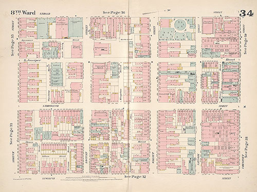
Insurance Maps of the City of Philadelphia, 1887, Plate 34
1887: Hexamer, Insurance Maps of the City of Philadelphia, Volume 3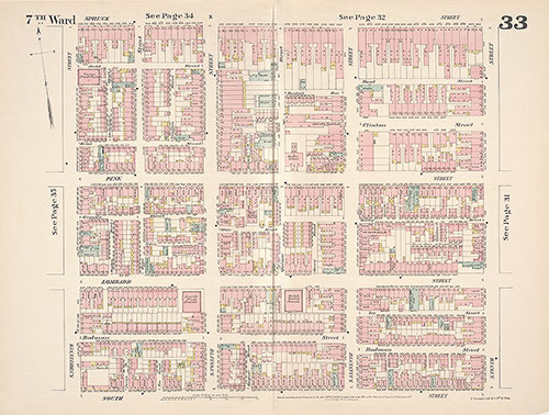
Insurance Maps of the City of Philadelphia, 1887, Plate 33
1887: Hexamer, Insurance Maps of the City of Philadelphia, Volume 3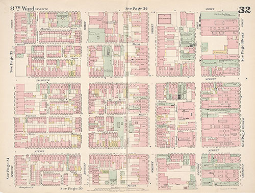
Insurance Maps of the City of Philadelphia, 1887, Plate 32
1887: Hexamer, Insurance Maps of the City of Philadelphia, Volume 3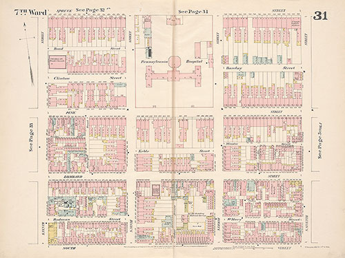
Insurance Maps of the City of Philadelphia, 1887, Plate 31
1887: Hexamer, Insurance Maps of the City of Philadelphia, Volume 3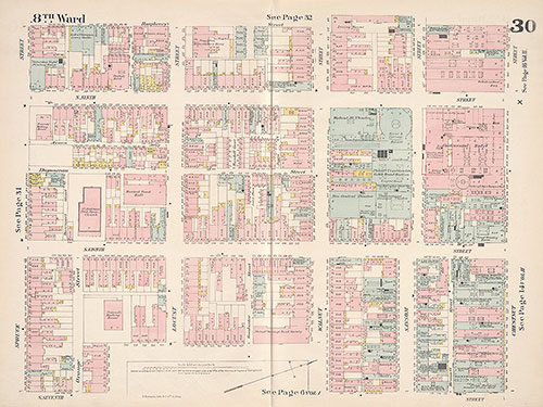
Insurance Maps of the City of Philadelphia, 1887, Plate 30
1887: Hexamer, Insurance Maps of the City of Philadelphia, Volume 3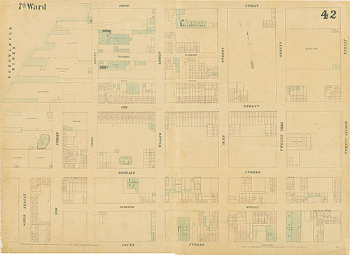
Maps of the City of Philadelphia, 1858-1860, Plate 42
1858: Hexamer & Locher, Maps of the City of Philadelphia: Volume 3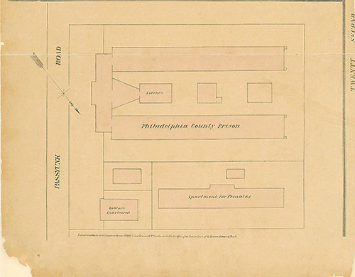
Maps of the City of Philadelphia, 1858-1860, plate 97, Section A2
1860: Hexamer & Locher, Maps of the City of Philadelphia: Volume 7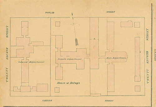
Maps of the City of Philadelphia, 1858-1860, plate 92, Section A1
1860: Hexamer & Locher, Maps of the City of Philadelphia: Volume 7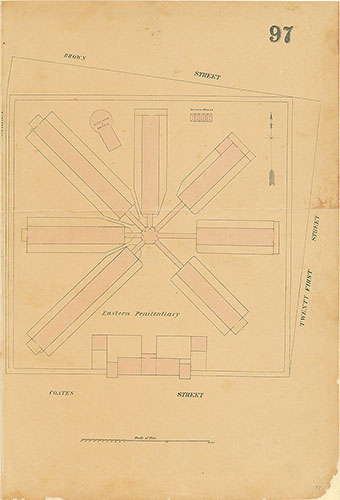
Maps of the City of Philadelphia, 1858-1860, Plate 97, Section B1
1860: Hexamer & Locher, Maps of the City of Philadelphia: Volume 7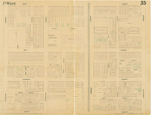
Maps of the City of Philadelphia, 1858-1860, Plate 35
1858: Hexamer & Locher, Maps of the City of Philadelphia: Volume 3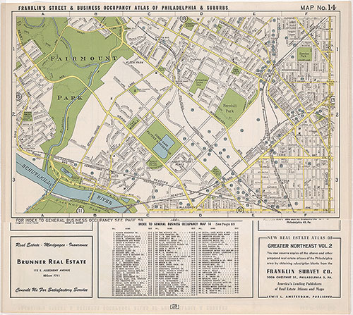
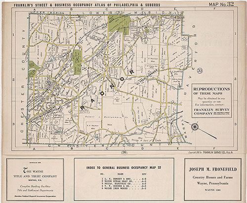
Franklin's Street and Business Occupancy Atlas of Philadelphia & Suburbs, 1946, Location Map 14
1946: Franklin's Street and Business Occupancy Atlas of Philadelphia & Suburbs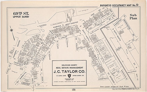
Franklin's Street and Business Occupancy Atlas of Philadelphia & Suburbs, 1946, Occupancy Map 9
1946: Franklin's Street and Business Occupancy Atlas of Philadelphia & Suburbs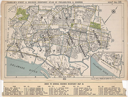
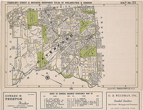
Franklin's Street and Business Occupancy Atlas of Philadelphia & Suburbs, 1946, Location Map 36
1946: Franklin's Street and Business Occupancy Atlas of Philadelphia & Suburbs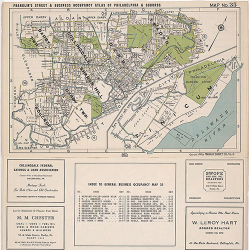
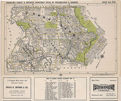
Franklin's Street and Business Occupancy Atlas of Philadelphia & Suburbs, 1946, Location Map 35
1946: Franklin's Street and Business Occupancy Atlas of Philadelphia & Suburbs