Map Collection
Our map collection enables you to see how Philadelphia's neighborhoods and streets have grown and changed. Use our interactive mapping tool to overlay atlases dating back as far as 1843 over today's street layout.
Showing 1161 to 1180 of 5,193
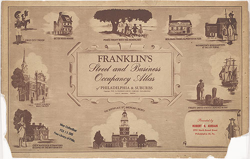
Franklin's Street and Business Occupancy Atlas of Philadelphia & Suburbs, 1946, Title Page
1946: Franklin's Street and Business Occupancy Atlas of Philadelphia & Suburbs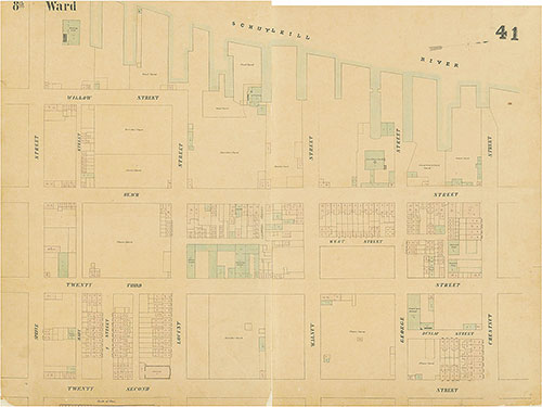
Maps of the City of Philadelphia, 1858-1860, Plate 41
1858: Hexamer & Locher, Maps of the City of Philadelphia: Volume 3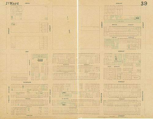
Maps of the City of Philadelphia, 1858-1860, Plate 39
1858: Hexamer & Locher, Maps of the City of Philadelphia: Volume 3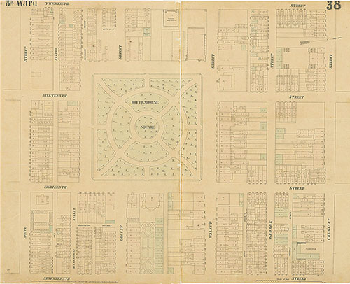
Maps of the City of Philadelphia, 1858-1860, Plate 38
1858: Hexamer & Locher, Maps of the City of Philadelphia: Volume 3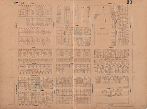
Maps of the City of Philadelphia, 1858-1860, Plate 37
1858: Hexamer & Locher, Maps of the City of Philadelphia: Volume 3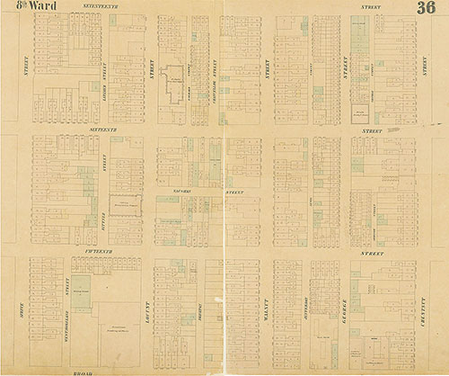
Maps of the City of Philadelphia, 1858-1860, Plate 36
1858: Hexamer & Locher, Maps of the City of Philadelphia: Volume 3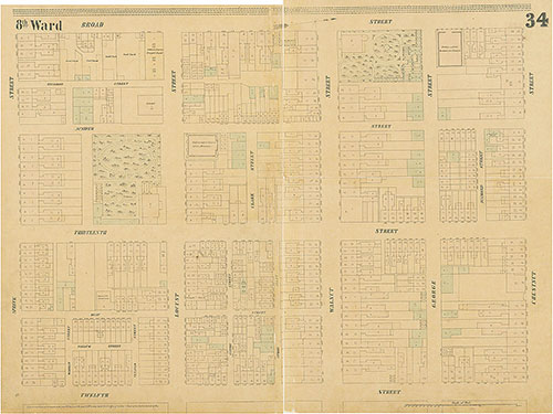
Maps of the City of Philadelphia, 1858-1860, Plate 34
1858: Hexamer & Locher, Maps of the City of Philadelphia: Volume 3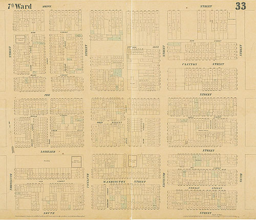
Maps of the City of Philadelphia, 1858-1860, Plate 33
1858: Hexamer & Locher, Maps of the City of Philadelphia: Volume 3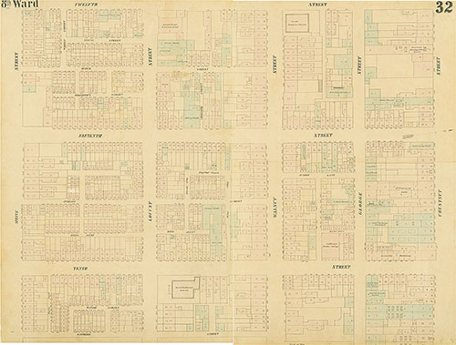
Maps of the City of Philadelphia, 1858-1860, Plate 32
1858: Hexamer & Locher, Maps of the City of Philadelphia: Volume 3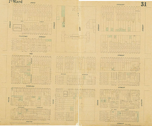
Maps of the City of Philadelphia, 1858-1860, Plate 31
1858: Hexamer & Locher, Maps of the City of Philadelphia: Volume 3
Nirenstein's 69th Street, Upper Darby [PA] Business Section, 1950, Key
1950: Nirenstein's 69th Street, Upper Darby [PA] Business Section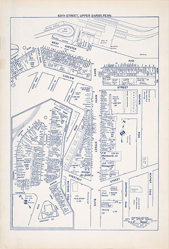
Nirenstein's 69th Street, Upper Darby [PA] Business Section , 1950, Plate 1
1950: Nirenstein's 69th Street, Upper Darby [PA] Business Section
Maps of the City of Philadelphia, 1858-1860, Plate 67
1859: Hexamer & Locher, Maps of the City of Philadelphia: Volume 5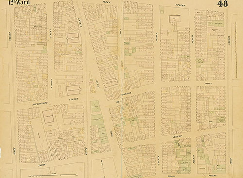
Maps of the City of Philadelphia, 1858-1860, Plate 48
1859: Hexamer & Locher, Maps of the City of Philadelphia: Volume 4
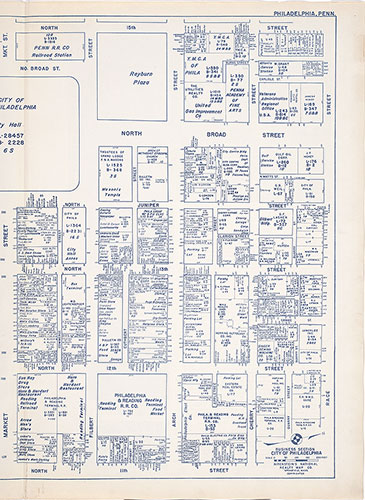
Nirenstein's Philadelphia Business Section [Center City], 1950, Key
1950: Nirenstein's Philadelphia Business Section [Center City]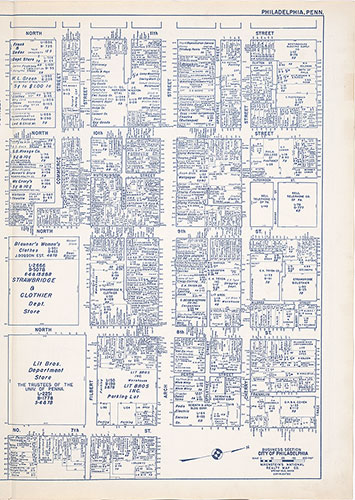
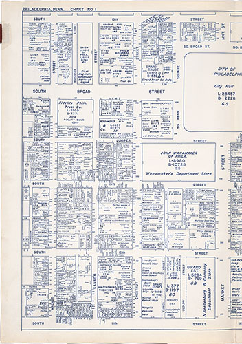
Nirenstein's Philadelphia Business Section [Center City], 1950, Plate 2-B
1950: Nirenstein's Philadelphia Business Section [Center City]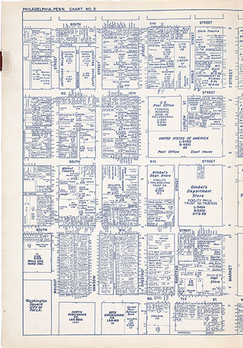
Nirenstein's Philadelphia Business Section [Center City], 1950, Plate 2-A
1950: Nirenstein's Philadelphia Business Section [Center City]