Map Collection
Our map collection enables you to see how Philadelphia's neighborhoods and streets have grown and changed. Use our interactive mapping tool to overlay atlases dating back as far as 1843 over today's street layout.
Showing 1181 to 1200 of 5,193
Nirenstein's Philadelphia Business Section [Center City], 1950, Introduction (con't)
1950: Nirenstein's Philadelphia Business Section [Center City]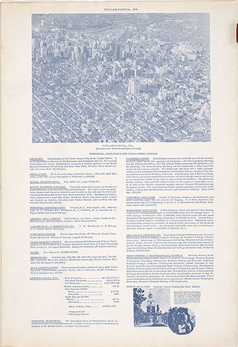
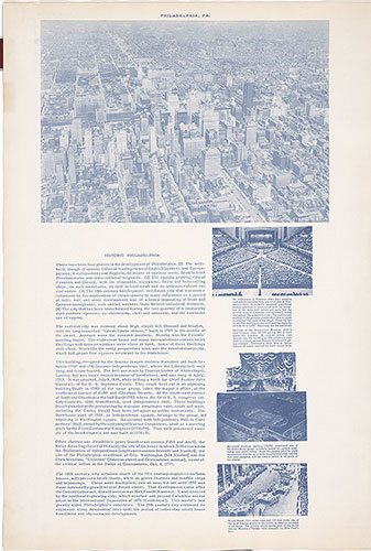
Nirenstein's Philadelphia Business Section [Center City], 1950, Introduction
1950: Nirenstein's Philadelphia Business Section [Center City]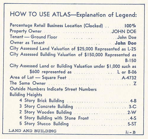
Nirenstein's Chester [PA] Business Section, 1950, Key
1950: Nirenstein's Chester [PA] Business Section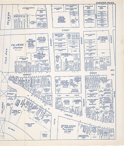
Nirenstein's Chester [PA] Business Section, 1950, Plate 1-B
1950: Nirenstein's Chester [PA] Business Section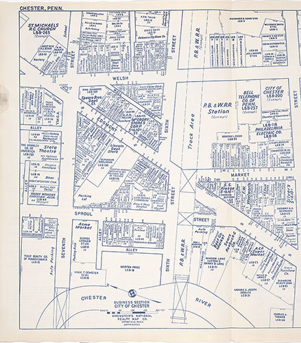
Nirenstein's Chester [PA] Business Section, 1950, Plate 1-A
1950: Nirenstein's Chester [PA] Business Section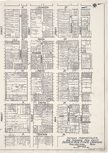
Nirenstein's Philadelphia Business Real Estate Locations [Center City], 1925, Plate 2-B
1925: Nirenstein's Philadelphia Business Real Estate Locations [Center City]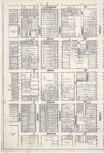
Nirenstein's Philadelphia Business Real Estate Locations [Center City], 1925, Plate 2-A
1925: Nirenstein's Philadelphia Business Real Estate Locations [Center City]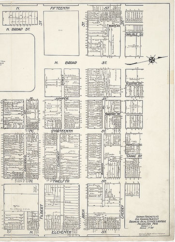
Nirenstein's Philadelphia Business Real Estate Locations [Center City], 1925, Plate 1-B
1925: Nirenstein's Philadelphia Business Real Estate Locations [Center City]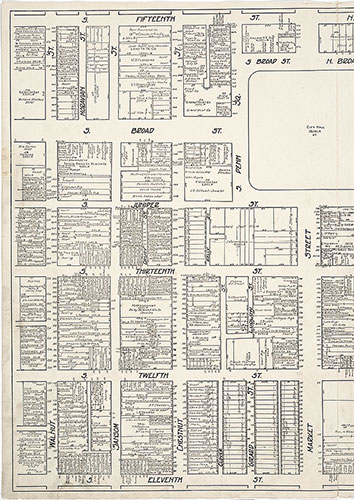
Nirenstein's Philadelphia Business Real Estate Locations [Center City], 1925, Plate 1-A
1925: Nirenstein's Philadelphia Business Real Estate Locations [Center City]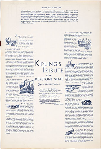
Nirenstein's Chester [PA] Business Section, 1950, Introduction (con't)
1950: Nirenstein's Chester [PA] Business Section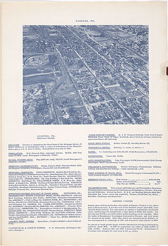
Nirenstein's Chester [PA] Business Section, 1950, Introduction
1950: Nirenstein's Chester [PA] Business Section
Nirenstein's Philadelphia Business Real Estate Locations [Center City], 1925, Property Owners (con't)
1925: Nirenstein's Philadelphia Business Real Estate Locations [Center City]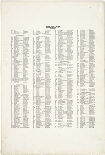
Nirenstein's Philadelphia Business Real Estate Locations [Center City], 1925, Property Owners
1925: Nirenstein's Philadelphia Business Real Estate Locations [Center City]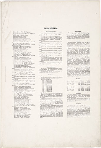
Nirenstein's Philadelphia Business Real Estate Locations [Center City], 1925, Introduction (con't)
1925: Nirenstein's Philadelphia Business Real Estate Locations [Center City]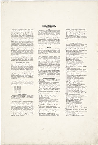
Nirenstein's Philadelphia Business Real Estate Locations [Center City], 1925, Introduction
1925: Nirenstein's Philadelphia Business Real Estate Locations [Center City]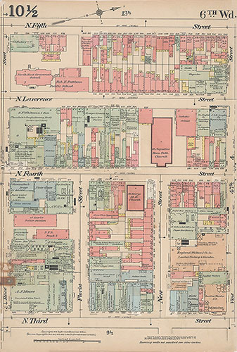
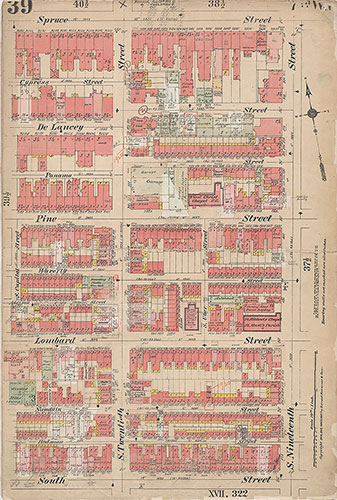
Insurance Maps of the City of Philadelphia, 1915-1916, Plate 10 1/2
1915-1916: Hexamer, Insurance Maps of the City of Philadelphia, Volume 1 Revised