Map Collection
Our map collection enables you to see how Philadelphia's neighborhoods and streets have grown and changed. Use our interactive mapping tool to overlay atlases dating back as far as 1843 over today's street layout.
Showing 1201 to 1220 of 5,193
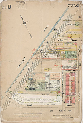
Insurance Maps of the City of Philadelphia, 1908-1920, Plate D
1908-1920: Hexamer, Insurance Maps of the City of Philadelphia, Volume 3 Revised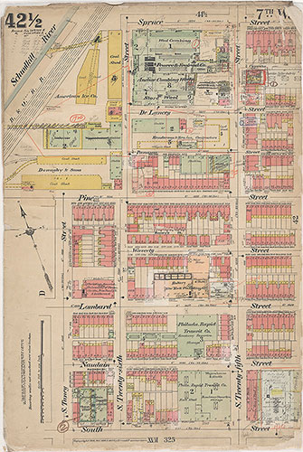
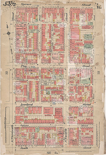
Insurance Maps of the City of Philadelphia, 1908-1920, Plate 42 1/2
1908-1920: Hexamer, Insurance Maps of the City of Philadelphia, Volume 3 Revised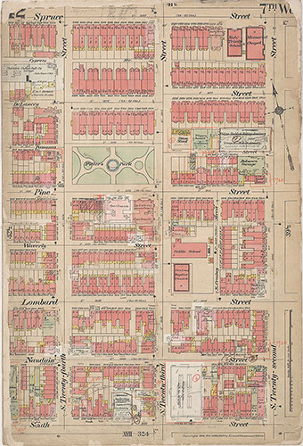
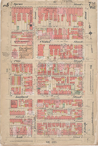
Insurance Maps of the City of Philadelphia, 1908-1920, Plate 42
1908-1920: Hexamer, Insurance Maps of the City of Philadelphia, Volume 3 Revised
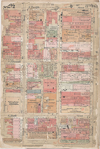
Insurance Maps of the City of Philadelphia, 1908-1920, Plate 41 1/2
1908-1920: Hexamer, Insurance Maps of the City of Philadelphia, Volume 3 Revised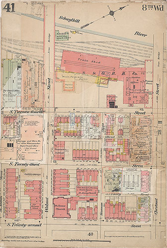
Insurance Maps of the City of Philadelphia, 1908-1920, Plate 41
1908-1920: Hexamer, Insurance Maps of the City of Philadelphia, Volume 3 Revised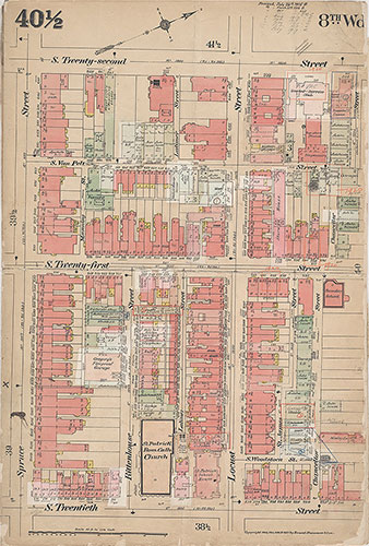
Insurance Maps of the City of Philadelphia, 1908-1920, Plate 40 1/2
1908-1920: Hexamer, Insurance Maps of the City of Philadelphia, Volume 3 Revised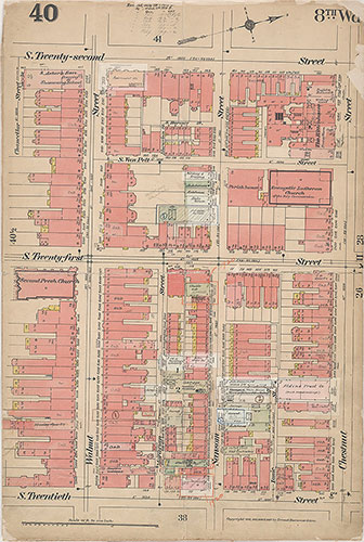
Insurance Maps of the City of Philadelphia, 1908-1920, Plate 40
1908-1920: Hexamer, Insurance Maps of the City of Philadelphia, Volume 3 Revised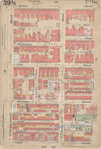
Insurance Maps of the City of Philadelphia, 1908-1920, Plate 39 1/2
1908-1920: Hexamer, Insurance Maps of the City of Philadelphia, Volume 3 Revised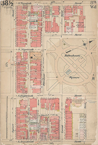
Insurance Maps of the City of Philadelphia, 1908-1920, Plate 38 1/2
1908-1920: Hexamer, Insurance Maps of the City of Philadelphia, Volume 3 Revised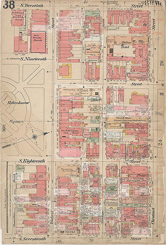
Insurance Maps of the City of Philadelphia, 1908-1920, Plate 38
1908-1920: Hexamer, Insurance Maps of the City of Philadelphia, Volume 3 Revised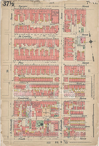
Insurance Maps of the City of Philadelphia, 1908-1920, Plate 37 1/2
1908-1920: Hexamer, Insurance Maps of the City of Philadelphia, Volume 3 Revised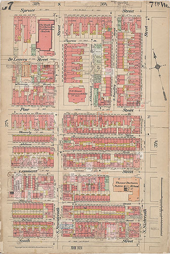
Insurance Maps of the City of Philadelphia, 1908-1920, Plate 37
1908-1920: Hexamer, Insurance Maps of the City of Philadelphia, Volume 3 Revised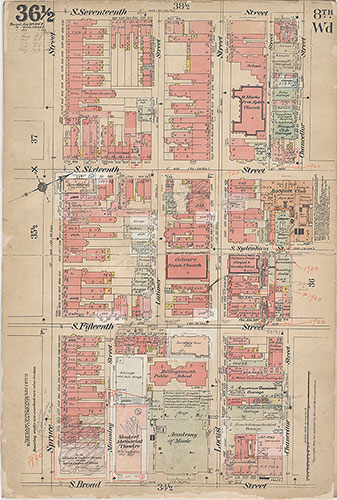
Insurance Maps of the City of Philadelphia, 1908-1920, Plate 36 1/2
1908-1920: Hexamer, Insurance Maps of the City of Philadelphia, Volume 3 Revised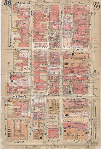
Insurance Maps of the City of Philadelphia, 1908-1920, Plate 36
1908-1920: Hexamer, Insurance Maps of the City of Philadelphia, Volume 3 Revised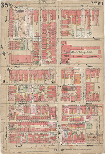
Insurance Maps of the City of Philadelphia, 1908-1920, Plate 35 1/2
1908-1920: Hexamer, Insurance Maps of the City of Philadelphia, Volume 3 Revised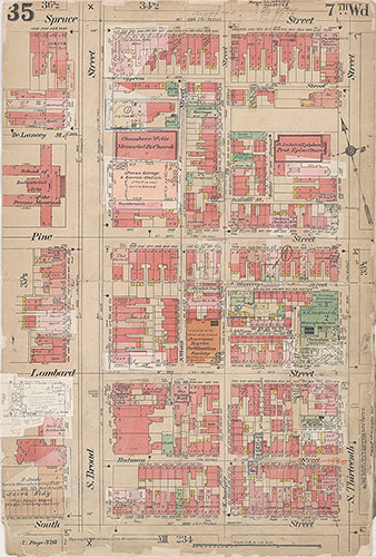
Insurance Maps of the City of Philadelphia, 1908-1920, Plate 35
1908-1920: Hexamer, Insurance Maps of the City of Philadelphia, Volume 3 Revised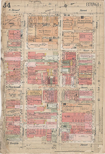
Insurance Maps of the City of Philadelphia, 1908-1920, Plate 34
1908-1920: Hexamer, Insurance Maps of the City of Philadelphia, Volume 3 Revised