Map Collection
Our map collection enables you to see how Philadelphia's neighborhoods and streets have grown and changed. Use our interactive mapping tool to overlay atlases dating back as far as 1843 over today's street layout.
Showing 1281 to 1300 of 5,193
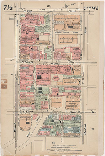
Insurance Maps of the City of Philadelphia, 1915-1916, Plate 7 1/2
1915-1916: Hexamer, Insurance Maps of the City of Philadelphia, Volume 1 Revised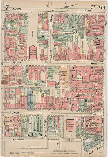
Insurance Maps of the City of Philadelphia, 1915-1916, Plate 7
1915-1916: Hexamer, Insurance Maps of the City of Philadelphia, Volume 1 Revised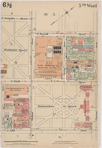
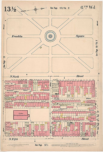
Insurance Maps of the City of Philadelphia, 1915-1916, Plate 6 1/2
1915-1916: Hexamer, Insurance Maps of the City of Philadelphia, Volume 1 Revised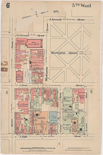
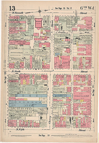
Insurance Maps of the City of Philadelphia, 1915-1916, Plate 6
1915-1916: Hexamer, Insurance Maps of the City of Philadelphia, Volume 1 Revised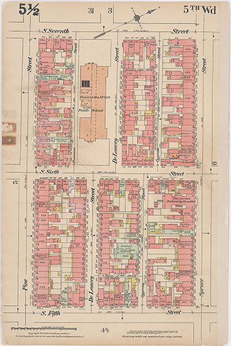
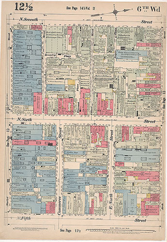
Insurance Maps of the City of Philadelphia, 1915-1916, Plate 5 1/2
1915-1916: Hexamer, Insurance Maps of the City of Philadelphia, Volume 1 Revised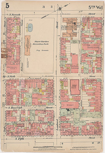
Insurance Maps of the City of Philadelphia, 1915-1916, Plate 5
1915-1916: Hexamer, Insurance Maps of the City of Philadelphia, Volume 1 Revised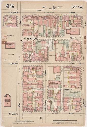
Insurance Maps of the City of Philadelphia, 1915-1916, Plate 4 1/2
1915-1916: Hexamer, Insurance Maps of the City of Philadelphia, Volume 1 Revised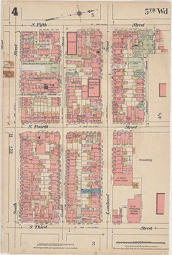
Insurance Maps of the City of Philadelphia, 1915-1916, Plate 4
1915-1916: Hexamer, Insurance Maps of the City of Philadelphia, Volume 1 Revised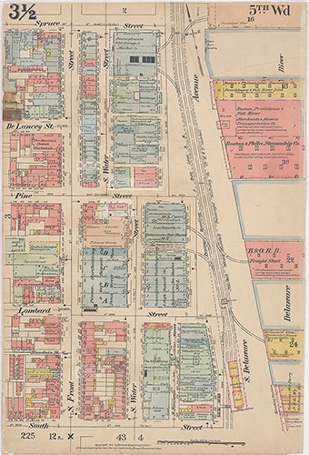
Insurance Maps of the City of Philadelphia, 1915-1916, Plate 3 1/2
1915-1916: Hexamer, Insurance Maps of the City of Philadelphia, Volume 1 Revised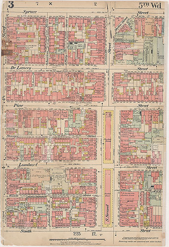
Insurance Maps of the City of Philadelphia, 1915-1916, Plate 3
1915-1916: Hexamer, Insurance Maps of the City of Philadelphia, Volume 1 Revised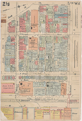
Insurance Maps of the City of Philadelphia, 1915-1916, Plate 2 1/2
1915-1916: Hexamer, Insurance Maps of the City of Philadelphia, Volume 1 Revised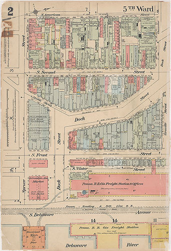
Insurance Maps of the City of Philadelphia, 1915-1916, Plate 2
1915-1916: Hexamer, Insurance Maps of the City of Philadelphia, Volume 1 Revised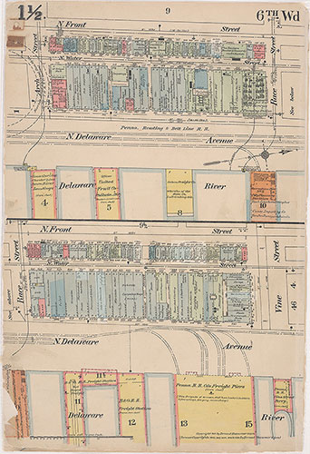
Insurance Maps of the City of Philadelphia, 1915-1916, Plate 1 1/2
1915-1916: Hexamer, Insurance Maps of the City of Philadelphia, Volume 1 Revised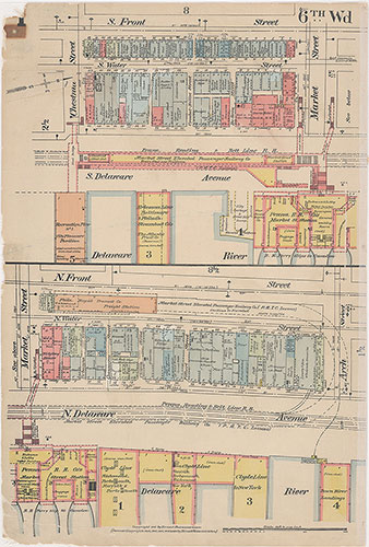
Insurance Maps of the City of Philadelphia, 1915-1916, Plate 1
1915-1916: Hexamer, Insurance Maps of the City of Philadelphia, Volume 1 Revised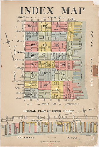
Insurance Maps of the City of Philadelphia, 1915-1916, Index Map
1915-1916: Hexamer, Insurance Maps of the City of Philadelphia, Volume 1 Revised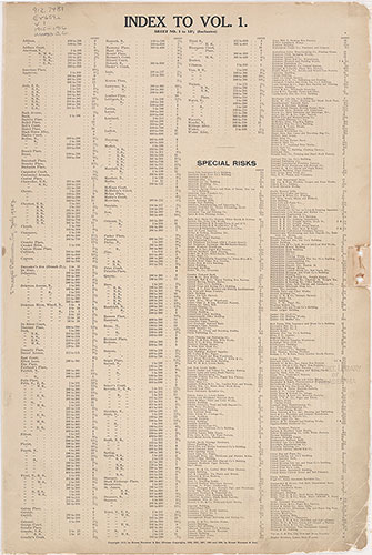
Insurance Maps of the City of Philadelphia, 1915-1916, Street Index
1915-1916: Hexamer, Insurance Maps of the City of Philadelphia, Volume 1 Revised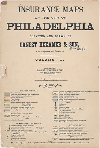
Insurance Maps of the City of Philadelphia, 1915-1916, Title Page and Key
1915-1916: Hexamer, Insurance Maps of the City of Philadelphia, Volume 1 Revised