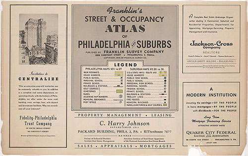
Map Collection
Our map collection enables you to see how Philadelphia's neighborhoods and streets have grown and changed. Use our interactive mapping tool to overlay atlases dating back as far as 1843 over today's street layout.
Showing 1141 to 1160 of 5,193
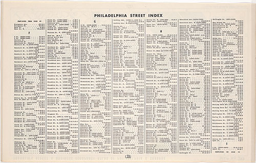
Franklin's Street and Business Occupancy Atlas of Philadelphia & Suburbs, 1946, Philadelphia Street Index, Evergreen-Idell
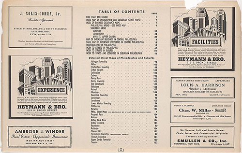
1946: Franklin's Street and Business Occupancy Atlas of Philadelphia & Suburbs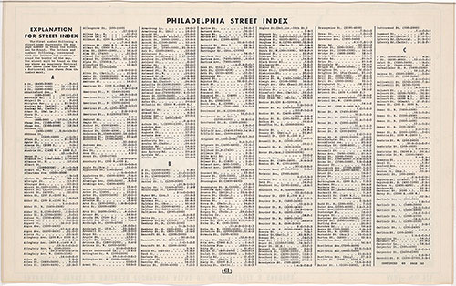
Franklin's Street and Business Occupancy Atlas of Philadelphia & Suburbs, 1946, Philadelphia Street Index, A-Carroll
1946: Franklin's Street and Business Occupancy Atlas of Philadelphia & Suburbs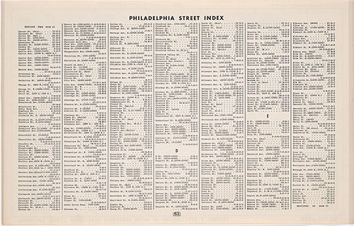
Franklin's Street and Business occupancy Atlas of Philadelphia & Suburbs, 1946, Philadelphia Street Index, Carson-Everett
1946: Franklin's Street and Business Occupancy Atlas of Philadelphia & Suburbs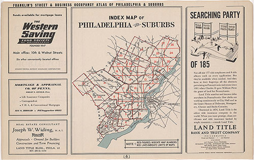
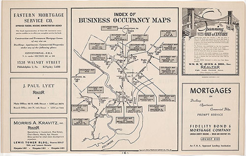
Franklin's Street and Business Occupancy Atlas of Philadelphia & Suburbs, 1946, General Business Location Map Index
1946: Franklin's Street and Business Occupancy Atlas of Philadelphia & Suburbs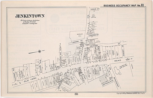
Franklin's Street and Business Occupancy Atlas of Philadelphia & Suburbs, 1946, Occupancy Map 11
1946: Franklin's Street and Business Occupancy Atlas of Philadelphia & Suburbs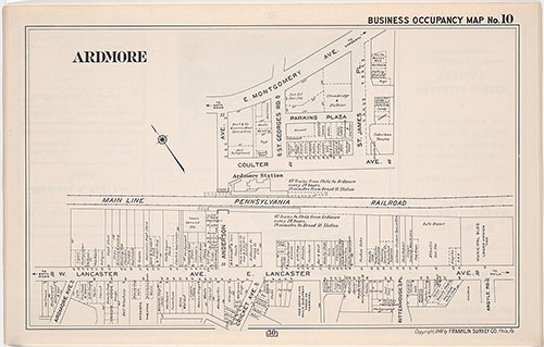
Franklin's Street and Business Occupancy Map of Philadelphia & Suburbs, 1946, Occupancy Map 10
1946: Franklin's Street and Business Occupancy Atlas of Philadelphia & Suburbs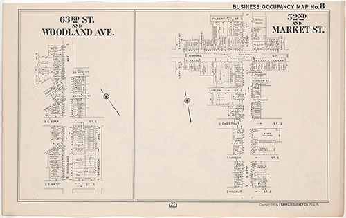
Franklin's Street and Business Occupancy Atlas of Philadelphia & Suburbs, 1946, Occupancy Map 8
1946: Franklin's Street and Business Occupancy Atlas of Philadelphia & Suburbs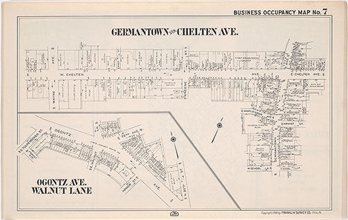
Franklin's Street and Business Occupancy Atlas of Philadelphia & Suburbs, 1946, Occupancy Map 7
1946: Franklin's Street and Business Occupancy Atlas of Philadelphia & Suburbs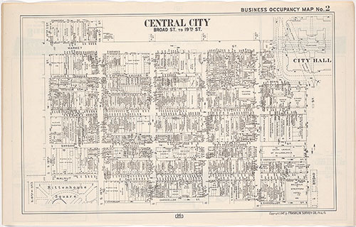
Franklin's Street and Business Occupancy Atlas of Philadelphia & Suburbs, 1946, Occupancy Map 2
1946: Franklin's Street and Business Occupancy Atlas of Philadelphia & Suburbs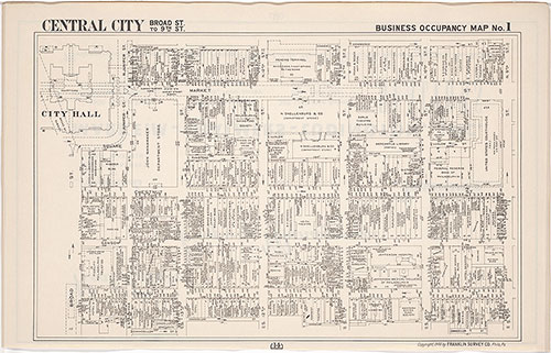
Franklin's Street and Business Occupancy Atlas of Philadelphia & Suburbs, 1946, Occupancy Map 1
1946: Franklin's Street and Business Occupancy Atlas of Philadelphia & Suburbs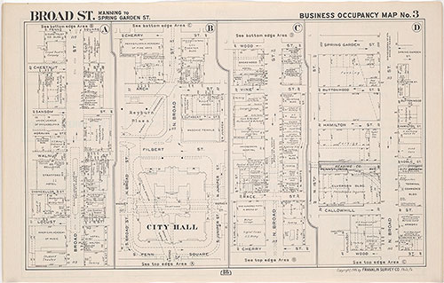
Franklin's Street and Business Occupancy Atlas of Philadelphia & Suburbs, 1946, Occupancy Map 3
1946: Franklin's Street and Business Occupancy Atlas of Philadelphia & Suburbs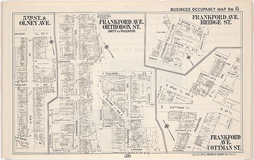
Franklin's Street and Business Occupancy Atlas of philadelphia & Suburbs, 1946, Occupancy Map 6
1946: Franklin's Street and Business Occupancy Atlas of Philadelphia & Suburbs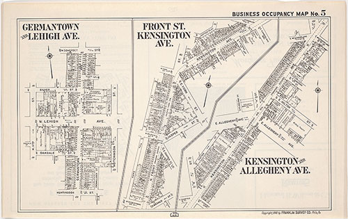
Franklin's Street and Business Occupancy Atlas of Philadelphia & Suburbs, 1946, Occupancy Map 5
1946: Franklin's Street and Business Occupancy Atlas of Philadelphia & Suburbs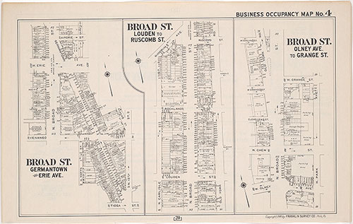
Franklin's Street and Business Occupancy Atlas of philadelphia & Suburbs, 1946, Occupancy Map 4
1946: Franklin's Street and Business Occupancy Atlas of Philadelphia & Suburbs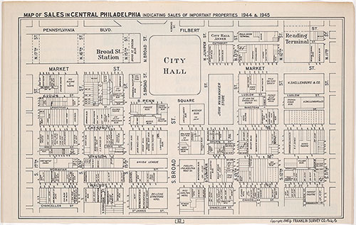
Franklin's Street and Business Occupancy Atlas of Philadelphia & Suburbs, 1946, Center City Sales, 1944/45
1946: Franklin's Street and Business Occupancy Atlas of Philadelphia & Suburbs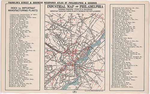
Franklin's Street and Business Occupancy Atlas of Philadelphia & Suburbs, 1946, Industrial Map & Index
1946: Franklin's Street and Business Occupancy Atlas of Philadelphia & Suburbs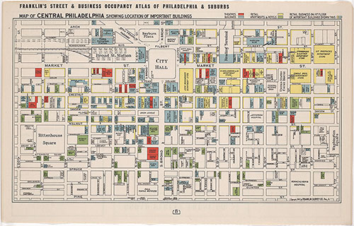
Franklin's Street and Business Occupancy Atlas of Philadelphia & Suburbs, 1946, Center City Buildings
1946: Franklin's Street and Business Occupancy Atlas of Philadelphia & Suburbs