Map Collection
Our map collection enables you to see how Philadelphia's neighborhoods and streets have grown and changed. Use our interactive mapping tool to overlay atlases dating back as far as 1843 over today's street layout.
Showing 1381 to 1400 of 5,193
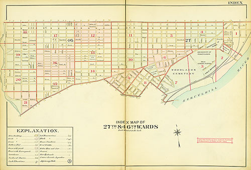
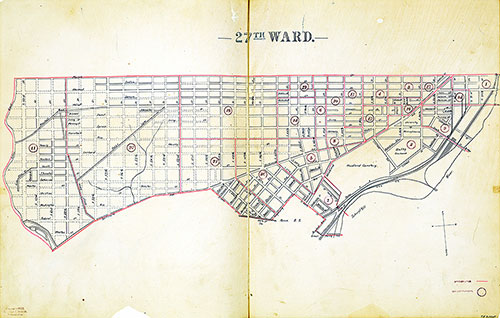
Atlas of the 27th & 46th Wards of the City of Philadelphia, Map Index
1909: Elvino V. Smith, Atlas of the 27th & 46th Wards of the City of Philadelphia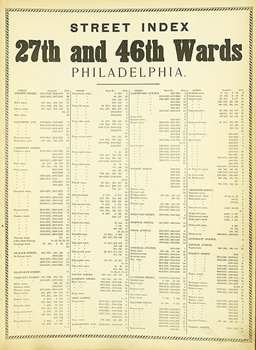
Atlas of the 27th & 46th Wards of the City of Philadelphia, Street Index
1909: Elvino V. Smith, Atlas of the 27th & 46th Wards of the City of Philadelphia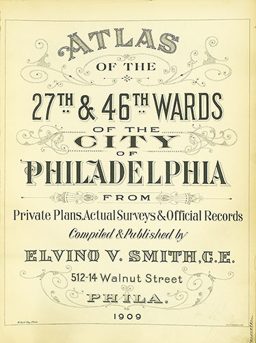
Atlas of the 27th & 46th Wards of the City of Philadelphia, Title Page
1909: Elvino V. Smith, Atlas of the 27th & 46th Wards of the City of Philadelphia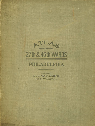
Atlas of the 27th & 46th Wards of the City of Philadelphia, Cover
1909: Elvino V. Smith, Atlas of the 27th & 46th Wards of the City of Philadelphia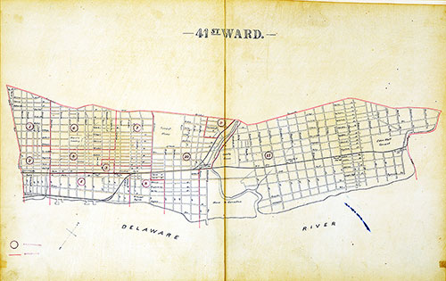
Atlas of the City of Philadelphia by Wards, Ward 41
1893: J. E. Shiedt, Atlas of the City of Philadelphia by Wards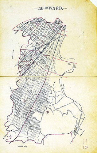
Atlas of the City of Philadelphia by Wards, Ward 40
1893: J. E. Shiedt, Atlas of the City of Philadelphia by Wards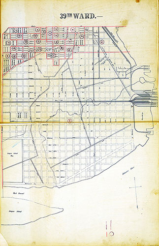
Atlas of the City of Philadelphia by Wards, Ward 39
1893: J. E. Shiedt, Atlas of the City of Philadelphia by Wards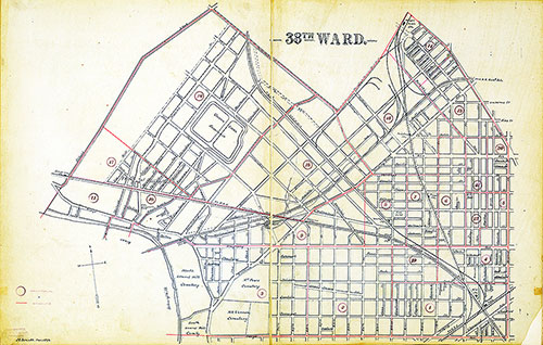
Atlas of the City of Philadelphia by Wards, Ward 38
1893: J. E. Shiedt, Atlas of the City of Philadelphia by Wards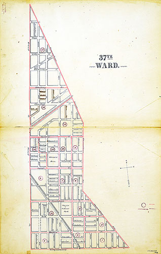
Atlas of the City of Philadelphia by Wards, Ward 37
1893: J. E. Shiedt, Atlas of the City of Philadelphia by Wards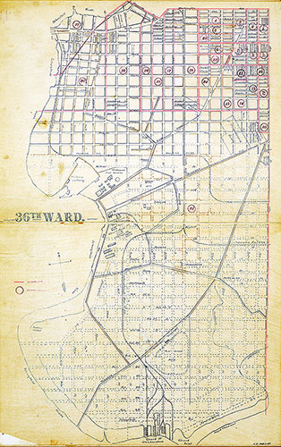
Atlas of the City of Philadelphia by Wards, Ward 36
1893: J. E. Shiedt, Atlas of the City of Philadelphia by Wards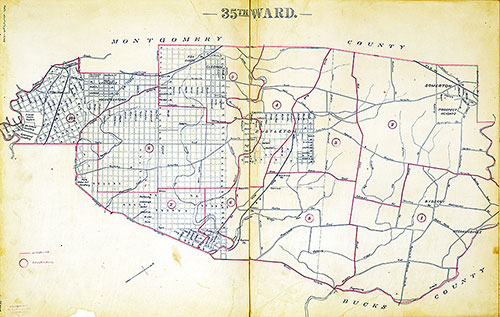
Atlas of the City of Philadelphia by Wards, Ward 35
1893: J. E. Shiedt, Atlas of the City of Philadelphia by Wards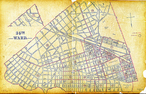
Atlas of the City of Philadelphia by Wards, Ward 34
1893: J. E. Shiedt, Atlas of the City of Philadelphia by Wards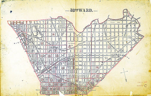
Atlas of the City of Philadelphia by Wards, Ward 33
1893: J. E. Shiedt, Atlas of the City of Philadelphia by Wards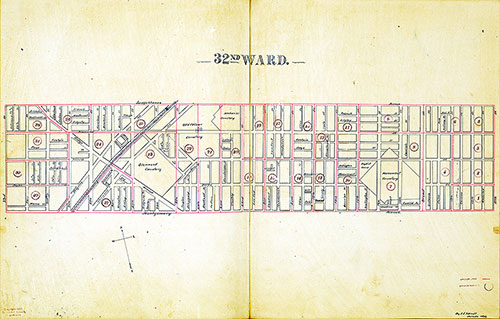
Atlas of the City of Philadelphia by Wards, Ward 32
1893: J. E. Shiedt, Atlas of the City of Philadelphia by Wards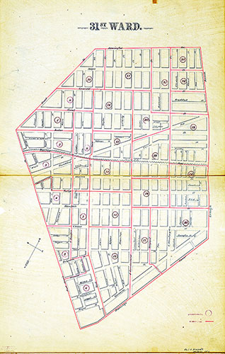
Atlas of the City of Philadelphia by Wards, Ward 31
1893: J. E. Shiedt, Atlas of the City of Philadelphia by Wards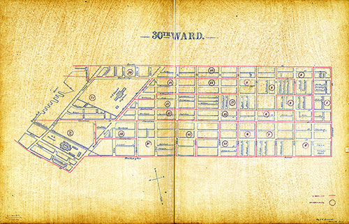
Atlas of the City of Philadelphia by Wards, Ward 30
1893: J. E. Shiedt, Atlas of the City of Philadelphia by Wards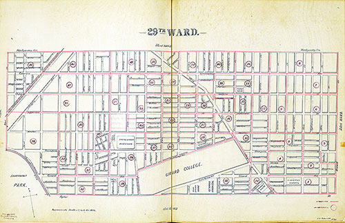
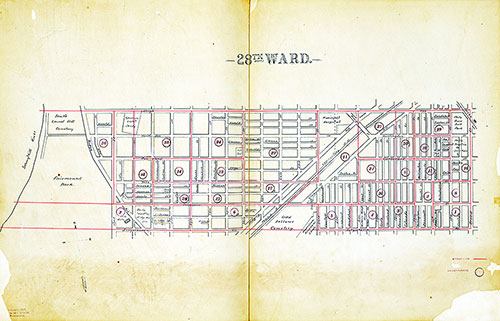
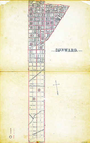
Atlas of the City of Philadelphia by Wards, Ward 29
1893: J. E. Shiedt, Atlas of the City of Philadelphia by Wards