Map Collection
Our map collection enables you to see how Philadelphia's neighborhoods and streets have grown and changed. Use our interactive mapping tool to overlay atlases dating back as far as 1843 over today's street layout.
Showing 481 to 500 of 5,193
Insurance Maps of the City of Philadelphia, 1915-1919, Plate 432
1915-1919: Hexamer, Insurance Maps of the City of Philadelphia, Volume 20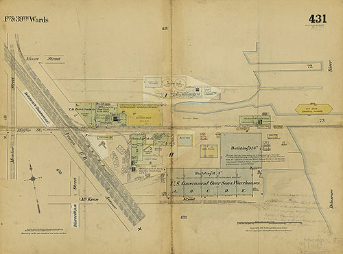
Insurance Maps of the City of Philadelphia, 1915-1919, Plate 431
1915-1919: Hexamer, Insurance Maps of the City of Philadelphia, Volume 20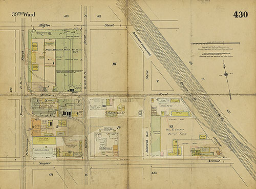
Insurance Maps of the City of Philadelphia, 1915-1919, Plate 430
1915-1919: Hexamer, Insurance Maps of the City of Philadelphia, Volume 20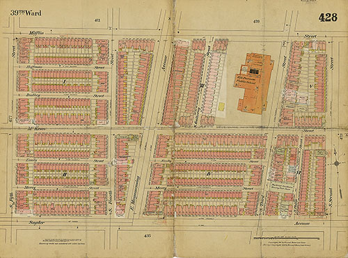
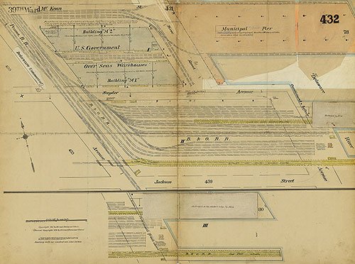
Insurance Maps of the City of Philadelphia, 1915-1919, Plate 428
1915-1919: Hexamer, Insurance Maps of the City of Philadelphia, Volume 20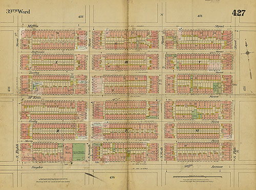
Insurance Maps of the City of Philadelphia, 1915-1919, Plate 427
1915-1919: Hexamer, Insurance Maps of the City of Philadelphia, Volume 20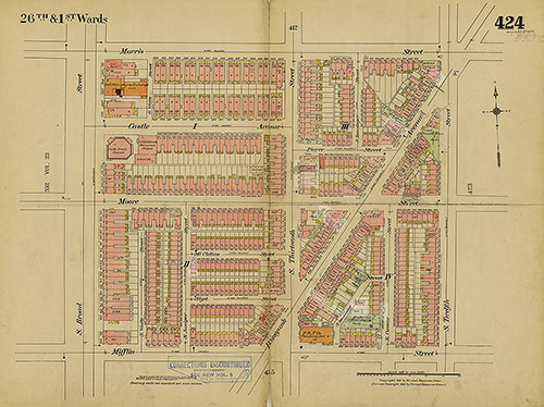
Insurance Maps of the City of Philadelphia, 1915-1919, Plate 424
1915-1919: Hexamer, Insurance Maps of the City of Philadelphia, Volume 20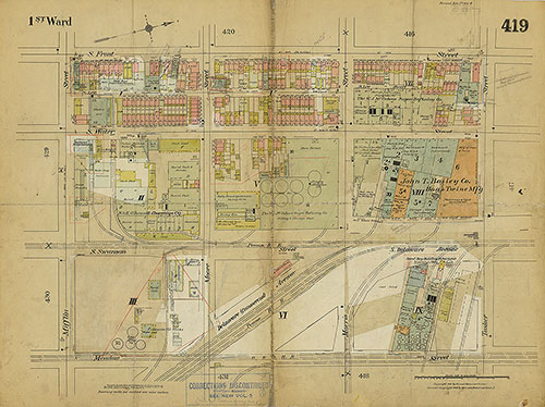
Insurance Maps of the City of Philadelphia, 1915-1919, Plate 419
1915-1919: Hexamer, Insurance Maps of the City of Philadelphia, Volume 20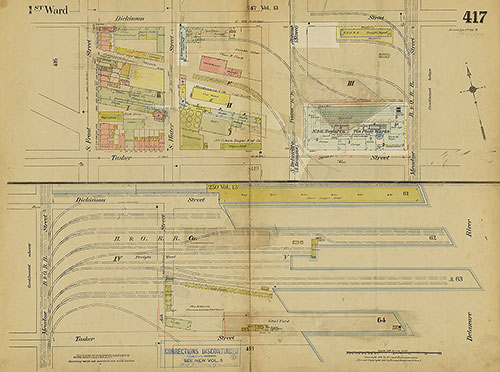
Insurance Maps of the City of Philadelphia, 1915-1919, Plate 417
1915-1919: Hexamer, Insurance Maps of the City of Philadelphia, Volume 20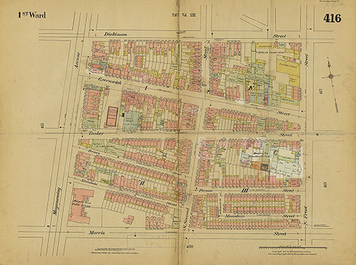
Insurance Maps of the City of Philadelphia, 1915-1919, Plate 416
1915-1919: Hexamer, Insurance Maps of the City of Philadelphia, Volume 20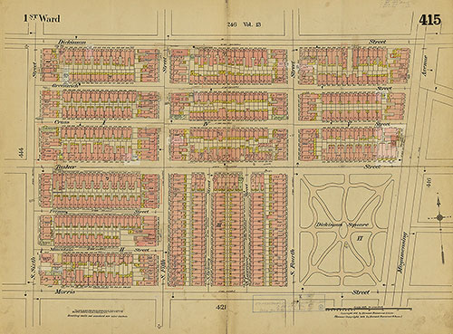
Insurance Maps of the City of Philadelphia, 1915-1919, Plate 415
1915-1919: Hexamer, Insurance Maps of the City of Philadelphia, Volume 20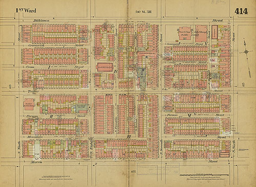
Insurance Maps of the City of Philadelphia, 1915-1919, Plate 414
1915-1919: Hexamer, Insurance Maps of the City of Philadelphia, Volume 20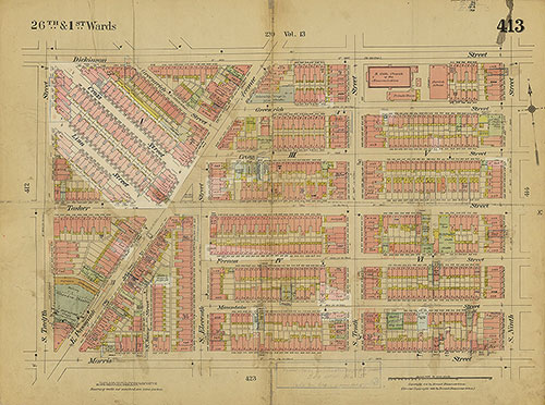
Insurance Maps of the City of Philadelphia, 1915-1919, Plate 413
1915-1919: Hexamer, Insurance Maps of the City of Philadelphia, Volume 20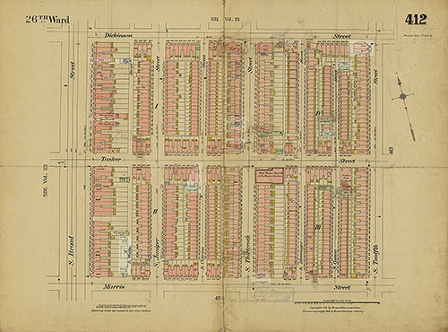
Insurance Maps of the City of Philadelphia, 1915-1919, Plate 412
1915-1919: Hexamer, Insurance Maps of the City of Philadelphia, Volume 20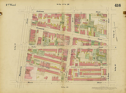
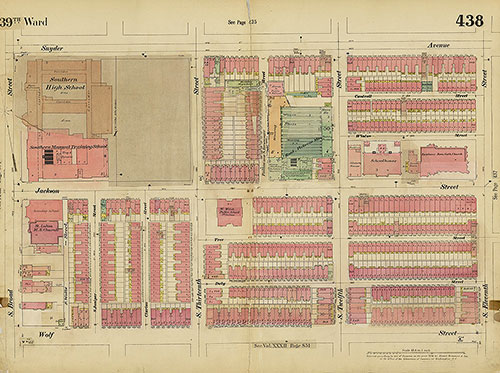
Insurance Maps of the City of Philadelphia, 1893-1914, Plate 416
1893-1914: Hexamer, Insurance Maps of the City of Philadelphia, Volume 20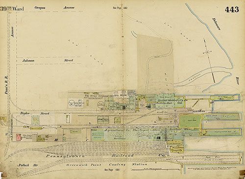
Insurance Maps of the City of Philadelphia, 1893-1914, Plate 443
1893-1914: Hexamer, Insurance Maps of the City of Philadelphia, Volume 20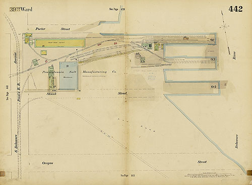
Insurance Maps of the City of Philadelphia, 1893-1914, Plate 442
1893-1914: Hexamer, Insurance Maps of the City of Philadelphia, Volume 20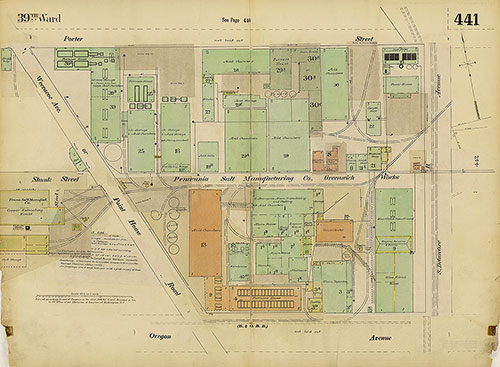
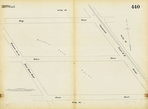
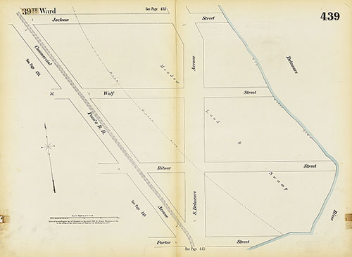
Insurance Maps of the City of Philadelphia, 1893-1914, Plate 441
1893-1914: Hexamer, Insurance Maps of the City of Philadelphia, Volume 20