Map Collection
Our map collection enables you to see how Philadelphia's neighborhoods and streets have grown and changed. Use our interactive mapping tool to overlay atlases dating back as far as 1843 over today's street layout.
Showing 401 to 420 of 5,193
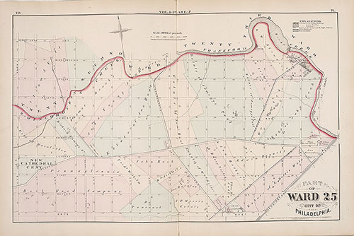
City Atlas of Philadelphia, 1st, 26th and 30th Wards, 1876, Plate N
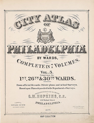
1876: G. M. Hopkins, City Atlas of Philadelphia, 1st, 26th and 30th Wards, Volume 5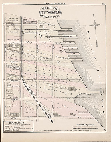
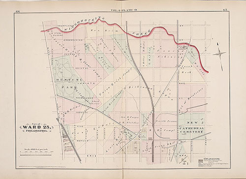
City Atlas of Philadelphia, 1st, 26th and 30th Wards, 1876, Plate M
1876: G. M. Hopkins, City Atlas of Philadelphia, 1st, 26th and 30th Wards, Volume 5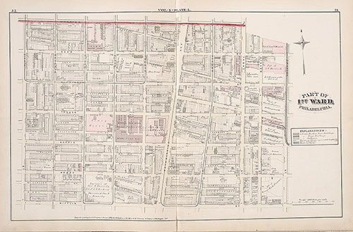
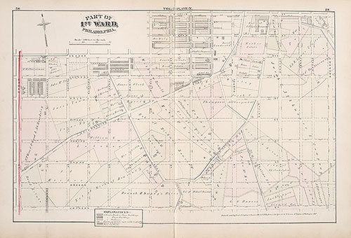
City Atlas of Philadelphia, 1st, 26th and 30th Wards, 1876, Plate L
1876: G. M. Hopkins, City Atlas of Philadelphia, 1st, 26th and 30th Wards, Volume 5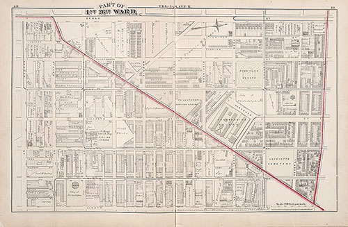
City Atlas of Philadelphia, 1st, 26th and 30th Wards, 1876, Plate K
1876: G. M. Hopkins, City Atlas of Philadelphia, 1st, 26th and 30th Wards, Volume 5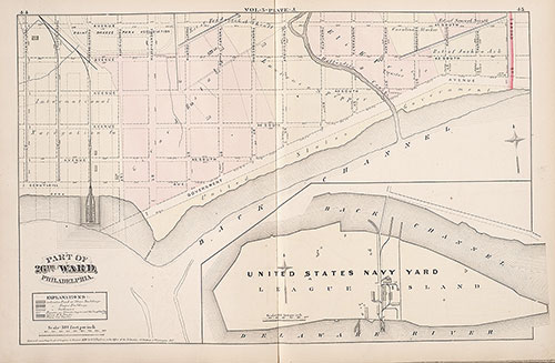
City Atlas of Philadelphia, 1st, 26th and 30th Wards, 1876, Plate J
1876: G. M. Hopkins, City Atlas of Philadelphia, 1st, 26th and 30th Wards, Volume 5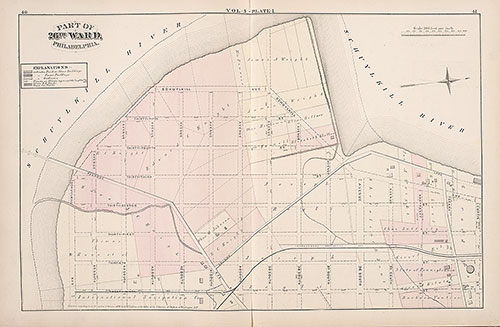
City Atlas of Philadelphia, 1st, 26th and 30th Wards, 1876, Plate I
1876: G. M. Hopkins, City Atlas of Philadelphia, 1st, 26th and 30th Wards, Volume 5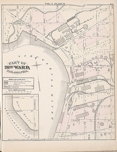
City Atlas of Philadelphia, 1st, 26th and 30th Wards, 1876, Plate H
1876: G. M. Hopkins, City Atlas of Philadelphia, 1st, 26th and 30th Wards, Volume 5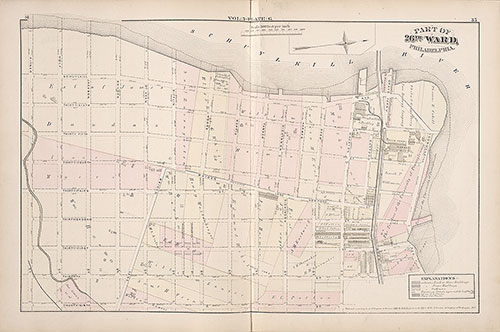
City Atlas of Philadelphia, 1st, 26th and 30th Wards, 1876, Plate G
1876: G. M. Hopkins, City Atlas of Philadelphia, 1st, 26th and 30th Wards, Volume 5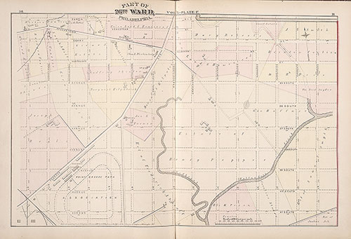
City Atlas of Philadelphia, 1st, 26th and 30th Wards, 1876, Plate F
1876: G. M. Hopkins, City Atlas of Philadelphia, 1st, 26th and 30th Wards, Volume 5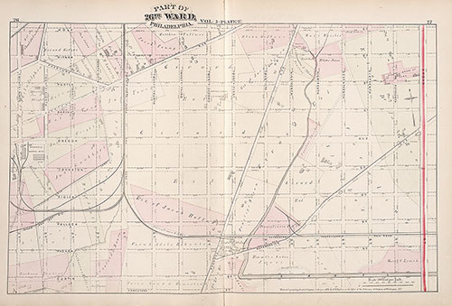
City Atlas of Philadelphia, 1st, 26th and 30th Wards, 1876, Plate E
1876: G. M. Hopkins, City Atlas of Philadelphia, 1st, 26th and 30th Wards, Volume 5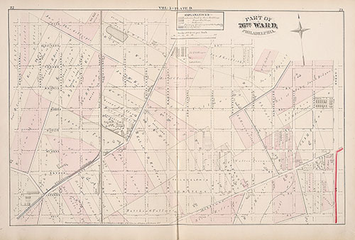
City Atlas of Philadelphia, 1st, 26th and 30th Wards, 1876, Plate D
1876: G. M. Hopkins, City Atlas of Philadelphia, 1st, 26th and 30th Wards, Volume 5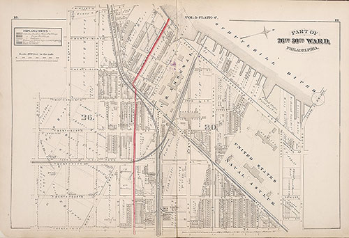
City Atlas of Philadelphia, 1st, 26th and 30th Wards, 1876, Plate C
1876: G. M. Hopkins, City Atlas of Philadelphia, 1st, 26th and 30th Wards, Volume 5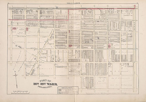
City Atlas of Philadelphia, 1st, 26th and 30th Wards, 1876, Plate B
1876: G. M. Hopkins, City Atlas of Philadelphia, 1st, 26th and 30th Wards, Volume 5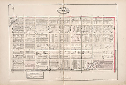
City Atlas of Philadelphia, 1st, 26th and 30th Wards, 1876, Plate A
1876: G. M. Hopkins, City Atlas of Philadelphia, 1st, 26th and 30th Wards, Volume 5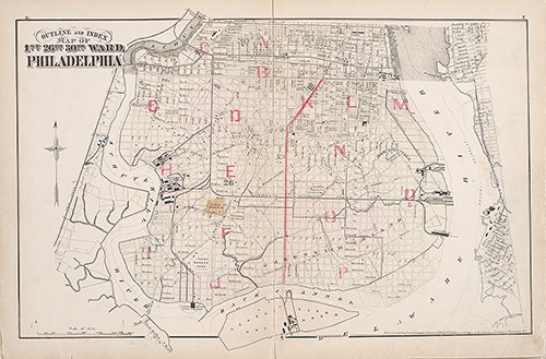
City Atlas of Philadelphia, 1st, 26th and 30th Wards, 1876, Index Map
1876: G. M. Hopkins, City Atlas of Philadelphia, 1st, 26th and 30th Wards, Volume 5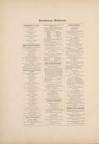
City Atlas of Philadelphia, 1st, 26th and 30th Wards, 1876, Business Notices
1876: G. M. Hopkins, City Atlas of Philadelphia, 1st, 26th and 30th Wards, Volume 5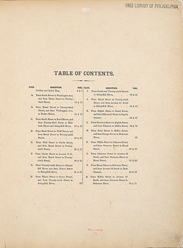
City Atlas of Philadelphia, 1st, 26th and 30th Wards, 1876, Table of Contents
1876: G. M. Hopkins, City Atlas of Philadelphia, 1st, 26th and 30th Wards, Volume 5