Map Collection
Our map collection enables you to see how Philadelphia's neighborhoods and streets have grown and changed. Use our interactive mapping tool to overlay atlases dating back as far as 1843 over today's street layout.
Showing 541 to 560 of 5,193
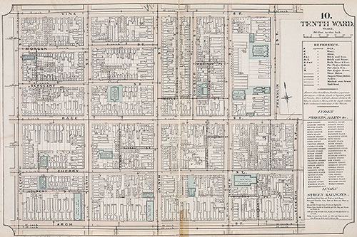
Atlas of Philadelphia, 6th, 9th and 10th Wards, 1875, Plate 10
1875: G. H. Jones, Atlas of Philadelphia, 6th, 9th and 10th Wards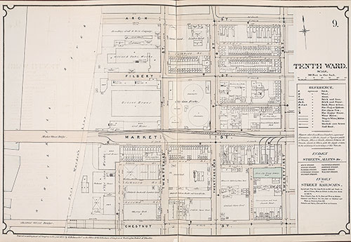
Atlas of Philadelphia, 6th, 9th and 10th Wards, 1875, Plate 9
1875: G. H. Jones, Atlas of Philadelphia, 6th, 9th and 10th Wards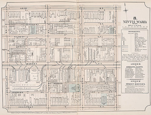
Atlas of Philadelphia, 6th, 9th and 10th Wards, 1875, Plate 8
1875: G. H. Jones, Atlas of Philadelphia, 6th, 9th and 10th Wards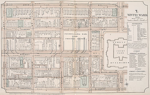
Atlas of Philadelphia, 6th, 9th and 10th Wards, 1875, Plate 7
1875: G. H. Jones, Atlas of Philadelphia, 6th, 9th and 10th Wards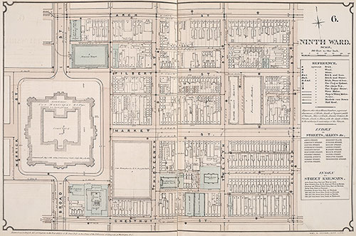
Atlas of Philadelphia, 6th, 9th and 10th Wards, 1875, Plate 6
1875: G. H. Jones, Atlas of Philadelphia, 6th, 9th and 10th Wards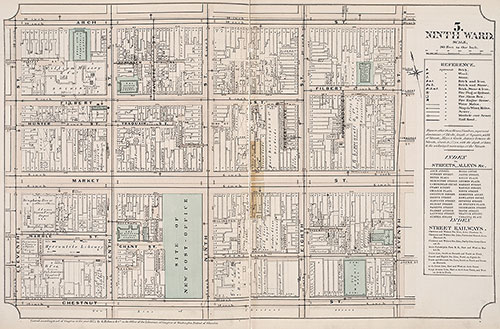
Atlas of Philadelphia, 6th, 9th and 10th Wards, 1875, Plate 5
1875: G. H. Jones, Atlas of Philadelphia, 6th, 9th and 10th Wards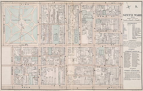
Atlas of Philadelphia, 6th, 9th and 10th Wards, 1875,, Plate 4
1875: G. H. Jones, Atlas of Philadelphia, 6th, 9th and 10th Wards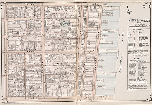
Atlas of Philadelphia, 6th, 9th and 10th Wards, 1875, PLate 3
1875: G. H. Jones, Atlas of Philadelphia, 6th, 9th and 10th Wards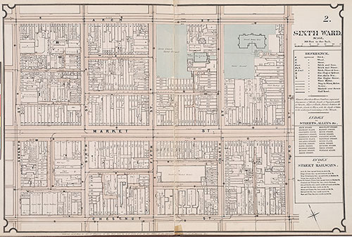
Atlas of Philadelphia, 6th, 9th and 10th Wards, 1875, Plate 2
1875: G. H. Jones, Atlas of Philadelphia, 6th, 9th and 10th Wards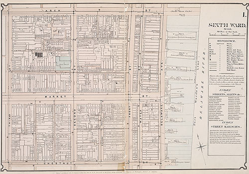
Atlas of Philadelphia, 6th, 9th and 10th Wards, 1875, Plate 1
1875: G. H. Jones, Atlas of Philadelphia, 6th, 9th and 10th Wards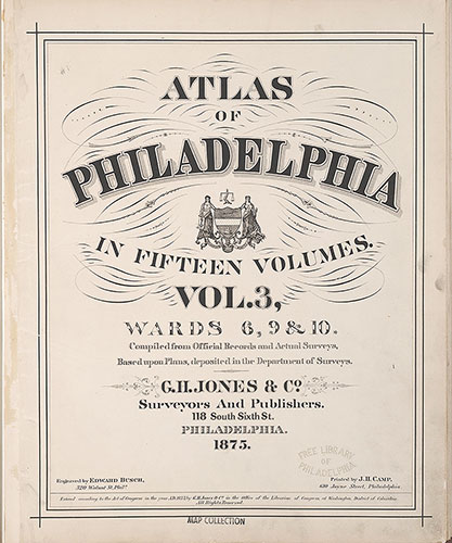
Atlas of Philadelphia, 6th, 9th and 10th Wards, 1875, Title Page
1875: G. H. Jones, Atlas of Philadelphia, 6th, 9th and 10th Wards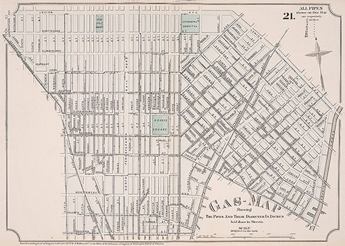
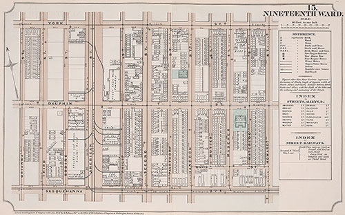
Atlas of Philadelphia, 19th Ward, 1874, Plate 21
1874: G. H. Jones, Atlas of Philadelphia, 19th Ward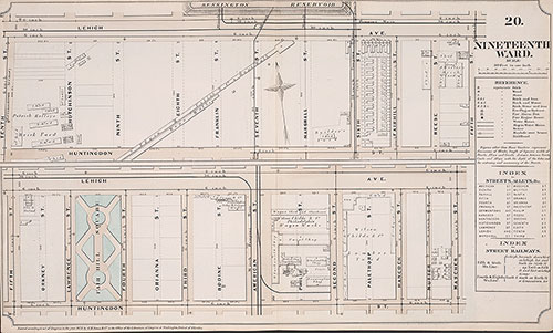
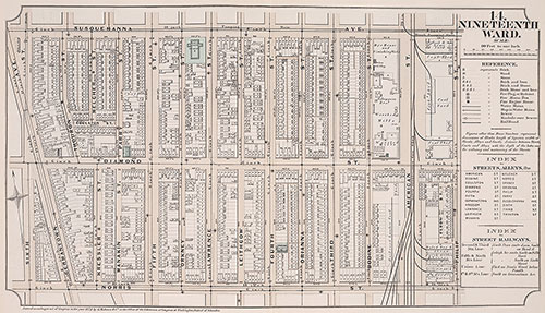
Atlas of Philadelphia, 19th Ward, 1874, Plate 20
1874: G. H. Jones, Atlas of Philadelphia, 19th Ward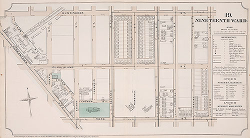
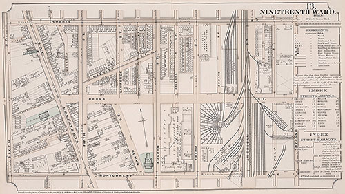
Atlas of Philadelphia, 19th Ward, 1874, Plate 19
1874: G. H. Jones, Atlas of Philadelphia, 19th Ward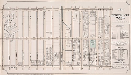
Atlas of Philadelphia, 19th Ward, 1874, Plate 18
1874: G. H. Jones, Atlas of Philadelphia, 19th Ward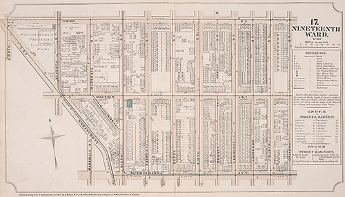
Atlas of Philadelphia, 19th Ward, 1874, Plate 17
1874: G. H. Jones, Atlas of Philadelphia, 19th Ward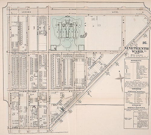
Atlas of Philadelphia, 19th Ward, 1874, Plate 16
1874: G. H. Jones, Atlas of Philadelphia, 19th Ward