Map Collection
Our map collection enables you to see how Philadelphia's neighborhoods and streets have grown and changed. Use our interactive mapping tool to overlay atlases dating back as far as 1843 over today's street layout.
Showing 561 to 580 of 5,193
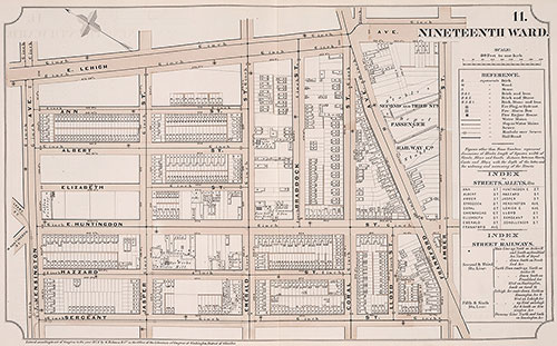
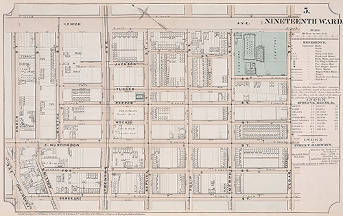
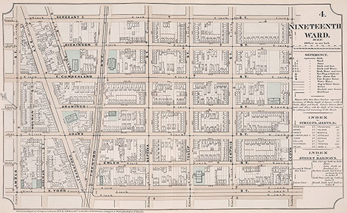
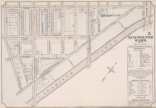
Atlas of Philadelphia, 19th Ward, 1874, Plate 11
1874: G. H. Jones, Atlas of Philadelphia, 19th Ward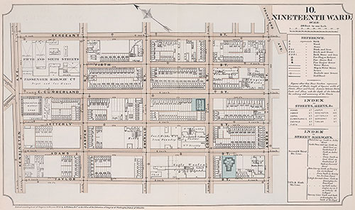
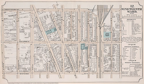
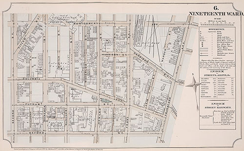
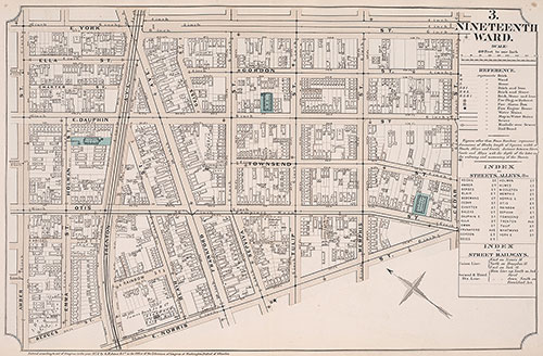
Atlas of Philadelphia, 19th Ward, 1874, Plate 10
1874: G. H. Jones, Atlas of Philadelphia, 19th Ward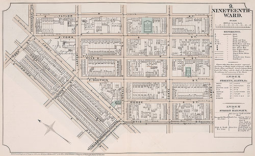
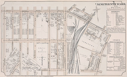
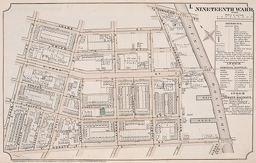
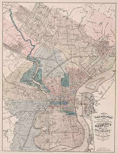
Atlas of Philadelphia, 19th Ward, 1874, City Map
1874: G. H. Jones, Atlas of Philadelphia, 19th Ward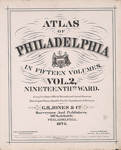
Atlas of Philadelphia, 19th Ward, 1874, Title Page
1874: G. H. Jones, Atlas of Philadelphia, 19th Ward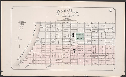
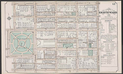
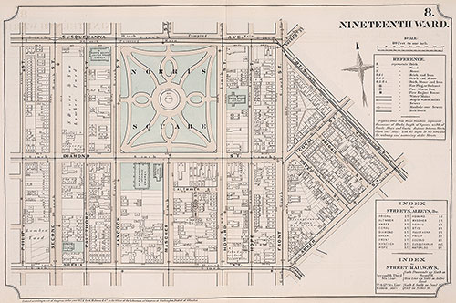
Atlas of Philadelphia, 5th, 7th & 8th Wards, 1874, Plate 17
1874: G. H. Jones, Atlas of Philadelphia, 5th, 7th & 8th Wards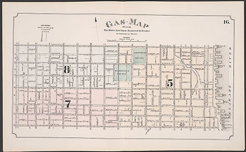
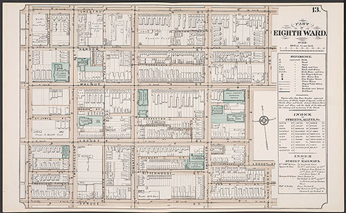
Atlas of Philadelphia, 5th, 7th & 8th Wards, 1874, Plate 16
1874: G. H. Jones, Atlas of Philadelphia, 5th, 7th & 8th Wards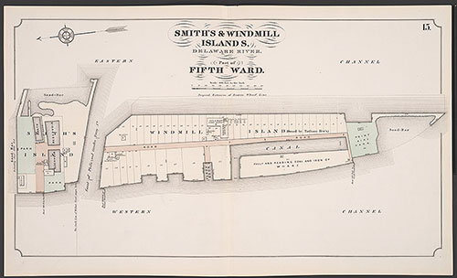
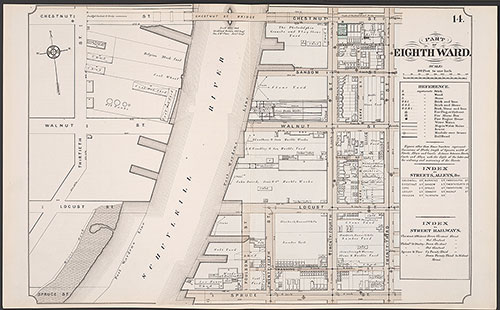
Atlas of Philadelphia, 5th, 7th & 8th Wards, 1874, Plate 15
1874: G. H. Jones, Atlas of Philadelphia, 5th, 7th & 8th Wards