Map Collection
Our map collection enables you to see how Philadelphia's neighborhoods and streets have grown and changed. Use our interactive mapping tool to overlay atlases dating back as far as 1843 over today's street layout.
Showing 4721 to 4740 of 5,193
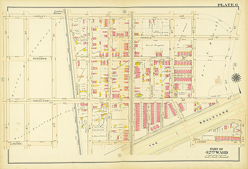
Atlas of the City of Philadelphia, 42nd Ward, Plate 6
1913: Bromley, Atlas of the City of Philadelphia, 42nd Ward
Atlas of the City of Philadelphia, 42nd Ward, Plate 5
1913: Bromley, Atlas of the City of Philadelphia, 42nd Ward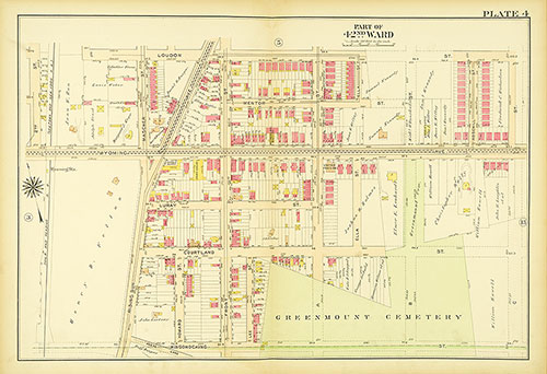
Atlas of the City of Philadelphia, 42nd Ward, Plate 4
1913: Bromley, Atlas of the City of Philadelphia, 42nd Ward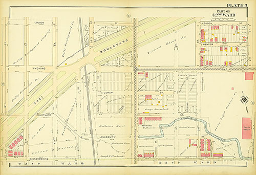
Atlas of the City of Philadelphia, 42nd Ward, Plate 3
1913: Bromley, Atlas of the City of Philadelphia, 42nd Ward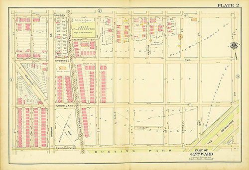
Atlas of the City of Philadelphia, 42nd Ward, Plate 2
1913: Bromley, Atlas of the City of Philadelphia, 42nd Ward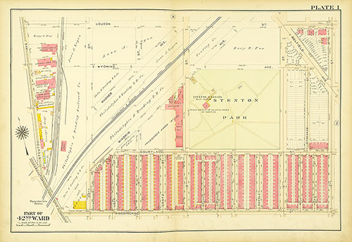
Atlas of the City of Philadelphia, 42nd Ward, Plate 1
1913: Bromley, Atlas of the City of Philadelphia, 42nd Ward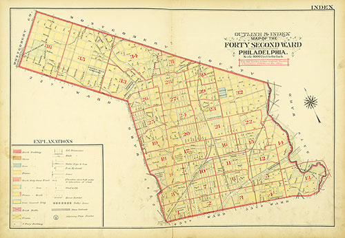
Atlas of the City of Philadelphia, 42nd Ward, Map Index
1913: Bromley, Atlas of the City of Philadelphia, 42nd Ward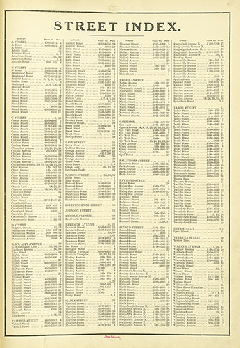
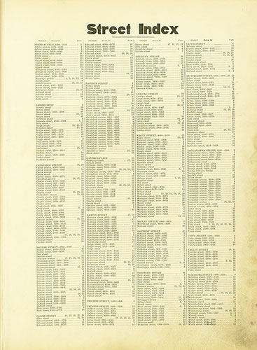
Atlas of the City of Philadelphia, 42nd Ward, Street Index
1913: Bromley, Atlas of the City of Philadelphia, 42nd Ward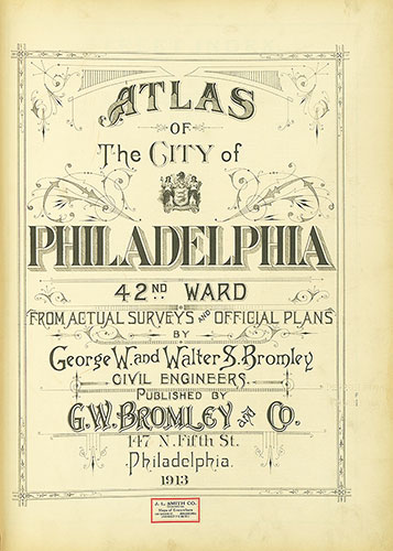
Atlas of the City of Philadelphia, 42nd Ward, Title Page
1913: Bromley, Atlas of the City of Philadelphia, 42nd Ward
Atlas of the City of Philadelphia, 42nd Ward, Cover
1913: Bromley, Atlas of the City of Philadelphia, 42nd Ward
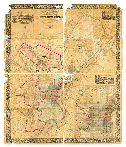
New Map of the Consolidated City of Philadelphia, 1855, Map
1855: Barnes, New Map of the Consolidated City of Philadelphia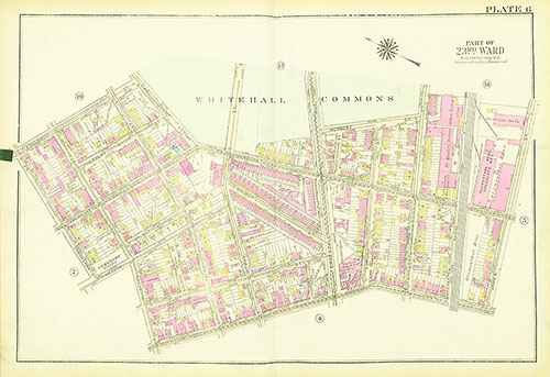
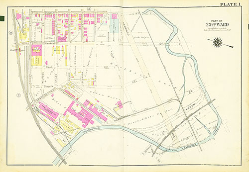
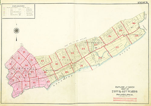
Atlas of the City of Philadelphia, 23rd and 41st Wards, Plate 6
1929: Bromley, Atlas of the City of Philadelphia, 23rd and 41st Wards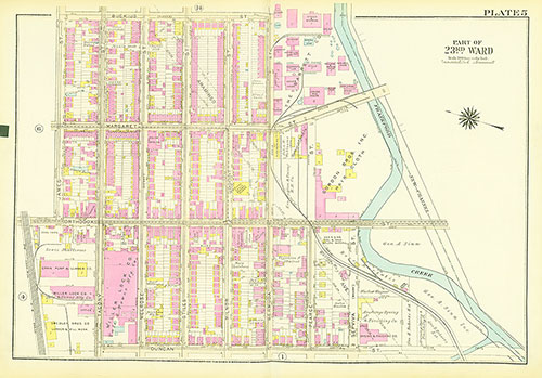
Atlas of the City of Philadelphia, 23rd and 41st Wards, Plate 5
1929: Bromley, Atlas of the City of Philadelphia, 23rd and 41st Wards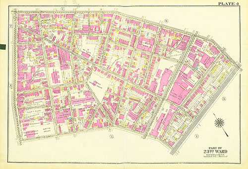
Atlas of the City of Philadelphia, 23rd and 41st Wards, Plate 4
1929: Bromley, Atlas of the City of Philadelphia, 23rd and 41st Wards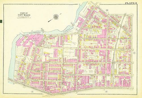
Atlas of the City of Philadelphia, 23rd and 41st Wards, Plate 3
1929: Bromley, Atlas of the City of Philadelphia, 23rd and 41st Wards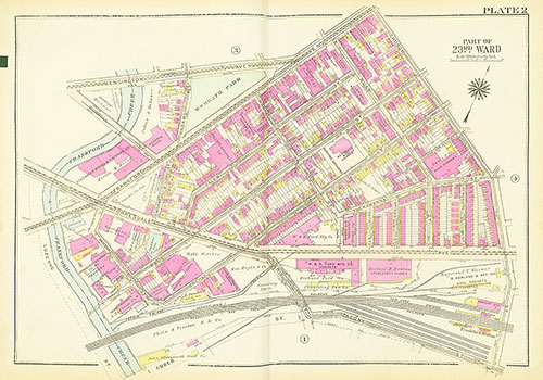
Atlas of the City of Philadelphia, 23rd and 41st Wards, Plate 2
1929: Bromley, Atlas of the City of Philadelphia, 23rd and 41st Wards