Map Collection
Our map collection enables you to see how Philadelphia's neighborhoods and streets have grown and changed. Use our interactive mapping tool to overlay atlases dating back as far as 1843 over today's street layout.
Showing 4521 to 4540 of 5,193
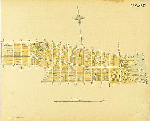
Street Atlas of Philadelphia by Wards, 2nd Ward
1895: Kaufmann, Street Atlas of Philadelphia by Wards
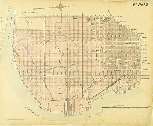
Street Atlas of Philadelphia by Wards, 1st Ward
1895: Kaufmann, Street Atlas of Philadelphia by Wards
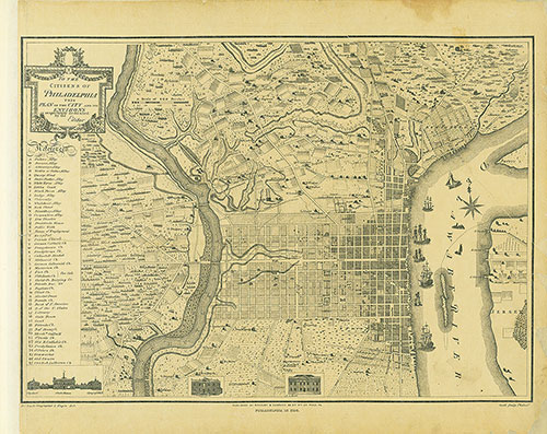
Street Atlas of Philadelphia by Wards, Philadelphia in 1796
1895: Kaufmann, Street Atlas of Philadelphia by Wards
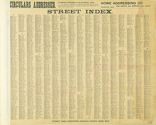
Street Atlas of Philadelphia by Wards, Street Index
1895: Kaufmann, Street Atlas of Philadelphia by Wards
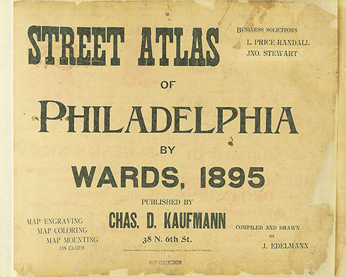
Street Atlas of Philadelphia by Wards, Title Page
1895: Kaufmann, Street Atlas of Philadelphia by Wards
Street Atlas of Philadelphia by Wards, 1895, Cover
1895: Kaufmann, Street Atlas of Philadelphia by Wards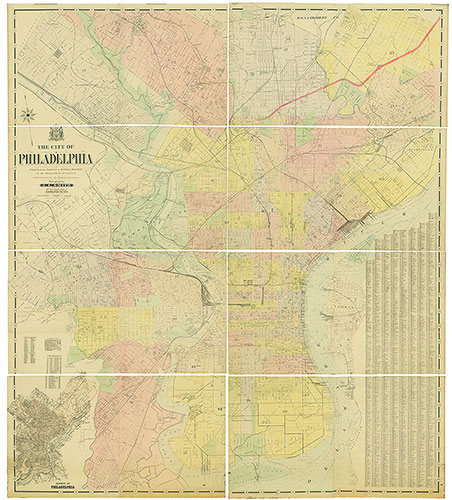
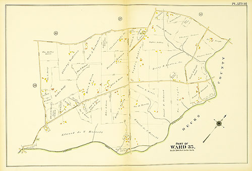
Atlas of the 23rd, 35th, & 41st Wards of the City of Philadelphia, Plate 41
1910: J. L. Smith, Atlas of the 23rd, 35th, & 41st Wards of the City of Philadelphia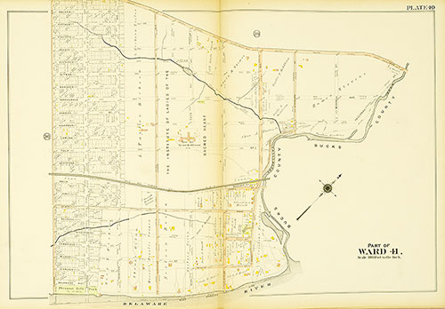
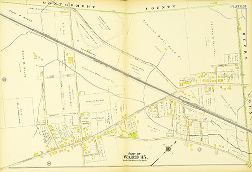
Atlas of the 23rd, 35th, & 41st Wards of the City of Philadelphia, Plate 40
1910: J. L. Smith, Atlas of the 23rd, 35th, & 41st Wards of the City of Philadelphia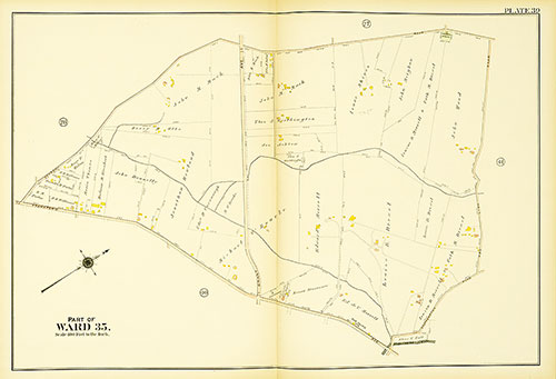
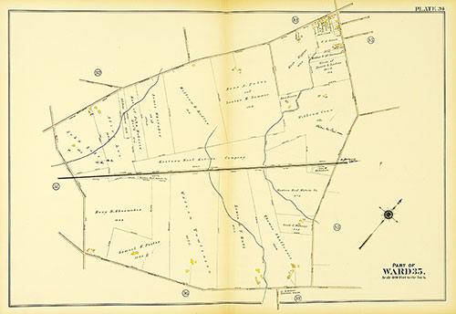
Atlas of the 23rd, 35th, & 41st Wards of the City of Philadelphia, Plate 39
1910: J. L. Smith, Atlas of the 23rd, 35th, & 41st Wards of the City of Philadelphia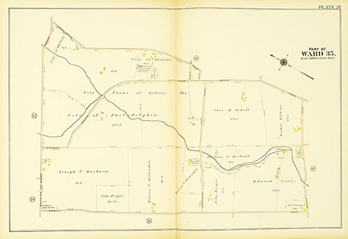
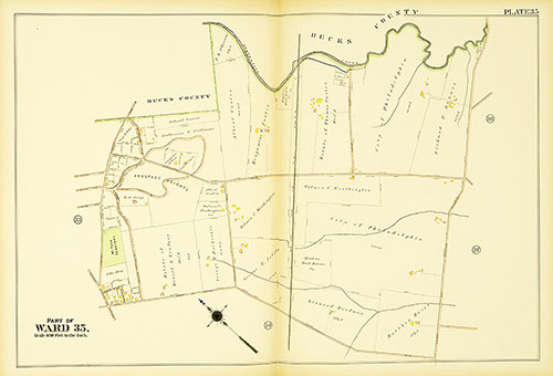
Atlas of the 23rd, 35th, & 41st Wards of the City of Philadelphia, Plate 38
1910: J. L. Smith, Atlas of the 23rd, 35th, & 41st Wards of the City of Philadelphia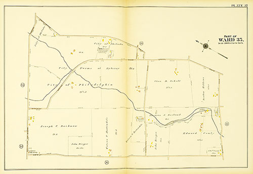
Atlas of the 23rd, 35th, & 41st Wards of the City of Philadelphia, Plate 37
1910: J. L. Smith, Atlas of the 23rd, 35th, & 41st Wards of the City of Philadelphia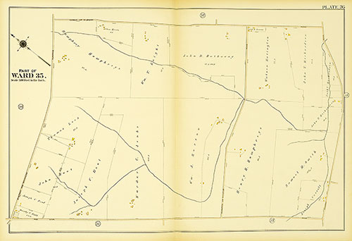
Atlas of the 23rd, 35th, & 41st Wards of the City of Philadelphia, Plate 36
1910: J. L. Smith, Atlas of the 23rd, 35th, & 41st Wards of the City of Philadelphia