Map Collection
Our map collection enables you to see how Philadelphia's neighborhoods and streets have grown and changed. Use our interactive mapping tool to overlay atlases dating back as far as 1843 over today's street layout.
Showing 1 to 20 of 125
Results for brewery

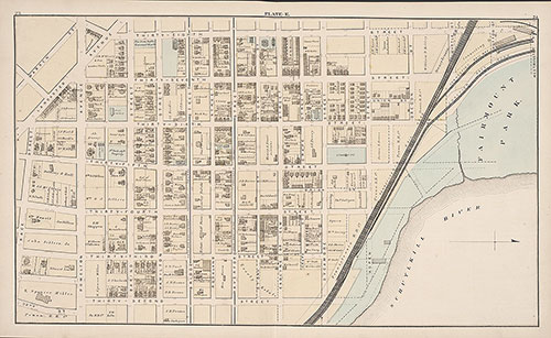
City Atlas of Philadelphia, 24th and 27th Wards, 1872, Plate E
1872: G. M. Hopkins, City Atlas of Philadelphia, 24th and 27th Wards, Volume 7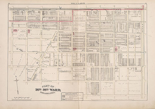
City Atlas of Philadelphia, 1st, 26th and 30th Wards, 1876, Plate B
1876: G. M. Hopkins, City Atlas of Philadelphia, 1st, 26th and 30th Wards, Volume 5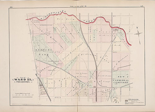
City Atlas of Philadelphia, 25th Ward, 1875, Plate O
1875: G. M. Hopkins, City Atlas of Philadelphia, 25th Ward, Volume 4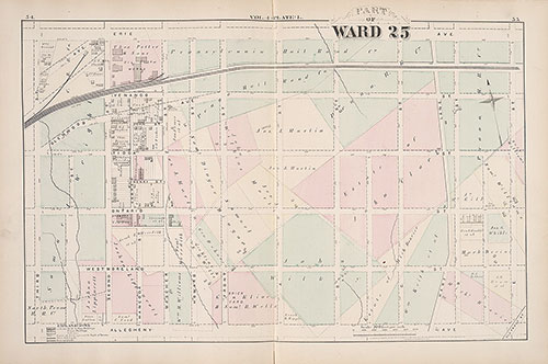
City Atlas of Philadelphia, 25th Ward, 1875, Plate L
1875: G. M. Hopkins, City Atlas of Philadelphia, 25th Ward, Volume 4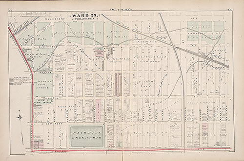
City Atlas of Philadelphia, 25th Ward, 1875, Plate I
1875: G. M. Hopkins, City Atlas of Philadelphia, 25th Ward, Volume 4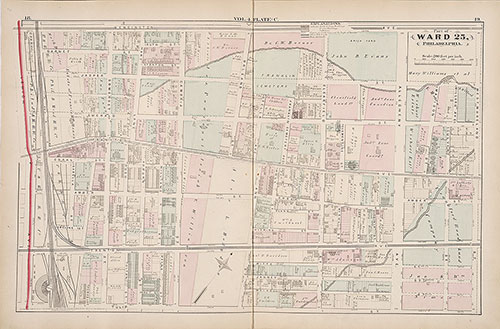
City Atlas of Philadelphia, 25th Ward, 1875, Plate C
1875: G. M. Hopkins, City Atlas of Philadelphia, 25th Ward, Volume 4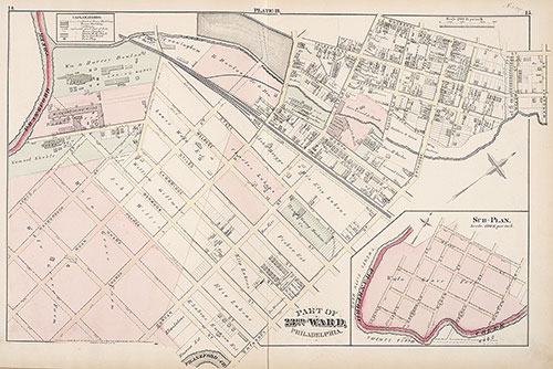
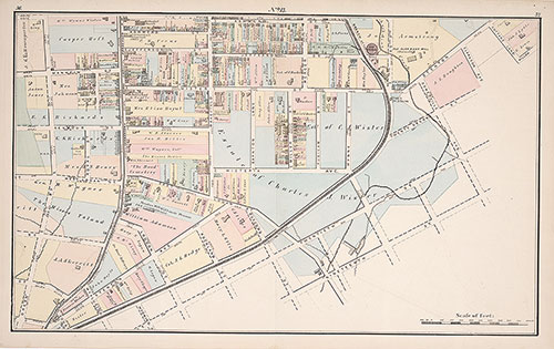
City Atlas of Philadelphia, 23rd Ward, 1876, Plate B
1876: G. M. Hopkins, City Atlas of Philadelphia, 23rd Ward, Volume 3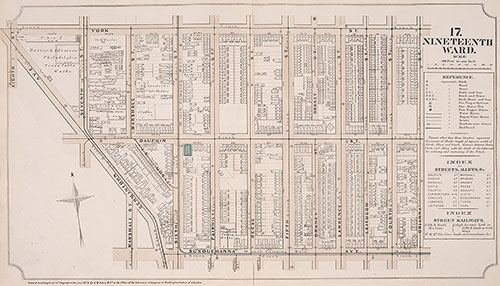
Atlas of Philadelphia, 19th Ward, 1874, Plate 17
1874: G. H. Jones, Atlas of Philadelphia, 19th Ward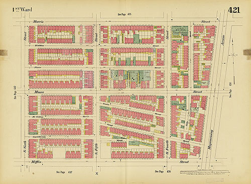
Insurance Maps of the City of Philadelphia, 1893-1895, Plate 421
1893-1895: Hexamer, Insurance Maps of the City of Philadelphia, Volume 20
Map of the Vicinity of Philadelphia From Actual Surveys 1861, Plate 3-A: Philadelphia (part)
1861: Map of the Vicinity of Philadelphia, from Actual Surveys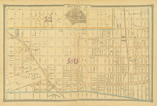
Atlas of the City of Philadelphia, 1862, Section 17
1862: Smedley, Atlas of the City of Philadelphia
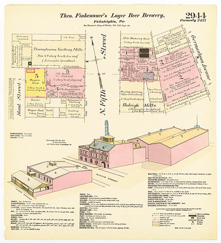
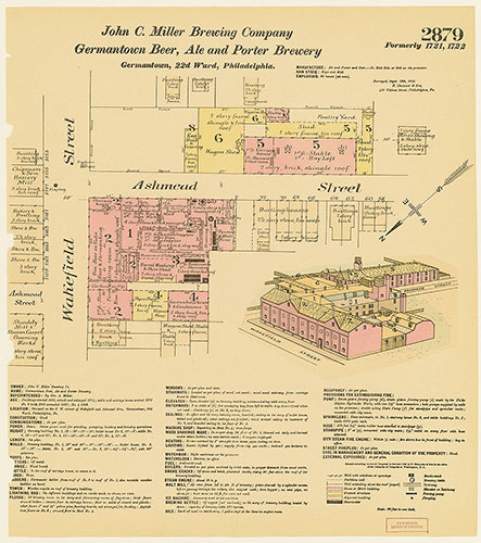
Hexamer General Surveys, Volume 30, Plate 2944
1895-1896: Hexamer General Surveys: Volume 30, Plates 2856-2954/5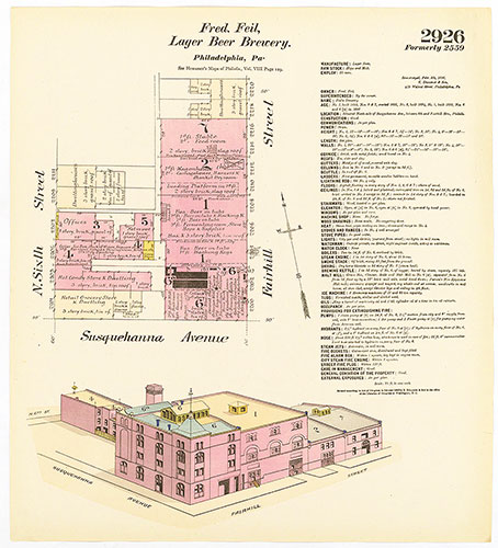
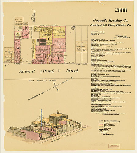
Hexamer General Surveys, Volume 30, Plate 2926
1895-1896: Hexamer General Surveys: Volume 30, Plates 2856-2954/5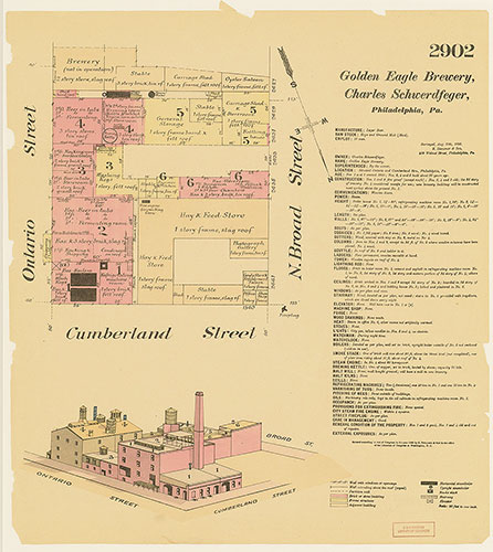
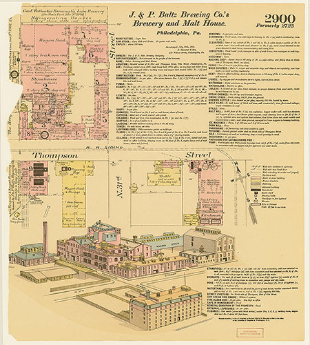
Hexamer General Surveys, Volume 30, Plate 2902
1895-1896: Hexamer General Surveys: Volume 30, Plates 2856-2954/5