Map Collection
Our map collection enables you to see how Philadelphia's neighborhoods and streets have grown and changed. Use our interactive mapping tool to overlay atlases dating back as far as 1843 over today's street layout.
Showing 4901 to 4920 of 5,193
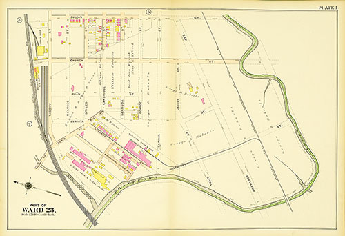
Atlas of the 23rd, 35th, & 41st Wards of the City of Philadelphia, Plate 1
1910: J. L. Smith, Atlas of the 23rd, 35th, & 41st Wards of the City of Philadelphia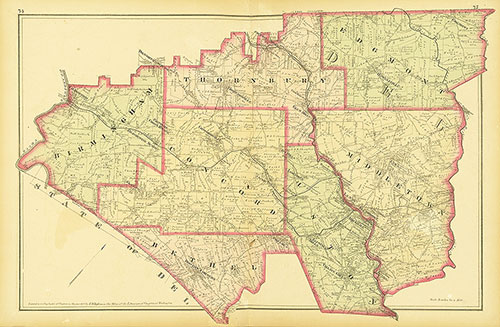
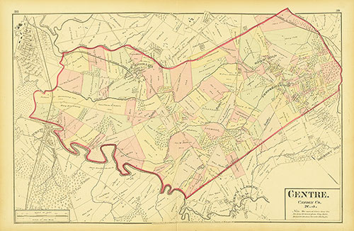
Atlas of Philadelphia and Environs, Pages 74-75
1877: G. M. Hopkins, Atlas of Philadelphia and Environs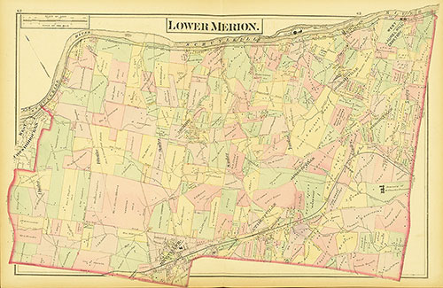
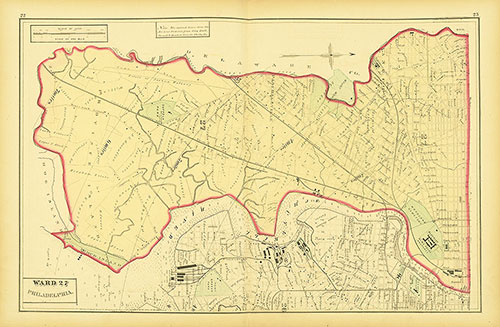
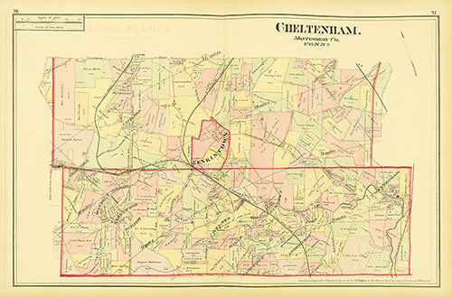
Atlas of Philadelphia and Environs, Pages 62-63
1877: G. M. Hopkins, Atlas of Philadelphia and Environs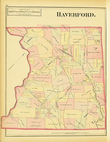
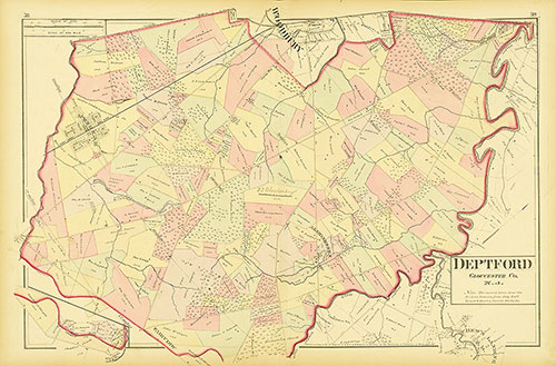
Atlas of Philadelphia and Environs, Pages 66-67
1877: G. M. Hopkins, Atlas of Philadelphia and Environs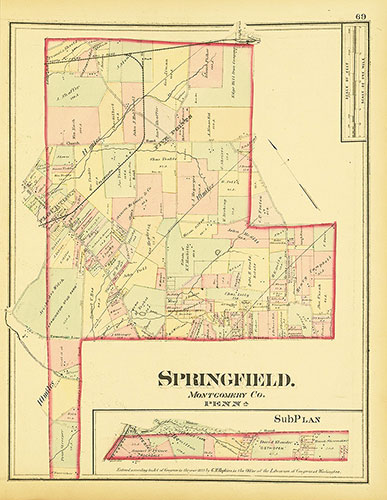
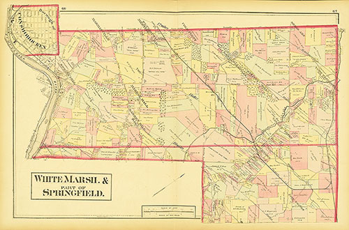
Atlas of Philadelphia and Environs, Pages 70-71
1877: G. M. Hopkins, Atlas of Philadelphia and Environs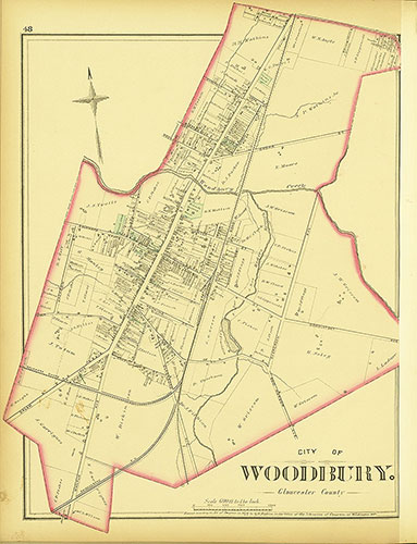
Atlas of Philadelphia and Environs, Pages 48-49
1877: G. M. Hopkins, Atlas of Philadelphia and Environs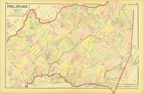
Atlas of Philadelphia and Environs, Pages 50-51
1877: G. M. Hopkins, Atlas of Philadelphia and Environs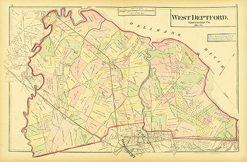
Atlas of Philadelphia and Environs, Pages 54-55
1877: G. M. Hopkins, Atlas of Philadelphia and Environs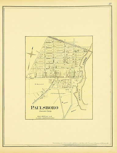
Atlas of Philadelphia and Environs, Pages 58-59
1877: G. M. Hopkins, Atlas of Philadelphia and Environs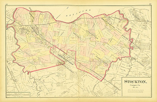
Atlas of Philadelphia and Environs, Pages 42-43
1877: G. M. Hopkins, Atlas of Philadelphia and Environs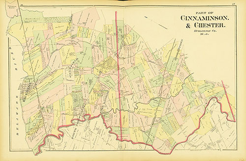
Atlas of Philadelphia and Environs, Pages 46-47
1877: G. M. Hopkins, Atlas of Philadelphia and Environs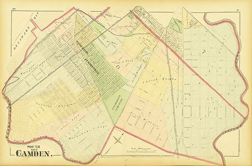
Atlas of Philadelphia and Environs, Pages 30-31
1877: G. M. Hopkins, Atlas of Philadelphia and Environs
Atlas of Philadelphia and Environs, Pages 34-35
1877: G. M. Hopkins, Atlas of Philadelphia and Environs