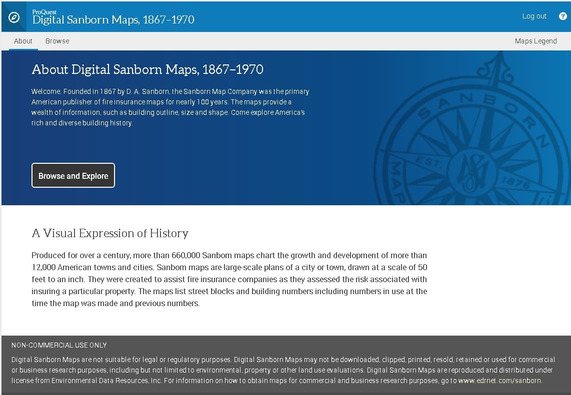
Sanborn fire insurance maps are available once again through ProQuest’s updated and newly-released database, Sanborn Maps 1867-1970 (formerly known as Sanborn Maps Geo Edition 1867-1970). This database gives you access to black-and-white, large-scale maps of over 12,000 cities and towns across the U.S.
Fire insurance maps were created to help fire insurance companies assess risks and determine insurance premiums for properties. These maps are great resources for tracing historical roots, especially as it relates to urban development, genealogy, and historic preservation.
While the content of this database remains the same, how you search for and retrieve maps is a little different. Read the Frequently Asked Questions (FAQs) below for more information.
FREQUENTLY ASKED QUESTIONS:
How do I access the database?
Visit the Free Library of Philadelphia website and click the databases link under the Find search box. Then click on the “S” button on the database page. Finally, look for the Sanborn Maps, 1867-1970 database and click the link. If accessing the database from outside of the library, you will be prompted to enter your library card and pin number.
What American cities are included in this database?
Too many to list! To see what cities and towns are included: 1) access the database using the above instructions; 2) select the state you’re interested in by using the first dropdown menu; 3) browse the cities and towns listed using the second dropdown menu.
How do I find a specific address / location in Philadelphia?
This is a major change from the former iteration of the database. Georeferencing is no longer available, so you can no longer search by a specific address or location within the database. There are two methods you can use to determine the volume and plate number for the location / address of interest.
- You can refer to this volume index map for Sanborn volumes. Locate the address within one of the numbered sections (notice that street names indicate boundaries of the sections). That number is the volume number. Then, in the ProQuest Sanborn Map database, select Pennsylvania and Philadelphia from the dropdown menus, and select the year you’re interested in. Using the dropdown menu towards the top center of the screen, select the volume number you want to view. Once that volume appears, select either the index map or street index (at the beginning of the volume) to find the specific address / location you’re looking for. Either index will give you the corresponding plate number. Once you identify the plate number, scroll through the thumbnails on the right side of the screen until you find the page you’re looking for, and click on it to see an enlarged view.
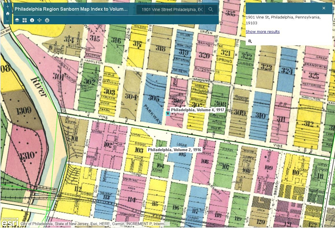
- Alternatively, use the Penn State University interactive, searchable index. Enter the address (including “Philadelphia, PA”) into the search box and click the magnifying glass button. It will then generate the volume number and plate number for that specific address (remember these numbers!). Then, using the ProQuest Sanborn Map database, select Pennsylvania and Philadelphia from the dropdown menus, and select the year you’re interested in. Using the dropdown menu towards the top center of the screen, select the volume number you want to view, then scroll through the thumbnails on the right side of the screen until you find the plate you want to view, and click on it.
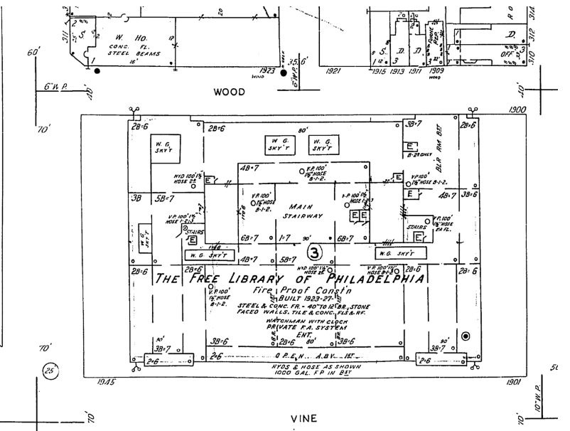
This is my first time seeing fire insurance maps. How do I read them?
The Library of Congress provides a great overview on how to decipher the colors and symbols of Sanborn maps.
The earliest Sanborn fire insurance maps of Philadelphia date to 1916. Are there older fire insurance maps of the city?
Yes! Ernest Hexamer and William Locher began creating fire insurance maps of Philadelphia in the 1850s. Eventually, Ernest Hexamer and his son C.J. worked together to produce fire insurance maps under the name "Hexamer & Son." These maps date from the 1870s to the 1920s. See our Map Collection page for details on how to access the Hexamer collections. Note: the Hexamer & Locher volumes are within the "Ward (City) Atlas" Collection.
Are there online Sanborn maps in color?
Yes! One of the best resources is the digital collection at the Library of Congress Geography and Map Division. If you’re interested specifically in Philadelphia or other Pennsylvania cities and towns, you can also check out Penn State University’s online collection.
Who can I contact if I have more maps-related questions?
Contact the Map Collection at Parkway Central Library via email: eRefMap @ FreeLibrary.org.
Have a question for Free Library staff? Please submit it to our Ask a Librarian page and receive a response within two business days.