Insurance Maps of the City of Philadelphia, 1893-1914, Plate 471
Maps 1893-1914: Hexamer, Insurance Maps of the City of Philadelphia, Volume 21
Item Info
Item No: mhimcd00032
Title: Insurance Maps of the City of Philadelphia, 1893-1914, Plate 471
Additional Title: Insurance Maps of the City of Philadelphia, 1893-1914, Volume 21
Page:
32
Work Type: Property Atlases/Maps
Source: Map Collection
Northside Orientation of Image: Right
Alternate Page Number: Plate 471
City/Town/Township: Geographic Coverage State/Province:Pennsylvania
Geographic Coverage City/Town/Township:Philadelphia
Geographic Coverage Region/County:Philadelphia
Creation Year (Single Year or Range Begin): 1914
Creator Name: Ernest Hexamer & Son - Publisher
 Front Cover
  Front End Papers
  Front End Papers and Title Page [verso]
 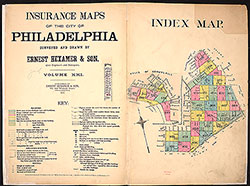 Title Page and Index Map
 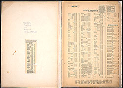 Street Index
 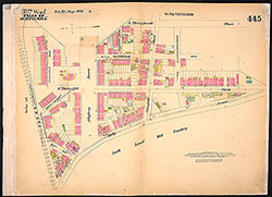 Plate 445
 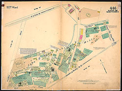 Plate 446
 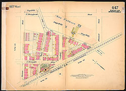 Plate 447
 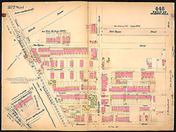 Plate 448
 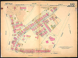 Plate 449
 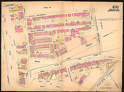 Plate 450
 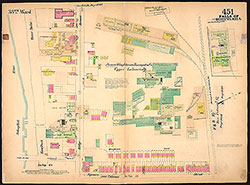 Plate 451
 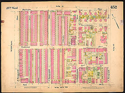 Plate 452
 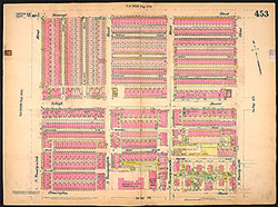 Plate 453
 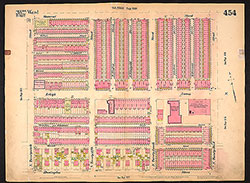 Plate 454
 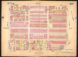 Plate 455
  Plate 456
 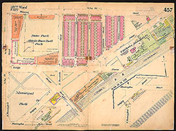 Plate 457
 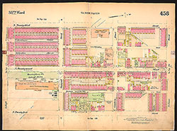 Plate 458
 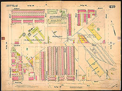 Plate 459
 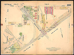 Plate 460
 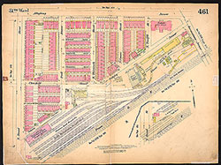 Plate 461
 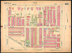 Plate 462
 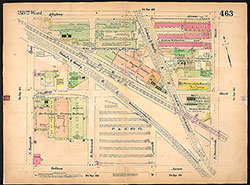 Plate 463
 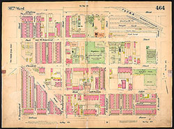 Plate 464
 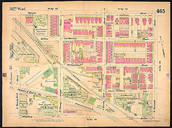 Plate 465
 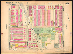 Plate 446
 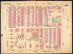 Plate 467
 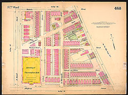 Plate 468
 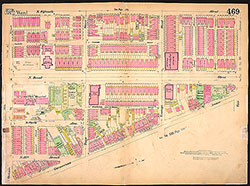 Plate 469
 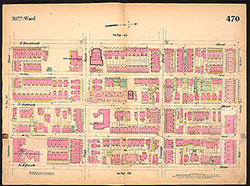 Plate 470
 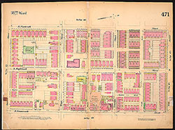 Plate 471
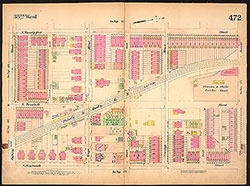 Plate 472
 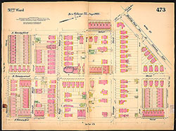 Plate 473
 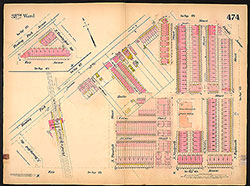 Plate 474
 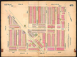 Plate 475
 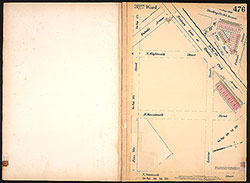 Plate 476
 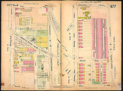 Plate 477
 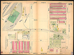 Plate 478
 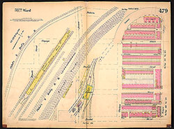 Plate 479
  Back End Papers
  Back Cover