
Item Info
Item No: amer00016
Title: Waggoner of the South Seas, map of the Pacific coast
Media Type:
Books
Source: Rare Book Department
Notes:
This manuscript volume of coastal charts from Acapulco south to Tierra del Fuego. Drawn by William Hack, and dedicated to Charles II by Bartholomew Sharp, who captured the original charts from a Spanish ship in 1680.
Creation Year (Single Year or Range Begin): 1683
Call Number: Elkins 169
Creator Name: Hacke, William - Cartographer
Sharpe, Bartholomew, active 1679-1682
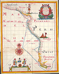 Waggoner of the South Seas, map of the Pacific coast
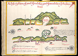 A description of port Guatulco; port Guamalula & ye Indian town
 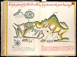 A description of ye old hill & old town with ye entrance into port Realejo
 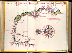 A chart of ye sea coast from point chame to ye pt of Garachin
 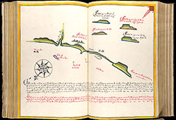 [untitled map of Colanche]