Charleston Harbor and Its Approaches Showing the Positions of the Rebel Batteries, Map
Maps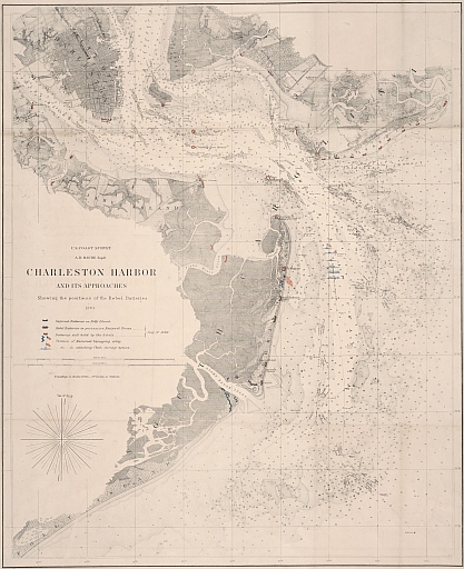
Item Info
Item No: MCWMAA00003
Title: Charleston Harbor and Its Approaches Showing the Positions of the Rebel Batteries, Map
Additional Title: Charleston Harbor and Its Approaches Showing the Positions of the Rebel Batteries
Publication Year:
1863
Work Type: General Maps
Source: Map Collection
Notes:
nautical chart of Charleston and vicinity South Carolina harbor in 1863
Northside Orientation of Image: Top
City/Town/Township: Geographic Coverage State/Province:South Carolina
Geographic Coverage City/Town/Township:Charleston
Creator Name: U.S. Coast Survey - Publisher