Insurance Maps of the City of Philadelphia, 1897, Plate 9 1/2
Maps 1897: Hexamer, Insurance Maps of the City of Philadelphia, Volume 1
Item Info
Item No: MHIMAA00021
Title: Insurance Maps of the City of Philadelphia, 1897, Plate 9 1/2
Additional Title: Insurance Maps of the City of Philadelphia, 1897: Volume 1
Publication Year:
1897
Page: 21
Work Type: Property Atlases/Maps
Source: Map Collection
Notes:
Barley Sheaf Hotel: 257-259 North 2nd Street
Eagle Hotel: 227-229 North 3rd Street
Ellis & Co. 145-147 Race Street
Lonergan Building: 213-215 Race Street
McKInley's Drug Mill: 244-246 North Front Street
Wilbur Chocolate Factory: 235-241 North 3rd Street
Northside Orientation of Image: Right
Alternate Page Number: Plate 9 1/2
City/Town/Township: Geographic Coverage State/Province:Pennsylvania
Geographic Coverage City/Town/Township:Philadelphia
Creation Year (Single Year or Range Begin): 1897
Creator Name: Ernest Hexamer & Son - Publisher
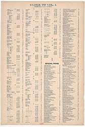 Street Index
 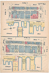 Plate 1
 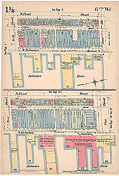 Plate 1 1/2
 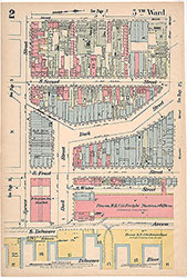 Plate 2
 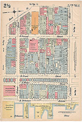 Plate 2 1/2
 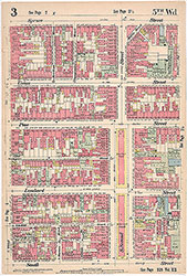 Plate 3
 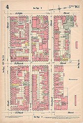 Plate 4
 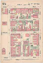 Plate 4 1/2
 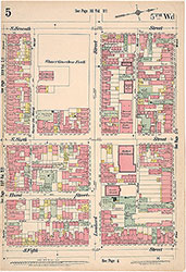 Plate 5
 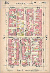 Plate 5 1/2
 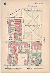 Plate 6
 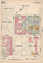 Plate 6 1/2
 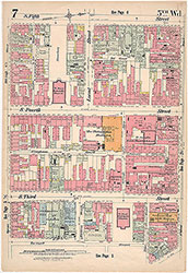 Plate 7
 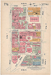 Plate 7 1/2
  Plate 8
  Plate 8 1/2
 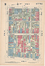 Plate 9
 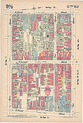 Plate 9 1/2
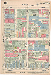 Plate 10
  Plate 10 1/2
 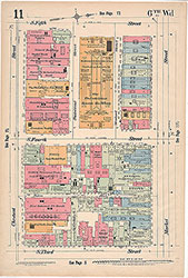 Plate 11
 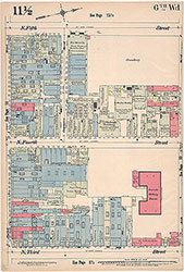 Plate 11 1/2
 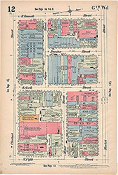 Plate 12
 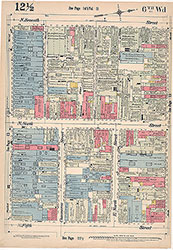 Plate 12 1/2
 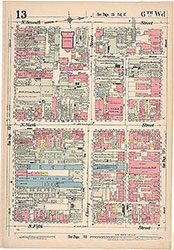 Plate 13
 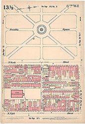 Plate13 1/2
 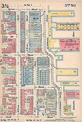 Plate 3 1/2
 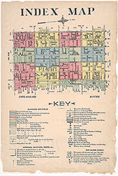 Index Map and Key
  Title Page