Street Atlas of Philadelphia by Wards, 32nd Ward
Maps 1895: Kaufmann, Street Atlas of Philadelphia by Wards
Item Info
Item No: MKAUAA00070
Title: Street Atlas of Philadelphia by Wards, 32nd Ward
Additional Title: Street Atlas of Philadelphia by Wards
Publication Year:
1895
Page: 70
Work Type: Historical Divisions and Boundaries
Source: Map Collection
Northside Orientation of Image: Top
Alternate Page Number: Ward 32
City/Town/Township: Geographic Coverage Ward:32nd ward
Geographic Coverage State/Province:Pennsylvania
Geographic Coverage City/Town/Township:Philadelphia
Creator Name: Charles D. Kaufmann, Publisher; Compiled and drawn by J. Edelmann
 Cover
Cover  Ads
Ads  Ads
Ads 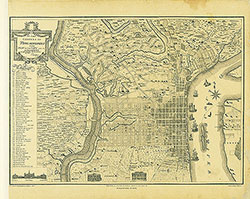 Phila in 1796
  Ads
Ads 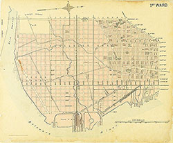 1st Ward
  Ads
Ads 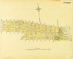 Ward 2
  Ads
Ads 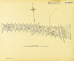 Ward 3
 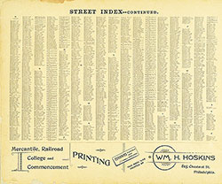 Street Index Cont
 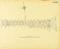 Ward 4
  Ads
Ads 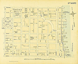 Ward 5
  Ads
Ads 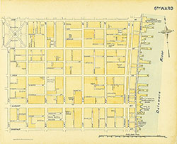 Ward 6
  Ads
Ads 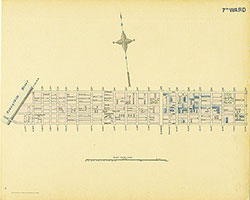 Ward 7
  Ads
Ads 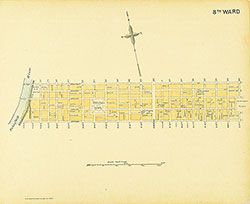 Ward 8
  Ads
Ads 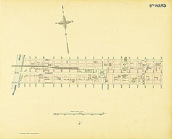 Ward 9
  Ads
Ads 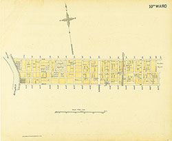 Ward 10
  Ads
Ads 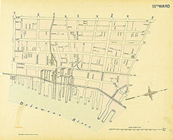 Ward 11
  Ads
Ads 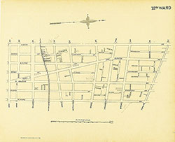 12th Ward
 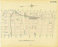 Ward 13
 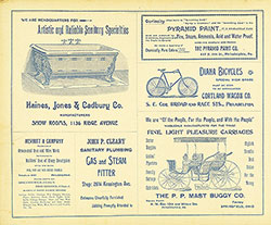 Ads
Ads 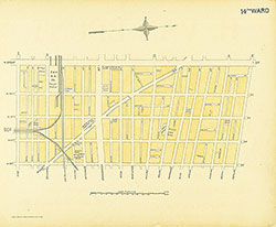 Ward 14
 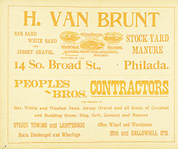 Ads
Ads 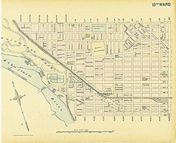 Ward 15
 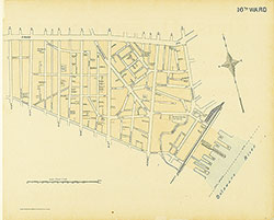 Ward 16
  Ads
Ads 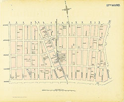 Ward 17
  Ads
Ads 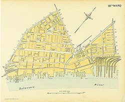 Ward 18
  Ads
Ads 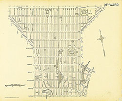 Ward 19
  Ads
Ads 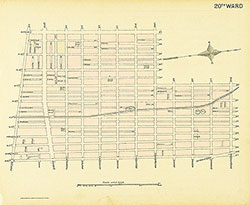 Ward 20
  Ads
Ads  Ads
Ads 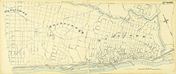 Ward 21
  Ads
Ads  Ads
Ads 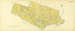 Ward 22
  Ads
Ads 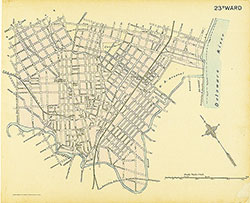 Ward 23
  Ads
Ads 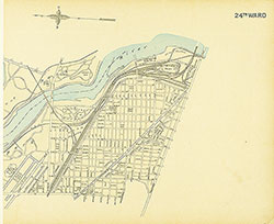 Ward 24
  Ads
Ads 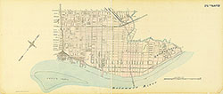 Ward 25
  Ads
Ads 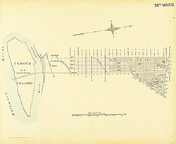 Ward 26
  Ads
Ads  Ads
Ads 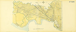 Ward 27
  Ads
Ads 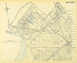 Ward 28
  Ads
Ads 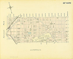 Ward 29
 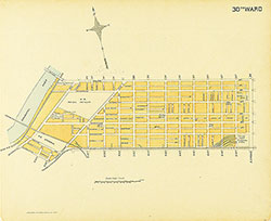 Ward 30
  Ads
Ads 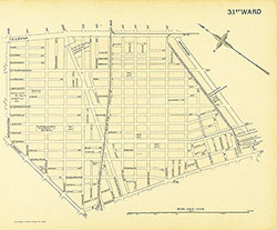 Ward 31
  Ads
Ads 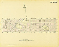 Ward 32
 Ads
Ads 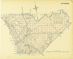 Ward 33
 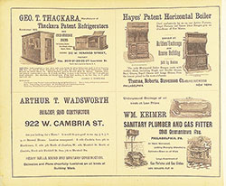 Ads
Ads 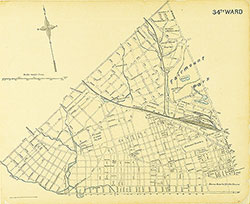 Ward 34
 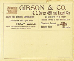 Ads
Ads 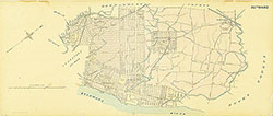 Ward 35
  Ads
Ads 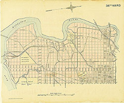 Ward 36
  Ads
Ads 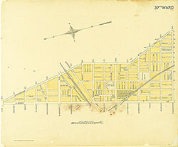 Ward 37
 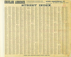 Street Index
 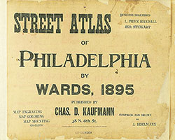 Title Page