Hexamer General Surveys, Volume 20, Plate 1932
Maps 1884-1885: Hexamer General Surveys: Volume 20, Plates 1855-1955
Item Info
Item No: MHGSAU00063
Title: Hexamer General Surveys, Volume 20, Plate 1932
Additional Title: Hexamer General Surveys, Volume 20
Publication Year:
8/7/1885
Page: 1932
Work Type: Industrial Site Surveys
Source: Map Collection
Notes:
Facility Name: Moorehouse Brothers Paper Mill
Owner: Moorehouse Brothers
Products:
- Paper
Notes:
Other Plates: 1659, 1932
Notes:
Ward: 25
Northside Orientation of Image: North
Alternate Page Number: Plate 1932
City/Town/Township: Geographic Coverage Ward:25th ward
Geographic Coverage State/Province:Pennsylvania
Geographic Coverage City/Town/Township:Philadelphia
Geographic Coverage Note:Frankford Creek (south side)
Geographic Coverage Neighborhood:Bridesburg
Geographic Coverage Region/County:Philadelphia
Creator Name: Ernest Hexamer
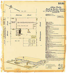 Plate 1856
 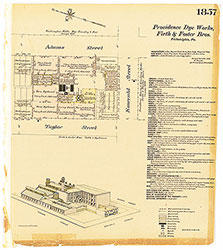 Plate 1857
 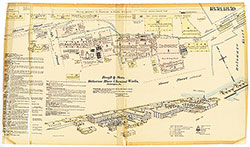 Plates 1858-1859
 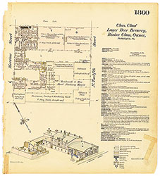 Plate 1860
  Plate 1861
  Plates 1862-1863
  Plate 1864
 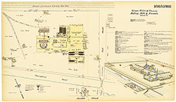 Plates 1865-1866
 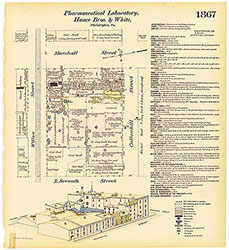 Plate 1867
 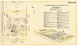 Plates 1868-1869
 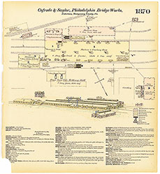 Plate 1870
 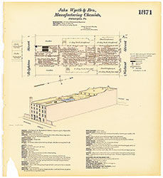 Plate 1871
 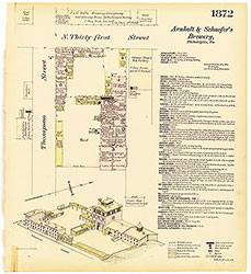 Plate 1872
 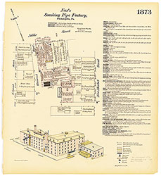 Plate 1873
  Plates 1874-1875
 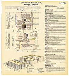 Plate 1876
 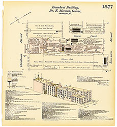 Plate 1877
 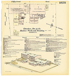 Plate 1878
 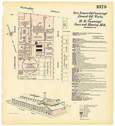 Plate 1879
 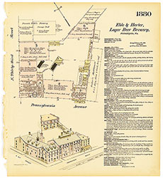 Plate 1880
 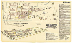 Plates 1881-1882
 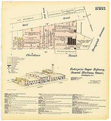 Plate 1883
 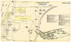 Plates 1884-1885
 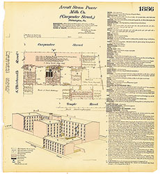 Plate 1886
 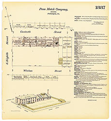 Plate 1887
 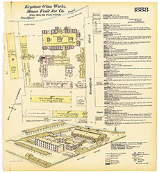 Plate 1888
 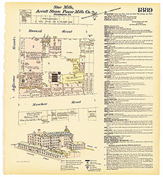 Plate 1889
 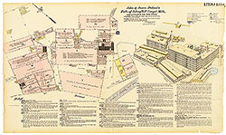 Plates 1890-1891
 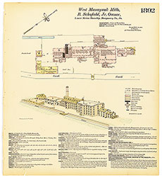 Plate 1892
 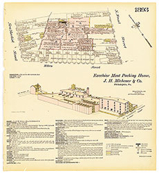 Plate 1893
 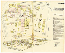 Plates 1894-1895
 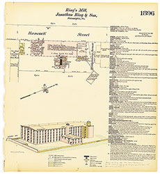 Plate 1896
 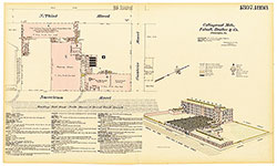 Plates 1897-1898
 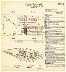 Plate 1899
 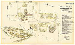 Plates 1900-1901
 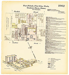 Plate 1902
 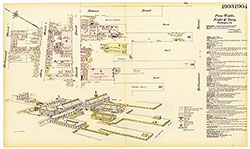 Plates 1903-1904
 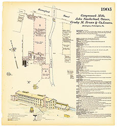 Plate 1905
 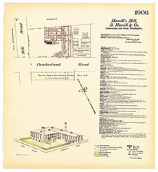 Plate 1906
 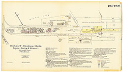 Plates 1907-1908
 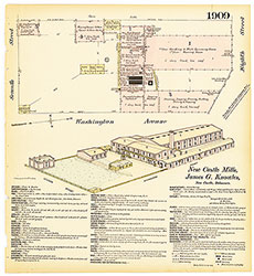 Plate 1909
 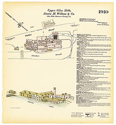 Plate 1910
 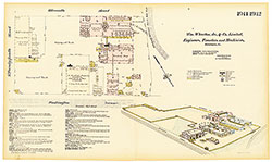 Plates 1911-1912
 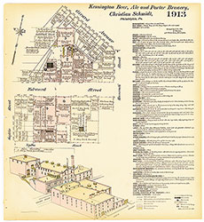 Plate 1913
 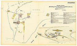 Plates 1914-1915
 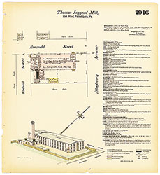 Plate 1916
 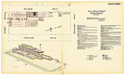 Plates 1917-1918
 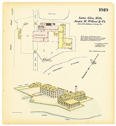 Plate 1919
 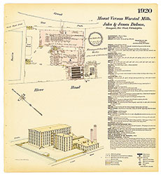 Plate 1920
 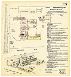 Plate 1921
 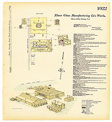 Plate 1922
 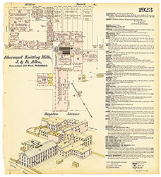 Plate 1923
 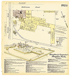 Plate 1924
 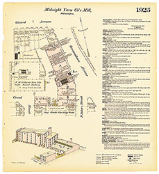 Plate 1925
 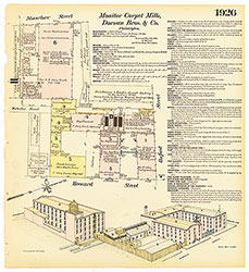 Plate 1926
 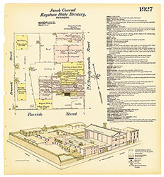 Plate 1927
 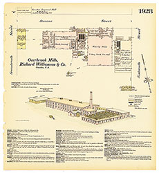 Plate 1928
 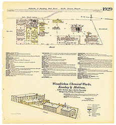 Plate 1929
 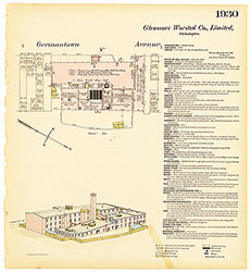 Plate 1930
 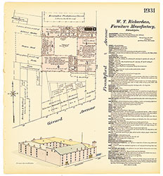 Plate 1931
 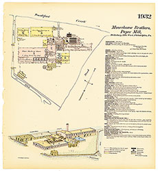 Plate 1932
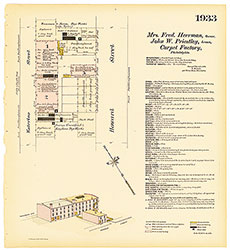 Plate 1933
 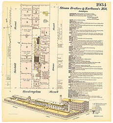 Plate 1934
 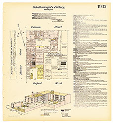 Plate 1935
 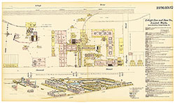 Plates 1936-1937
 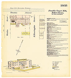 Plate 1938
 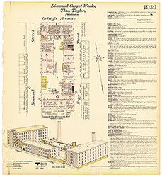 Plate 1939
 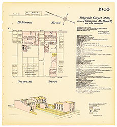 Plate 1940
 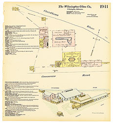 Plate 1941
 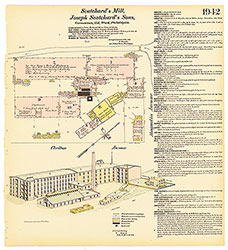 Plate 1942
 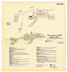 Plate 1943
 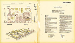 Plates 1944-1945
 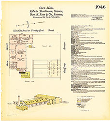 Plate 1946
 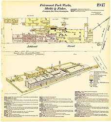 Plate 1947
 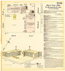 Plate 1948
 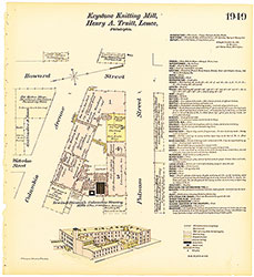 Plate 1949
 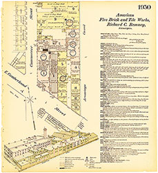 Plate 1950
 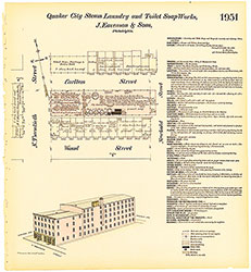 Plate 1951
 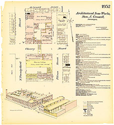 Plate 1952
 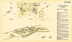 Plates 1953-1954
 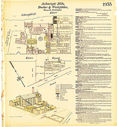 Plate 1955
  Plate 1855
  Index (Vol. 20)