Maps of the City of Philadelphia, 1858-1860, Plate 44
Maps 1859: Hexamer & Locher, Maps of the City of Philadelphia: Volume 4
Item Info
Item No: MHXLAE00004
Title: Maps of the City of Philadelphia, 1858-1860, Plate 44
Additional Title: Maps of the City of Philadelphia, 1858-1860: Volume 4
Publication Year:
1859
Page: 4
Work Type: Property Atlases/Maps
Source: Map Collection
Notes:
Northern Liberty Bank: north side Vine Street below 3rd Street
Union Sugar Refinery: St. John Street between Wood and Callowhill Streets
Northside Orientation of Image: Top
Alternate Page Number: Plate 44
City/Town/Township: Geographic Coverage State/Province:Pennsylvania
Geographic Coverage City/Town/Township:Philadelphia
Creator Name: Hexamer & Locher
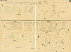 Plate 43
 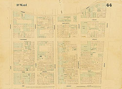 Plate 44
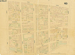 Plate 45
 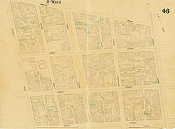 Plate 46
 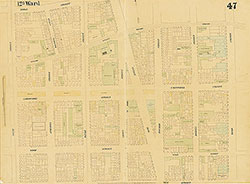 Plate 47
 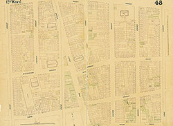 Plate 48
 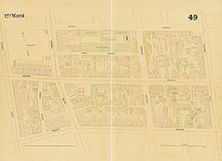 Plate 49
 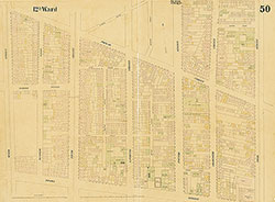 Plate 50
 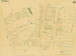 Plate 51
 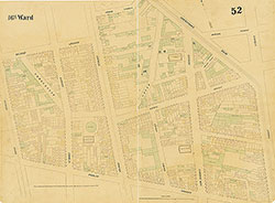 Plate 52
 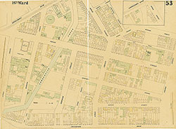 Plate 53
 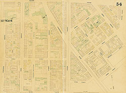 Plate 54
 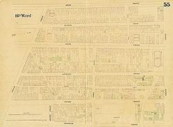 Plate 55
 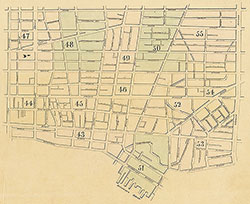 Index (v. 4)
 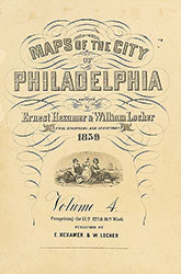 Title
Title