
Last month we released a post about the Better Philadelphia Exhibition, a 1947 exhibit designed by architects and city planners showing the citizens of Philadelphia their plans for urban renewal in Center City. The exhibition is documented in a two-volume scrapbook, available for in-library viewing in the Art Department at Parkway Central.
For anyone enticed by that vision of a future Philadelphia, or looking for further context on it, we’ve prepared a list of other holdings you may like to check out.
Design of Cities by Edumund Bacon
Edmund Bacon was one of the main designers of the Better Philadelphia Exhibition and is broadly credited with the re-making of Center City as a whole. His book Design of Cities, published in 1967 and issued with revisions in 1973, lays out Bacon’s beliefs about urban design, architecture, and the challenges of the modern city. It shows the thought process behind the drastic changes made to Center City and includes a lengthy section on the development of Philadelphia in particular. Bacon’s principle idea is that modern cities have become “simultaneous movement systems," that is, people moving through them are experiencing them at different speeds, whether by car, train, or on foot. Thus, designs must be just as legible from a car cruising along a freeway at 70 mph as from a bicycle. With this priority in mind, it becomes clear why Bacon thought putting massive freeways through neighborhoods was a worthwhile project.
Although he writes with great confidence and conviction of purpose, Bacon does not assert the superiority of a designer’s vision over the views of the community. Rather, he emphasizes the necessity for architects and planners to gain community consensus for their proposals. In the introduction to the 1973 edition, he wrote, “The reason the plans [for Philadelphia] got built was that the ingredient of acceptance was built into the plans from the beginning and that the planning process and the process of carrying out the plans were always seen as one.”
The Art of the Architectural Model by Akiko Busch
The Art of the Architectural Model is an art book comprised mostly of photos of various architectural models. The photos are divided into chapters focusing on different aspects of model making, each with a brief introduction by Busch. The models featured run the gamut from full cities to skyscrapers to rural mansions. Some are extremely detailed, some are made from unpainted wood. All make a clear case for the beauty of this ad hoc art form.
The topics Busch covers include practical matters, like the techniques and materials that model makers employ, and specific sub-types of models, like interior models or abstract models that could never be built. She also offers several answers to the question of why models are made, and why we find them so appealing. Of course, there is the obvious answer: that they are marketing tools for architectural firms, a readily comprehensible way to show a client a proposal. Beyond that, Busch writes that “Our enchantment with the miniature is rooted in the sense of power it instills in us.” Model buildings are “more easily maneuvered and manipulated, more easily observed and understood.” It seems the Better Philadelphia Exhibition, with its moving panels and enormous plaster hands, was certainly hoping to evoke that sense of power in the citizens who visited it, a sense of control over their urban environment and its future.
Black Citymakers by Marcus Anthony Hunter
The “citymakers” in Marcus Anthony Hunter’s Black Citymakers are not architects or urban planners. They are the residents of Philadelphia’s “Black Seventh Ward,” the area of South Philly that W.E.B. DuBois examined in The Philadelphia Negro in 1899. Hunter takes that date as his departure point and traces how the neighborhood changed throughout the 20th century, and how the people who lived there were active participants in the city-making process.
Two chapters in particular shed light on the Better Philadelphia Exhibition. Chapter 3, “The Night the Roof Caved In,” describes how in the 1920s and 30s, housing stock was allowed to deteriorate in the Seventh Ward, becoming the “blight” that city planners would later identify for removal. Hunter reveals how Black residents sought housing solutions from city officials and began to shift allegiances from the Republican Party to the Democratic Party, as the latter promised more to public housing.
Chapter 4, “Philadelphia’s Mason-Dixon Line,” directly discusses the Better Philadelphia Exhibition and the plans for urban renewal it contained. Mainly, the chapter focuses on the proposal for the Crosstown Expressway, the resulting disinvestment in the neighborhood, and how organizers like Alice Lipscomb and George Dukes formed a broad coalition of Black and white residents to ultimately defeat it.
Silver Cities by Peter Bacon Hales
And for a broader array of historical urban photographs, Silver Cities is an excellent resource. The book contains photographs of cities from 1839 to 1915, including three large fold-out panoramas. The book is a wonderful collection just to browse, but it also provides the context for these photos and describes the evolution of urban photography from the earlier “grand style,” to the reform photography of Jacob Riis.
Although photographs carry a sense of authenticity and objective reality, Hales argues that this was far from the case. Photographers used specific techniques and angles, and selected specific vistas instead of others, in order to impose their message on the subject. In the grand-style photographs, they sought to present the city as orderly, monumental, and civilized; in reform photography, the camera lens turned to the city’s most impoverished residents, attempting to demonstrate the degrading effect of the environment on its inhabitants.
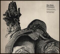
Man-Made Philadelphia by John Andrew Gallery and Richard Saul Wurman
John Andrew Gallery is an architect and writer who has been publishing and updating A Guide to Philadelphia Architecture since 1984. These guides are well-organized and detailed, with suggested walking tours and informative overviews of every building listed.
But a decade before writing the first of those books, Gallery co-authored a much more idiosyncratic architectural guide with the architect and graphic designer Richard Saul Wurman: Man-Made Philadelphia. The book is intended for visitors, focusing on the built environment, the man-made world that Philadelphians inhabit every day. The book highlights great architectural sights as well as more practical structures, like the transit system and the highways.
Unlike Gallery’s later guidebooks, which present each building in an orderly list, chronologically organized from past to present, Man-Made Philadelphia is divided into Routes, Areas, Growth, and Plans for Growth (this last category contains plans from 1682 up to the urban renewal plans of the 1960s.) It doesn’t catalog buildings one by one but presents them all together, just as the visitor will encounter them in person. The graphics are an eclectic mix, including fish-eye lens photographs, isometric maps, and abstracted plans of the city in the style of subway maps, but showing bus routes or highways. Sometimes all these different images are jumbled together on one page, sometimes a single photograph takes up a two-page spread.
The book is about the design of these structures, and also a marvelous work of design in itself. Even long-time residents familiar with the city may enjoy paging through it and seeing familiar neighborhoods represented with such a wide variety of techniques.
The book was published in 1972, so it is outdated (the rail transit map in the back includes Penn Central and the Reading Company, for instance.) On the other hand, it would be an excellent guidebook for time travelers.
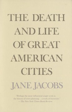
The Death and Life of Great American Cities by Jane Jacobs
The Death and Life of Great American Cities is present on probably every urban planning reading list you can find, but it makes this one for two reasons.
First, Jacobs does frequently refer to Philadelphia, and she writes critically of Bacon’s urban renewal projects, which were in full swing when the book was published in 1961.
Second, she provides perhaps one of the best, most all-encompassing depictions of a city ever put forth. The book is entirely text, with no maps or photographs, but in a note headed “Illustrations” at the start of the book, Jacobs writes, “The scenes which illustrate this book are all about us. For illustrations, please look closely at real cities. While you are looking, you might as well also listen, linger and think about what you see.”
For a resource you can view right from your computer, the Free Library has extensive collections of digitized historic maps. You can search this collection for maps of Philadelphia or other parts of Pennsylvania.
Or, if you want to see how Philadelphia has changed over the years, you can explore the Map Overlay Tool. This tool allows you to view historic maps of the city from 1843 to 1962, and compare them to one another, or to the modern city in Google Maps. Users can also find, under “Historical Images,” photos of the city matched to their location on the map. This resource is a fantastic way to look through the history of a particular neighborhood, as it was mapped and as it was photographed throughout the past.
Have a question for Free Library staff? Please submit it to our Ask a Librarian page and receive a response within two business days.