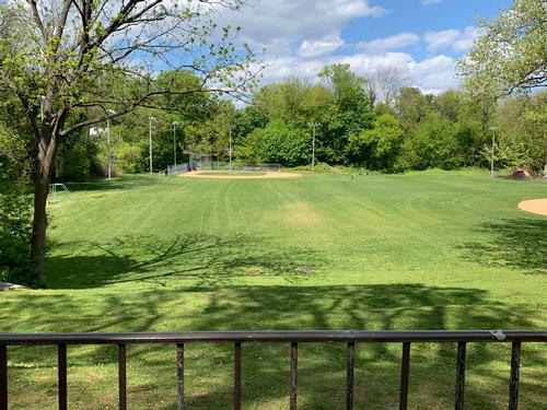
With current stay-at-home orders and social distancing precautions in place, I find myself more eager to spend time outside and walk (or jog if I’m feeling really motivated) around the neighborhood. This has sparked a growing curiosity about the history of the area—both its past and present.
Using our Digital Collections, I’ve been able to view old maps and photos of my neighborhood, and then walk the area to see just how things have (or haven’t) changed over the decades. Interested in doing the same? Using one or all of the following resources, you can explore (or even discover!) new aspects of your stomping grounds. Share what you find with the Map Collection on Instagram by tagging @freelibrarymaps!
Map Overlay Tool
This tool enables you to view a historical map on top of a modern Google map, as well as view historical photos of different parts of the city. You can search by address, location, zip code, or neighborhood.
- If you’d like a short, guided walkthrough of the map overlay tool, follow this link and then click on the "About" button in the top right-hand corner. Under "Tour and Walkthroughs" you can do one of a few things: take a simple guided walkthrough by clicking "Take a tour of the Map Overlay Tool;" or have fun with a guided activity by selecting "Watch a Whole Island Disappear" or "Find the Shot Tower Playground."
- To view photos: You can search one of two ways: 1) enter an address, landmark, zip code, or neighborhood name into the search box and click "Locate." Then click the button "Historical Images" in the top right corner and check the box next to "Any." 2) After clicking the box "Historical Images," a dropdown menu will appear, where you can then select the box(es) for the neighborhood(s) you want to see images of. Red markers will then appear, indicating where the photograph was taken. Click on the marker to view the image and description.
Ward/City Atlas Collection, Map Collection, Free Library of Philadelphia
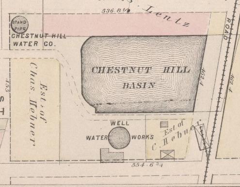
Beginning in the early 1860s, mapmakers produced highly detailed maps of Philadelphia neighborhoods using Ward boundaries to define the scope of their atlases. (A Ward is an administrative division of a city that typically elects and is represented by a councilor(s).)
- First, choose the general year(s) you’re interested in (between 1858-1954), then identify the Ward number according to these Ward index maps (arranged by year). Ward numbers can change over time, so it’s good to check out these indexes first.
- Then, open this list of Ward/City atlases in our collection. Scroll to the Ward number you’re interested in and follow the hyperlinks to the digitized resource. If you haven’t used these atlases before, instructions are provided at the top of the list to help guide you through the process.
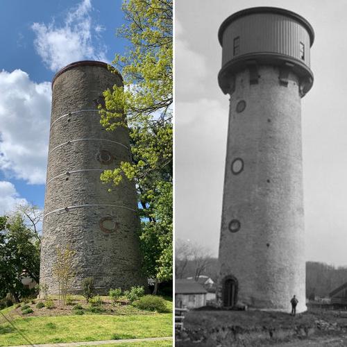
Historical Images of Philadelphia, Print and Picture Collection, Free Library of Philadelphia
The images contained in this digital collection are from the Print and Picture Collection's Philadelphiana Collection, which includes photographs, prints, watercolors, and scrapbooks documenting Philadelphia. Of particular interest are images of Old Philadelphia in Early Photographs, the Samuel Castner Scrapbooks, and the watercolors of Augustus Kollner.
PhillyHistory.org
The site contains the City's photo archive of over 2 million photo records that date from the late 1800s. Photos may be searched by keyword and date, and those that have been assigned a geographic location are searchable by proximity to an address, intersection, place name, or neighborhood.
Learn more about the resources available in the Map Collection and Print and Picture Collection by visiting www.freelibrary.org/maps, www.freelibrary.org/pix, by emailing the Map Collection at erefmap @ freelibrary . org, or the Print and Picture Collection at erefpix @ freelibrary . org.
Have a question for Free Library staff? Please submit it to our Ask a Librarian page and receive a response within two business days.